
Roosevelt County, Montana facts for kids
Quick facts for kids
Roosevelt County
|
|
|---|---|

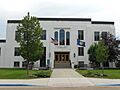
Roosevelt County Courthouse in Wolf Point
|
|

Location within the U.S. state of Montana
|
|
 Montana's location within the U.S. |
|
| Country | |
| State | |
| Founded | 1919 |
| Named for | Theodore Roosevelt |
| Seat | Wolf Point |
| Largest city | Wolf Point |
| Area | |
| • Total | 2,369 sq mi (6,140 km2) |
| • Land | 2,355 sq mi (6,100 km2) |
| • Water | 15 sq mi (40 km2) 0.6% |
| Population
(2020)
|
|
| • Total | 10,794 |
| • Estimate
(2022)
|
10,572 |
| • Density | 4.5564/sq mi (1.7592/km2) |
| Time zone | UTC−7 (Mountain) |
| • Summer (DST) | UTC−6 (MDT) |
| Congressional district | 2nd |
|
|
Roosevelt County is a county located in the state of Montana in the United States. In 2020, about 10,794 people lived here. The main town and county seat is Wolf Point. Roosevelt County was created in 1919 from part of Sheridan County. It was named after Theodore Roosevelt, a former U.S. president who passed away that same year.
Contents
Geography
Roosevelt County covers a total area of about 2,369 square miles. Most of this area, about 2,355 square miles, is land. The rest, about 15 square miles, is water. A large part of the county, about three-fourths, is located within the Fort Peck Indian Reservation.
Main Roads
These are the important roads that go through Roosevelt County:
 U.S. Route 2
 Montana Highway 13
 Montana Highway 16
 Montana Highway 25
 Montana Highway 251
Train Travel
- The Amtrak Empire Builder train stops at the Wolf Point station.
Neighboring Counties
Roosevelt County shares borders with these other counties:
- Daniels County – to the northwest
- Sheridan County – to the northeast
- Williams County, North Dakota – to the east
- McKenzie County, North Dakota – to the southeast
- Richland County – to the south
- McCone County – to the southwest
- Valley County - to the west
Protected Areas
Some parts of these special protected areas are found in Roosevelt County:
Climate
Roosevelt County generally has a cold, semi-dry climate. This means it can get very cold in winter and quite warm in summer. The highest temperature ever recorded in Bredette, a community in the county, was 108°F (42°C). This happened on August 6, 1983, and again on July 24, 2007. The coldest temperature recorded was -52°F (-47°C) on January 20, 1954.
Population Information
| Historical population | |||
|---|---|---|---|
| Census | Pop. | %± | |
| 1920 | 10,347 | — | |
| 1930 | 10,672 | 3.1% | |
| 1940 | 9,806 | −8.1% | |
| 1950 | 9,580 | −2.3% | |
| 1960 | 11,731 | 22.5% | |
| 1970 | 10,365 | −11.6% | |
| 1980 | 10,467 | 1.0% | |
| 1990 | 10,999 | 5.1% | |
| 2000 | 10,620 | −3.4% | |
| 2010 | 10,425 | −1.8% | |
| 2020 | 10,794 | 3.5% | |
| 2022 (est.) | 10,572 | 1.4% | |
| U.S. Decennial Census 1790–1960, 1900–1990, 1990–2000, 2010–2020 |
|||
2020 Population Count
In 2020, the census showed that 10,794 people lived in Roosevelt County.
2010 Population Details
According to the 2010 census, there were 10,425 people living in the county. There were 3,553 households and 2,548 families. The county had about 4.4 people per square mile.
The people living in the county came from different backgrounds:
- 60.4% were American Indian
- 35.8% were white
- 0.4% were Asian
- 0.1% were black or African American
- 0.2% were from other races
- 3.0% were from two or more races
About 1.3% of the population was of Hispanic or Latino origin. Many people had ancestors from Norway (20.0%), Germany (16.3%), and Ireland (6.1%).
Of the households, 42.4% had children under 18 living with them. About 42.9% were married couples. The average household had 2.88 people, and the average family had 3.41 people. The average age of people in the county was 31.6 years old.
The average income for a household was $37,451, and for a family it was $50,146. About 21.5% of the total population lived below the poverty line. This included 28.6% of those under 18 and 10.9% of those aged 65 or older.
Towns and Cities

Cities
- Poplar
- Wolf Point (This is the county seat, where the main government offices are.)
Towns
Other Communities
These are smaller communities that are not officially cities or towns:
- Biem
- Blair
- Bredette
- Chelsea
- Fort Kipp
- Macon
- Sprole
Images for kids
-
Roosevelt County Courthouse in Wolf Point
See also
 In Spanish: Condado de Roosevelt (Montana) para niños
