Daniels County, Montana facts for kids
Quick facts for kids
Daniels County
|
|
|---|---|

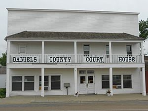
Daniels County Courthouse in Scobey
|
|

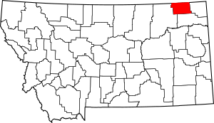
Location within the U.S. state of Montana
|
|
 Montana's location within the U.S. |
|
| Country | |
| State | |
| Founded | 1920 |
| Named for | Mansfield Daniels |
| Seat | Scobey |
| Largest city | Scobey |
| Area | |
| • Total | 1,426 sq mi (3,690 km2) |
| • Land | 1,426 sq mi (3,690 km2) |
| • Water | 0.4 sq mi (1 km2) 0.03% |
| Population
(2020)
|
|
| • Total | 1,661 |
| • Estimate
(2022)
|
1,628 |
| • Density | 1.1648/sq mi (0.44973/km2) |
| Time zone | UTC−7 (Mountain) |
| • Summer (DST) | UTC−6 (MDT) |
| Congressional district | 2nd |
|
|
Daniels County is a place in the state of Montana, United States. A county is like a smaller region within a state. In 2020, about 1,661 people lived here. The main town and government center is called Scobey. Daniels County is right on Montana's northern border. This means it touches the country of Canada, specifically the province of Saskatchewan.
Contents
History of Daniels County
Daniels County was created in 1920. It was formed from parts of two other counties: Sheridan County and Valley County. The county got its name from Mansfield Daniels. He was a local rancher who lived in the area.
Geography of Daniels County
Daniels County covers a total area of about 1,426 square miles. Almost all of this area is land. Only a very small part is water.
The land in Daniels County is mostly made up of rolling plains. These are wide, flat, or gently hilly areas. The Poplar River flows through the county.
Main Roads
Neighboring Areas
- Rural Municipality (RM) of Old Post No. 43, Saskatchewan (SK) - northwest
- RM of Poplar Valley No. 12, SK - north
- RM of Hart Butte No. 11, SK - north
- RM of Happy Valley No. 10, SK - northeast
- Sheridan County - east
- Roosevelt County - south
- Valley County - west
People in Daniels County
| Historical population | |||
|---|---|---|---|
| Census | Pop. | %± | |
| 1930 | 5,553 | — | |
| 1940 | 4,563 | −17.8% | |
| 1950 | 3,946 | −13.5% | |
| 1960 | 3,755 | −4.8% | |
| 1970 | 3,083 | −17.9% | |
| 1980 | 2,835 | −8.0% | |
| 1990 | 2,266 | −20.1% | |
| 2000 | 2,017 | −11.0% | |
| 2010 | 1,751 | −13.2% | |
| 2020 | 1,661 | −5.1% | |
| 2022 (est.) | 1,628 | −7.0% | |
| U.S. Decennial Census 1790–1960, 1900–1990, 1990–2000, 2010–2020 |
|||
In 2020, there were 1,661 people living in Daniels County. Back in 2010, there were 1,751 people. At that time, most people were white (95.7%). About 2.1% were American Indian. A small number of people were from other backgrounds. About 1.5% of the population was of Hispanic or Latino origin. The average age of people living here was about 50 years old.
Economy
The main ways people make money in Daniels County are through farming and ranching. Raising cattle is very important. Growing wheat on dry land is also a big part of the economy.
Education
There is one school in Daniels County that serves all students. It is called Scobey High School. This school teaches students from kindergarten all the way through 12th grade.
Communities
Daniels County has several towns and communities.
City
- Scobey (This is the county seat, where the main government offices are.)
Town
Census-designated places
These are special areas defined for gathering census information.
Unincorporated communities
These are smaller places that are not officially organized as cities or towns.
- Carbert
- Four Buttes
- Navajo
- Pleasant Prairie
- West Fork
See also
 In Spanish: Condado de Daniels para niños
 | Frances Mary Albrier |
 | Whitney Young |
 | Muhammad Ali |

