Brown Owl, New Zealand facts for kids
Quick facts for kids
Brown Owl
|
|
|---|---|

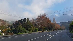
Akatarawa Road in Brown Owl
|
|
| Country | New Zealand |
| Region | Wellington Region |
| Territorial authority | Upper Hutt |
| Electorates |
|
| Area | |
| • Total | 8.99 km2 (3.47 sq mi) |
| Population
(June 2023)
|
|
| • Total | 3,850 |
| • Density | 428.3/km2 (1,109.2/sq mi) |
Brown Owl is a suburb in Upper Hutt, New Zealand. It is about 3 to 4 kilometers from the city center. This area slowly grew and developed starting in the 1960s.
Brown Owl is located on the eastern side of the Hutt River. It sits at the bottom of the Eastern Hutt Valley Hills and Emerald Hill. State Highway 2 (SH2) runs right through the suburb. Brown Owl is next to Timberlea to the east. It borders Maoribank to the south of SH2. Birchville is just north of Harcourt Park. You can walk to Tōtara Park by crossing the Harcourt Park Bridge.
Contents
Exploring Brown Owl's Neighborhoods
Brown Owl is divided into three main areas. Each area has its own unique feel and history.
Central Brown Owl
The main part of Brown Owl was mostly built between 1970 and 1990. This central area is where you will find all the businesses in Brown Owl. It's the busy hub of the suburb.
Sunnyview Drive Area
On the southwestern side of Emerald Hill, there are four streets. Houses here have amazing views across the whole Upper Hutt Valley. The main street, Sunnyview Drive, is famous for its Christmas lights. Every December, many residents decorate their homes with bright light displays. You can see these lights from far across the valley. This part of Brown Owl was mostly developed in the late 1960s and early 1970s.
Riverglade Subdivision
Next to the river and Te Haukaretu Park is the Riverglade subdivision. This newer area was built between the early 1990s and mid-2000s. It features large, modern homes. Many of these houses have great views of Te Haukaretu Park and the Hutt River.
Parks and Green Spaces
Brown Owl has three public parks where you can relax and play.
Brown Owl Park
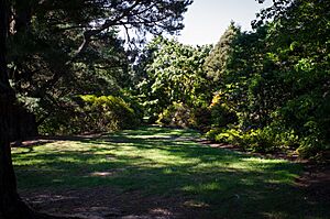
Brown Owl Park is located off SH2. You can also get to it from Speargrass Grove in Timberlea. This park has some natural bush and a small walking trail. It's a nice spot for a quiet walk.
Te Haukaretu Park
Te Haukaretu Park is at the end of Norbert Street. It's right next to the Harcourt Park Bridge. This beautiful park runs along the eastern bank of the Hutt River. At its southern end, you'll find a playground and a duck pond. A large football field is at the northern end. You can walk into the park from SH2. A part of the Hutt River Trail also goes through this park.
Harcourt Park
Harcourt Park is a large and important park in Upper Hutt. It's located off Akatarawa Road and Norbert Street. The park has two playgrounds, one small and one large. There's also a toddlers' pool and public toilets. A soundstage is at the southwestern end, used for local concerts.
On the northern side, there's a cycle track where you can learn to ride. The park also has many wide lawns, perfect for picnics. Wellington's Kiwi Holiday Park is next to it on Akatarawa Road. The Hutt River Trail runs along the western edge of the park. Harcourt Park is a great place to see river terraces, which are flat areas formed by the river over time.
Did you know? The "Gardens of Isengard" scenes in The Lord of the Rings movies were filmed right here in Harcourt Park!
People and Community
The Birchville-Brown Owl area covers about 8.99 square kilometers. As of June 2023, it had an estimated population of 3,850 people. This means there are about 428.25 people living in each square kilometer.
Population Changes Over Time
The population of Birchville-Brown Owl has grown steadily.
- In 2006, there were 3,339 people.
- In 2013, the population was 3,327.
- By 2018, it had increased to 3,519 people. This was 192 more people than in 2013.
In 2018, there were 1,275 households. There were slightly more females (1,773) than males (1,740). The average age was 38.8 years. About 19.6% of the people were under 15 years old.
Cultural Backgrounds
The community in Birchville-Brown Owl is diverse.
- Most people (87.7%) identify as European/Pākehā.
- About 13.6% identify as Māori.
- 4.9% are Pasifika.
- 5.1% are Asian.
- 2.4% identify with other ethnic groups.
Some people identify with more than one ethnicity. About 19.1% of the people were born overseas.
Beliefs and Religions
Many people in the area (57.6%) said they had no religion. About 32.2% were Christian. Smaller numbers followed other religions like Māori religious beliefs, Hindu, Muslim, and Buddhist.
Schools in the Area
Brown Owl used to have its own school, Brown Owl School. However, this school closed in 2002. Today, the closest primary schools for children are Maoribank School and Birchville School. For older students, the nearest secondary school is Heretaunga College, which is about 6 kilometers away.
Getting Around Brown Owl
Brown Owl has public transport options to help people travel. The Emerald Hill – Petone commuter bus service (Route #110) serves the area. This bus service is run by Metlink.
 | John T. Biggers |
 | Thomas Blackshear |
 | Mark Bradford |
 | Beverly Buchanan |


