Broxton, Georgia facts for kids
Quick facts for kids
Broxton, Georgia
|
|
|---|---|

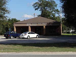
Broxton Post Office
|
|

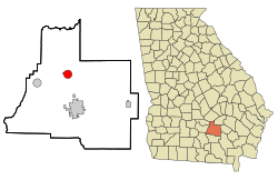
Location in Coffee County and the state of Georgia
|
|
| Country | United States |
| State | Georgia |
| County | Coffee |
| Area | |
| • Total | 3.36 sq mi (8.70 km2) |
| • Land | 3.25 sq mi (8.41 km2) |
| • Water | 0.11 sq mi (0.29 km2) |
| Elevation | 285 ft (87 m) |
| Population
(2020)
|
|
| • Total | 1,060 |
| • Density | 326.56/sq mi (126.07/km2) |
| Time zone | UTC-5 (Eastern (EST)) |
| • Summer (DST) | UTC-4 (EDT) |
| ZIP code |
31519
|
| Area code(s) | 912 |
| FIPS code | 13-11504 |
| GNIS feature ID | 0354876 |
Broxton is a city located in Coffee County, Georgia, in the United States. According to the 2020 census, about 1,060 people live there. Broxton is special because of its unique sandstone rock formations called Broxton Rocks. These rocks are found along Rocky Creek, about 10 miles north of the city.
History of Broxton
Broxton was once known by another name, "Gully Branch." The state government of Georgia officially made Broxton a town in 1904. The town's boundaries were set in a circle, about one mile around, starting from the front-yard well of a person named Jesse Lott. The city got its current name from Broxton Creek.
Geography of Broxton
Broxton is located in the northern-central part of Coffee County. You can find it at these coordinates: 31°37′39″N 82°53′23″W / 31.62750°N 82.88972°W. U.S. Route 441 is a main road that goes through the city. This road leads south about 9 miles to Douglas, which is the main city of Coffee County. If you go north on the same road, you'll reach McRae, about 33 miles away.
The United States Census Bureau says that Broxton covers a total area of about 3.36 square miles (8.7 square kilometers). Most of this area, about 3.25 square miles (8.4 square kilometers), is land. The rest, about 0.11 square miles (0.3 square kilometers), is water.
People of Broxton
The number of people living in Broxton has changed over the years. In 1900, there were about 300 residents. The population grew to 1,428 by 2000. However, by the 2010 census, the population was 1,189. In the most recent 2020 census, the population was 1,060.
Broxton is a diverse city. In 2020, about 42.55% of the people were White (not Hispanic or Latino). About 41.98% were Black or African American (not Hispanic or Latino). A small number of people were of other races or mixed races. About 11.13% of the population identified as Hispanic or Latino, who can be of any race.
See also

- In Spanish: Broxton (Georgia) para niños
 | Emma Amos |
 | Edward Mitchell Bannister |
 | Larry D. Alexander |
 | Ernie Barnes |

