Buckland, Ohio facts for kids
Quick facts for kids
Buckland, Ohio
|
|
|---|---|
|
Village
|
|

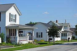
Houses on Main Street
|
|

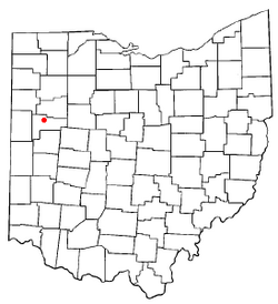
Location of Buckland, Ohio
|
|

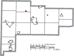
Location of Buckland in Auglaize County
|
|
| Country | United States |
| State | Ohio |
| County | Auglaize |
| Township | Logan |
| Area | |
| • Total | 0.30 sq mi (0.78 km2) |
| • Land | 0.30 sq mi (0.78 km2) |
| • Water | 0.00 sq mi (0.00 km2) |
| Elevation | 853 ft (260 m) |
| Population
(2020)
|
|
| • Total | 233 |
| • Estimate
(2023)
|
229 |
| • Density | 776.67/sq mi (299.65/km2) |
| Time zone | UTC-5 (Eastern (EST)) |
| • Summer (DST) | UTC-4 (EDT) |
| ZIP code |
45819
|
| Area code(s) | 419 |
| FIPS code | 39-09974 |
| GNIS feature ID | 2397484 |
Buckland is a small village in Auglaize County, Ohio, United States. In 2020, about 233 people lived there. It is part of the Wapakoneta, Ohio Micropolitan Statistical Area. This means it's connected to a larger city area. Students in Buckland go to schools in the Wapakoneta City School District.
Contents
History of Buckland
Buckland was started in 1872. Its first name was Whitefeather. In 1891, the village changed its name. It became Buckland to honor a man named Buckland. He was important because he helped bring the railroad to this area.
Geography of Buckland
Buckland is a small place. It covers about 0.78 square kilometers (0.30 square miles). All of this area is land. There are no large lakes or rivers inside the village.
People in Buckland (Demographics)
Demographics is the study of people. It looks at things like how many people live somewhere. It also checks their ages and family types.
| Historical population | |||
|---|---|---|---|
| Census | Pop. | %± | |
| 1900 | 349 | — | |
| 1910 | 364 | 4.3% | |
| 1920 | 258 | −29.1% | |
| 1930 | 242 | −6.2% | |
| 1940 | 287 | 18.6% | |
| 1950 | 274 | −4.5% | |
| 1960 | 300 | 9.5% | |
| 1970 | 281 | −6.3% | |
| 1980 | 271 | −3.6% | |
| 1990 | 239 | −11.8% | |
| 2000 | 255 | 6.7% | |
| 2010 | 233 | −8.6% | |
| 2020 | 233 | 0.0% | |
| 2023 (est.) | 229 | −1.7% | |
| U.S. Decennial Census | |||
2010 Census Information
In 2010, 233 people lived in Buckland. There were 96 homes, and 64 of these were families. The village had about 896 people per square mile. There were 102 housing units in total.
Most people (98.7%) were White. A small number were Asian. Some people were from two or more races. About 2.1% of the people were Hispanic or Latino.
- About 35% of homes had kids under 18.
- Almost half (46.9%) were married couples.
- Some homes (11.5%) had a female head of household.
- A few homes (8.3%) had a male head of household.
- About 27% of homes were single individuals.
- About 14.6% of homes had someone 65 or older living alone.
The average home had 2.43 people. The average family had 2.95 people. The average age in the village was 36.3 years old.
- About 28% of residents were under 18.
- About 5.5% were between 18 and 24.
- About 30.8% were between 25 and 44.
- About 21.1% were between 45 and 64.
- About 14.2% were 65 or older.
The village had slightly more males (50.6%) than females (49.4%).
See also
 In Spanish: Buckland (Ohio) para niños
 | Janet Taylor Pickett |
 | Synthia Saint James |
 | Howardena Pindell |
 | Faith Ringgold |

