
Buford, Ohio facts for kids
Quick facts for kids
Buford, Ohio
|
|
|---|---|

Location of Buford, Ohio
|
|
| Country | United States |
| State | Ohio |
| County | Highland |
| Township | Clay |
| Area | |
| • Total | 1.48 sq mi (3.84 km2) |
| • Land | 1.48 sq mi (3.84 km2) |
| • Water | 0.00 sq mi (0.00 km2) |
| Elevation | 965 ft (294 m) |
| Population
(2020)
|
|
| • Total | 306 |
| • Density | 206.34/sq mi (79.66/km2) |
| Time zone | UTC-5 (Eastern (EST)) |
| • Summer (DST) | UTC-4 (EDT) |
| ZIP code |
45171
|
| Area code(s) | 937, 326 |
| FIPS code | 39-10156 |
| GNIS feature ID | 2628870 |
Buford is a small place in Ohio, United States. It's called an "unincorporated community" and a "census-designated place." This means it's a recognized area, but it doesn't have its own local government like a city or town. Buford is located in Highland County, specifically in Clay Township. In 2020, about 306 people lived there. While Buford used to have its own post office with a specific ZIP code, mail for Buford now uses the ZIP code for the nearby town of Sardinia.
Contents
History of Buford
How Buford Started
Buford was officially planned and marked out on a map in 1834. This process is called "platting." The community was named after the maiden name of the wife of one of the very first settlers in the area.
Geography of Buford
Where is Buford Located?
Buford is found in the southwestern part of Highland County. It's right where three state roads meet: Route 134, Route 138, and Route 321.
Travel Around Buford
- Route 134 goes north about 12 miles (19 km) to Lynchburg. It also goes south about 5 miles (8 km) to Sardinia.
- Route 138 heads northeast about 15 miles (24 km) to Hillsboro. Hillsboro is the main town and "county seat" for Highland County.
- Route 321 travels southeast about 6 miles (10 km) to Mowrystown.
Size of Buford
According to the United States Census Bureau, the Buford area covers a total of 1.48 square miles (3.84 square kilometers). All of this area is land, with no water.
Population of Buford
How Many People Live Here?
| Historical population | |||
|---|---|---|---|
| Census | Pop. | %± | |
| 2020 | 306 | — | |
| U.S. Decennial Census | |||
In 2020, the census counted 306 people living in Buford. This number helps us understand the size of the community.
Notable People from Buford
Famous Individuals
- Edmund Wittenmyer was a U.S. Army major general. He was an important military leader who came from Buford.
Gallery
-
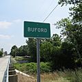
Buford community sign
-
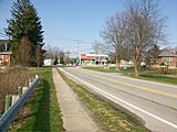
Intersection of State Routes 134 and 138
-
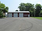
Clay Township Meeting Hall and Fire Station #66
-
Clay Township Community Park (formerly Buford Elementary and High School)
-
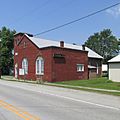
Buford Church of Christ
-
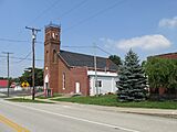
Buford Community Church
-
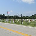
Buford Cemetery
-
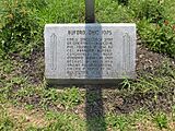
Bicentennial Corner Marker


See also
 In Spanish: Buford (Ohio) para niños
