Burdenis Glacier facts for kids
Quick facts for kids Burdenis Glacier |
|
|---|---|

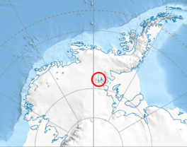
Location of Sentinel Range in Western Antarctica
|
|
| Location | Ellsworth Land |
| Coordinates | 78°14′S 86°03′W / 78.233°S 86.050°W |
| Length | 3 nmi (6 km; 3 mi) |
| Width | 1 nmi (2 km; 1 mi) |
| Thickness | unknown |
| Terminus | Sentinel Range |
| Status | unknown |
Burdenis Glacier (which is lednik Burdenis in Bulgarian) is a large river of ice in Antarctica. It is about 6 kilometers (3.7 miles) long and 1.7 kilometers (1 mile) wide. You can find it on the eastern side of the main ridge of the north-central Sentinel Range. This range is part of the Ellsworth Mountains.
Burdenis Glacier is located between two other glaciers: Delyo Glacier to its north and Gerila Glacier to its south. This glacier collects snow and ice from the northern slopes of Mount Viets. It also gathers ice from the southeastern slopes of the southern peak of Long Gables Peak. The glacier then flows towards the northeast. Eventually, it joins the upper part of Ellen Glacier, along with Delyo Glacier and Gerila Glacier. This meeting point is north of Bruguière Peak.
The name "Burdenis" comes from an ancient Roman town. This old settlement was located in Southern Bulgaria.
Where is Burdenis Glacier Located?
Burdenis Glacier is found in a very cold part of the world. Its exact center is at 78°14′00″S 86°03′00″W / 78.23333°S 86.05000°W. This location is in Ellsworth Land, a region of Antarctica. The United States created maps of this area in 1961 and again in 1988. These maps help us understand where the glacier is.
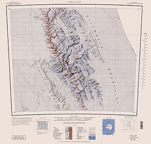
Maps of the Glacier
Scientists and explorers use special maps to study places like Burdenis Glacier.
- One important map is called "Vinson Massif." This map is a topographic map, which means it shows the shape and height of the land. It has a scale of 1:250,000. This map was made by the US Geological Survey in 1988. It helps us see the details of the Sentinel Range and the glaciers within it.
 | Calvin Brent |
 | Walter T. Bailey |
 | Martha Cassell Thompson |
 | Alberta Jeannette Cassell |


