Burnmoor Tarn facts for kids
Quick facts for kids Burnmoor Tarn |
|
|---|---|

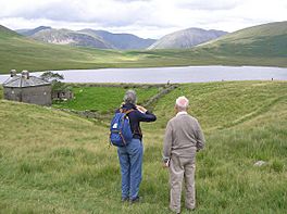
Overlooking Burnmoor Tarn with Burnmoor Lodge in the foreground.
|
|
| Location | Lake District |
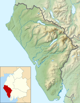
| Coordinates | 54°25′41″N 3°15′34″W / 54.42814°N 3.25953°W |
| Primary outflows | Whillan Beck |
| Catchment area | 6.02 km2 (2.32 sq mi) |
| Surface area | 23.9 ha (59 acres) |
| Max. depth | 13 m (43 ft) |
| Surface elevation | 253 m (830 ft) |
Burnmoor Tarn is a large, natural lake found on Eskdale Fell in Cumbria, England. It's one of the biggest natural lakes of its type in the entire Lake District. The water from the tarn flows out into a stream called Whillan Beck. This stream quickly turns south and flows into Eskdale, eventually joining the River Esk near a place called Beckfoot.
There's an old building called Burnmoor Lodge, which used to be a place for fishing, located right by the southern edge of the tarn. Also, a very old path, known as a mediaeval corpse road, runs along the eastern side of the tarn. This path crosses the beck (stream) there. To the south of the tarn, you'll find Eskdale Moor or Boat How.
About Burnmoor Tarn
Burnmoor Tarn is an important natural site. It's part of a special network called the UK Upland Waters Monitoring Network, run by DEFRA. This network helps keep an eye on the health of lakes and rivers in the uplands of the UK.
Location and Size
The tarn covers an area of about 23.9 hectares (which is like 239,000 square meters). It sits at an altitude of 253 meters above sea level. The tarn is located in a hollow area that was shaped by ancient glaciers, between Wastwater and Eskdale.
Tarn Features
Burnmoor Tarn has two distinct deep areas, or basins, close to its south-eastern shore. The deepest part of the lake is about 13 meters deep. Four main streams flow into the tarn from the north and north-west. The water flows out from the eastern end of the tarn. This outflow joins Hardrigg Beck, which drains water from the slopes of Scafell. When there's a lot of rain, some of the water from Hardrigg Beck can even flow into the tarn through a network of small, branching streams.
 | Delilah Pierce |
 | Gordon Parks |
 | Augusta Savage |
 | Charles Ethan Porter |


