River Esk, Cumbria facts for kids
Quick facts for kids Esk (Cumbria) |
|
|---|---|

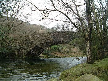
The River Esk flows under Wha House Bridge in Upper Eskdale
|
|

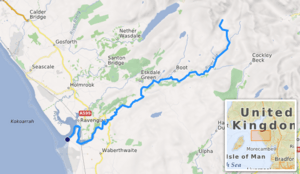
Path of the River Esk [1]
|
|
|
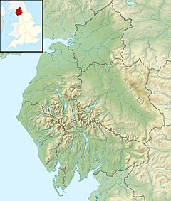
Location of the mouth within Cumbria
|
|
| Country | United Kingdom |
| Constituent country | England |
| Physical characteristics | |
| Main source | Esk Hause |
| River mouth | Irish Sea Ravenglass 54°20′17″N 3°25′42″W / 54.33806°N 3.42833°W |
The River Esk, sometimes called the Cumbrian Esk, is a river in Cumbria, England. It flows for about 25 kilometers (15.5 miles) from its source in the Scafells mountains to the Irish Sea at Ravenglass. This river is one of two Rivers Esk in Cumbria. It is different from the Border Esk which flows into Cumbria from Scotland.
Contents
Where the River Esk Flows
The River Esk starts high up in the Sca Fell mountains. Its source is about 800 meters (2,625 feet) high, just below a mountain pass called Esk Hause. From there, the young river flows south through beautiful, wild countryside.
Journey Through the Valley
As it flows, the Esk collects water from many smaller streams. These streams flow down from the Scafell mountains. Some important ones are Calfcove Gill and Little Narrowcove Beck. The river also tumbles over several waterfalls, including the Esk Falls.
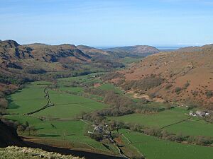
Soon, a bigger stream called Lingcove Beck joins the Esk at Lingcove Bridge. A few miles later, the river passes Brotherilkeld Farm. This farm used to belong to monks from Furness Abbey. Here, Hardknott Beck joins the Esk. The river then turns west and flows through the farmlands of Eskdale. A road also follows the river down the valley.
Passing Villages and Reaching the Sea
The Esk continues past the small villages of Boot and Eskdale Green. After Boot, Whillan Beck joins the river from the northeast. This beck carries water from Burnmoor Tarn, a lake about four kilometers away.
The Esk then flows southwest under Hinning House Bridge. This is about three kilometers east of Ravenglass. At this point, the river becomes tidal, meaning its water level changes with the ocean's tides. After passing the Muncaster Castle Estate, the river finally reaches the Irish Sea at Ravenglass.
The Esk Estuary
At its mouth, the Esk joins two other rivers: the Irt and the Mite. Together, they form an estuary. Over many years, the estuary has changed. The Esk and Irt were once separated by a bank of stones. Later, sand dunes formed when the rivers joined.
The sand dunes in the estuary are part of the Eskmeals nature reserve. This area is a Site of Special Scientific Interest (SSSI). It covers about 67 hectares (165.5 acres). The SSSI has many coastal dunes and salt marsh areas. These habitats attract different kinds of birds that nest there and a wide variety of flowers. The dunes are also home to the Eskmeals Range, which is a testing site. The Cumbrian Coast Line railway crosses the estuary on the Eskmeals viaduct, just south of Ravenglass.
What's in a Name?
The name "Esk" comes from a very old language called Brythonic. In this language, the word *Iska meant "full of fish." This is similar to the modern Welsh word Pysg, which means "fishes."
Many rivers in Britain have names like Esk, Axe, Exe, and Usk. They all come from this same old word. Over hundreds of years, the names changed slightly in different places.
Fishing in the Esk
The River Esk is known as a great place for fishing. People enjoy angling (fishing with a rod and line) for sea trout and salmon here.
A famous writer and broadcaster named Hugh Falkus lived in the Esk valley. He used the river as inspiration for many of his books and films about fishing. Some fishing spots on the Esk are privately owned. However, the Millom Angling Association sells daily tickets for visitors to fish at their spots on the Muncaster Castle Estate and Brant Rake.
 | Jessica Watkins |
 | Robert Henry Lawrence Jr. |
 | Mae Jemison |
 | Sian Proctor |
 | Guion Bluford |


