Burntwick Island facts for kids
| Geography | |
|---|---|
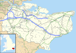
| Location | River Medway estuary |
| Coordinates | 51°25′16″N 0°40′30″E / 51.421°N 0.675°E |
| Length | 2 km (1.2 mi) |
| Width | 1 km (0.6 mi) |
| Administration | |
|
England
|
|
| County | Kent |
| Borough | Swale |
| Demographics | |
| Population | 0 |
Burntwick Island is a small island in the estuary of the River Medway in Kent, United Kingdom. It's a flat area of marshland. The island is about 2 kilometers (1.2 miles) long and 1 kilometer (0.6 miles) wide.
It sits among tidal sand banks on the southern side of the estuary. A narrow channel called Stangate Creek separates it from the mainland. At high tide, the island splits into several smaller islands. This happens because of narrow tidal channels that cross it.
Contents
Island History: From Mainland to Marsh
How Burntwick Became an Island
Until the 1700s, Burntwick Island was not an island at all. It was part of the mainland. It formed the northernmost part of the parish of Upchurch. You can still find traces of an old track. This track once ran from Shoregate Lane at Ham Green.
A Place for Sick Ships
In the late 1700s and early 1800s, the island had a special use. It became a place to keep ships separate. This was done if people on board had serious diseases. This was called a quarantine base. People who died were often buried on Deadman's Island, about 3 kilometers (1.8 miles) away.
Smugglers' Hideout
Burntwick Island was also a popular spot for smuggling. This happened a lot after taxes on goods went up in the late 1700s. Smugglers would secretly bring in items like tea and spirits.
In the early 1800s, a famous group of smugglers used Burntwick. They were known as the North Kent Gang. In 1820, officers tried to stop them. The smugglers were unloading goods in Stangate Creek. Many members of the gang were eventually caught. This helped to end smuggling in the area. Import duties were largely removed in 1831, which also helped stop the practice.
The Brave Doctor's Grave
In 1845, a naval ship called HMS Eclair had a serious problem. Many of its crew caught yellow fever. Another ship, HMS Rolla, was sent to help. Sidney Bernard, a surgeon from Rolla, went to treat the sick crew on Eclair.
When the ship returned to England, it had to stay in Stangate Creek. This was to stop the disease from spreading. Dr. Bernard kept caring for the crew. Sadly, he also caught yellow fever. He died at just 27 years old on October 9, 1845. His grave is still visible on Burntwick Island. It stands alone among the marshy grasslands.
Life on the Island
You can still see the remains of a small house on the island. In the 1840s, a shepherd named James Woolley lived there with his wife Sarah. Later, Thomas Hoare and Emma Castleton lived there in the 1870s.
In the early 1900s, the tide started to flood the island more often. Because of this, the sheep that grazed there were moved to the mainland. In the 1800s, the island was also used as a place to dump waste. Today, you can still find old Victorian pottery and glass on the ground.
Military Use and Nature's Return
Later, the Ministry of Defence owned the island. They built a battery there. During the Second World War, a torpedo school and barracks were also built.
Since then, the island has been mostly unused. It has become a very important safe place for seabirds. The tide often covers the island completely.
 | Laphonza Butler |
 | Daisy Bates |
 | Elizabeth Piper Ensley |


