Burren Way facts for kids
Quick facts for kids Burren Way |
|
|---|---|

The Burren
|
|
| Length | 114 kilometres (71 miles) |
| Location | County Clare, Republic of Ireland |
| Designation | National Waymarked Trail |
| Trailheads | Lahinch, Corofin |
| Use | Hiking |
| Elevation change | 540 m (1,772 ft) |
| Difficulty | Moderate |
| Season | Any |
| Sights | The Burren |
| Surface | Tarmac roads, green roads, droving roads, paths and forestry tracks |
| Website | http://burrenway.com/ |
The Burren Way (which is Slí Bhoirne in Irish) is a super long walking path in County Clare, Ireland. It's about 114 kilometers (71 miles) long! This amazing trail starts in Lahinch and finishes in Corofin.
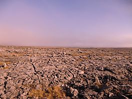
As you walk, you'll cross a special area called The Burren. It's one of the biggest places in Europe with a unique type of rock called karst limestone. This means the landscape is made of special rocks that have been shaped by water over many years.
Most people take about five days to walk the whole Burren Way. The path uses different kinds of surfaces. You'll walk on paved roads, small country lanes called boreens, old paths used for moving animals, and even tracks through forests. The trail is officially known as a National Waymarked Trail. This means it's a well-known and looked-after path for walkers.
Contents
What is the Burren Way?
The Burren Way is a famous walking route in Ireland. It lets you explore the incredible Burren region. This area is known for its unique rocky landscape and rare plants.
The trail is managed by the Burren Way Committee. They make sure the path is safe and clear for everyone to enjoy. It's a great way to see the natural beauty of County Clare.
Where Does the Burren Way Go?
The Burren Way starts right at the beach in Lahinch. From there, it follows smaller roads. These roads lead you to the famous Cliffs of Moher. Imagine walking near these giant cliffs overlooking the ocean!
After the cliffs, the path continues on roads to the village of Doolin. Then, it goes on to Lisdoonvarna. North of Lisdoonvarna, the trail joins a boreen. This is a narrow country lane between two areas called Ballinalacken and Formoyle.
Exploring Historic Sites
This part of the trail crosses a high, flat area above the Caher Valley. You'll be walking below a mountain called Slieve Elva. Along this section, you'll pass some really old and interesting places.
Look out for Ballinalacken Castle, which is an old castle. You might also see several ruined stone forts. These are old stone buildings that were used for protection long ago. There's also Newtown Castle, another historic spot.
The trail then joins a road again to reach the town of Ballyvaughan. From Ballyvaughan, the route mostly follows roads. It goes through places like Carran and Killinaboy before finishing in Corofin.
Tips for Walking the Burren Way
Many walkers like to start their journey from Ballyvaughan. They enjoy walking the boreen sections in the northern part of the trail. This lets them experience the unique rocky landscape up close.
The Burren Way is a "moderate" difficulty trail. This means it's not too hard, but it's not super easy either. It's perfect for people who enjoy a good walk and want to see amazing sights.
 | Ernest Everett Just |
 | Mary Jackson |
 | Emmett Chappelle |
 | Marie Maynard Daly |

