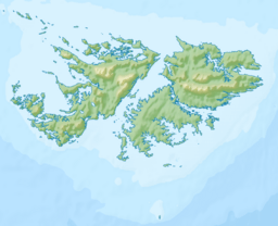
Byron Heights facts for kids
Quick facts for kids Byron Heights |
|
|---|---|
| Highest point | |
| Elevation | 497 m (1,630 ft) |
| Prominence | 497 m (1,630 ft) |
| Geography | |
| Location | Falkland Islands, South Atlantic Ocean |
Byron Heights is a mountain located in the Falkland Islands, a group of islands in the South Atlantic Ocean. It rises to about 497 meters (1,631 feet) high. This mountain is found at the far northwest end of West Falkland. It's about 11.65 kilometers (7.24 miles) southeast of a place called Hope Point.
What Makes Byron Heights Special?
The very top of Byron Heights is home to an important station. This station is called a Remote Radar Head (RRH) Byron Heights. It's part of the British Forces South Atlantic Islands (BFSAI).
A Watchful Eye: The Radar Station
A radar station uses special equipment to detect things far away. The Remote Radar Head at Byron Heights helps to watch over the skies. It acts like an "early warning" system. This means it can spot aircraft or other objects from a long distance. It also helps with "airspace control." This is like guiding planes safely through the sky.
Part of a Bigger Network
The station on Byron Heights is not alone. It's part of a larger network that works together. This network includes other radar stations in the Falkland Islands. For example, there are also stations at Mount Alice on West Falkland and Mount Kent on East Falkland. Together, these stations help keep the area safe and secure.
 | Jewel Prestage |
 | Ella Baker |
 | Fannie Lou Hamer |


