Cabeza Prieta Mountains facts for kids
Quick facts for kids Cabeza Prieta Mountains |
|
|---|---|
| Highest point | |
| Peak | Cabeza Benchmark |
| Elevation | 2,830 ft (860 m) |
| Geography | |
| Country | United States |
| State | Arizona |
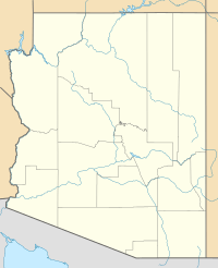
The Cabeza Prieta Mountains are a mountain range found in the southwestern part of Arizona, in an area called the Sonoran Desert. These mountains are located in southern Yuma County. The Sonoran Desert is known for being one of the hottest deserts in North America.
About the Mountains
The Cabeza Prieta Mountains stretch for about 24 miles (39 kilometers) from northwest to southeast. They are part of a group of mountains in this very hot desert region. This area is also near the northern edge of the Gran Desierto de Altar, which is a large desert in Mexico. It's also close to the northern part of the Pinacate volcanic field, an area with old volcanoes.
Tallest Peaks
The highest point in the Cabeza Prieta Mountains is an unnamed peak that stands at 2,832 feet (863 meters) tall. Other important peaks include:
- Cabeza Prieta Peak, which is 2,559 feet (780 meters) high.
- Buck Peak, located in the northern part of the range, at 2,629 feet (801 meters).
- Sierra Arida, in the south, reaching 1,736 feet (529 meters).
A separate mountain called Tordillo Mountain, at 2,170 feet (661 meters), is located southwest of the main range. It is next to a historic road called El Camino del Diablo, which runs along the US-Mexico Border.
Location and Importance
The Cabeza Prieta Mountains are about 36 miles (58 kilometers) southeast of the Mohawk Valley (Arizona). They are also within the Barry M. Goldwater Air Force Range, which is a training area for the Air Force.
Most importantly, these mountains make up the entire western part of the Cabeza Prieta National Wildlife Refuge. This refuge is a special protected area for wildlife. The mountains cover about 20 percent of the refuge's total size, providing a home for many desert animals and plants.
See also
 In Spanish: Sierra de la Cabeza Prieta para niños
 | Georgia Louise Harris Brown |
 | Julian Abele |
 | Norma Merrick Sklarek |
 | William Sidney Pittman |


