Cacho Island facts for kids

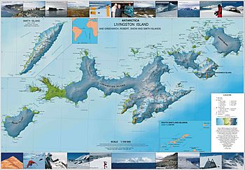
Topographic map of Livingston, Greenwich, Robert, Snow and Smith Islands; Cacho Island is shown as linked to Snow Island by a tiny isthmus that exists no longer
|
|
|
Location of Cacho Island
|
|
| Geography | |
|---|---|
| Location | Antarctica |
| Coordinates | 62°49′57.4″S 61°28′35″W / 62.832611°S 61.47639°W |
| Archipelago | South Shetland Islands |
| Area | 19 ha (47 acres) |
| Length | 750 m (2,460 ft) |
| Width | 350 m (1,150 ft) |
| Administration | |
| Administered under the Antarctic Treaty System | |
| Demographics | |
| Population | uninhabited |
Cacho Island (which is ostrov Cacho in Bulgarian) is a small, rocky island located in the very cold South Shetland Islands. These islands are part of Antarctica. The island is about 250 meters (820 feet) long from east to west and 100 meters (330 feet) wide.
Cacho Island is separated from Aktinia Beach on the southwest coast of Snow Island by a narrow water passage, about 160 meters (525 feet) wide. The island covers an area of about 1.63 hectares, which is roughly the size of two football fields. In the early 1800s, people who hunted seals often visited this area.
The island is named after Javier Cacho Gómez, a Spanish scientist, explorer, and writer. He was part of a Spanish expedition to Antarctica in 1986-1987. He also led the Juan Carlos I Base in Antarctica in later years. The island was named for his important work in promoting Antarctica and for supporting Bulgarian research programs there.
Where is Cacho Island Located?
Cacho Island is found at 62°49′57.4″S 61°28′35″W / 62.832611°S 61.47639°W. This location is about 315 meters (1,033 feet) south of Rebrovo Point. It is also about 2.5 kilometers (1.5 miles) west-northwest of Cape Conway. Bulgarian scientists created maps of this area in 2009 and again in 2017.
Maps of the Region
Scientists and explorers use detailed maps to understand the geography of Antarctica. Here are some important maps that show Cacho Island and the surrounding areas:
- L. Ivanov. Antarctica: Livingston Island and Greenwich, Robert, Snow and Smith Islands. This is a topographic map, meaning it shows the shape and features of the land. It was made in 2010 by the Manfred Wörner Foundation.
- L. Ivanov. Antarctica: Livingston Island and Smith Island. This is another topographic map, updated in 2017 by the Manfred Wörner Foundation.


