
Caguas barrio-pueblo facts for kids
Quick facts for kids
Caguas barrio-pueblo
Pueblo de Caguas
|
|
|---|---|
|
Municipality Seat
|
|

The old Caguas City Hall is a museum
|
|

Location of Caguas barrio-pueblo within the municipality of Caguas shown in red
|
|

Caguas barrio-pueblo
Location in Caribbean
|
|
| Commonwealth | |
| Municipality | |
| Area | |
| • Total | 2.67 sq mi (6.9 km2) |
| • Land | 2.67 sq mi (6.9 km2) |
| • Water | 0 sq mi (0 km2) |
| Elevation | 233 ft (71 m) |
| Population
(2010)
|
|
| • Total | 22,406 |
| • Density | 8,391.8/sq mi (3,240.1/km2) |
| Source: 2010 Census | |
| Time zone | UTC−4 (AST) |
Caguas Pueblo is the main downtown area of Caguas, Puerto Rico. It's like the heart of the city, where the local government offices are located. It sits near the Cagüitas River and the Grande de Loíza River. In 2010, about 22,406 people lived here.
In Puerto Rico, many towns have a special area called pueblo or barrio-pueblo. This area usually has a main town square, important city buildings like the city hall, and a Catholic church. Every year, fun festivals called Fiestas patronales (patron saint festivals) are held in the main square. The city's main offices were in the old City Hall building until 2010. Then, a new City Hall opened in another part of downtown.
Contents
Exploring Caguas Pueblo
Caguas Pueblo is also known as Downtown Caguas in English. It is located in the flat lands of the Caguas Valley. The Cagüitas River is to its north, the Loíza River to its east, and the Turabo River to its south.
A Look at Caguas History
The area where downtown Caguas is today was first home to the Taíno people. This part of the Caguas Valley was great for growing crops like cassava. This was because the soil was very rich from the rivers. When the Spanish arrived, the local tribes were led by a chief named Caguax. The Spanish settlement was named San Sebastián del Piñal de Caguax after him.
This village became an official town in 1812. Its first city hall was built in 1820. It was given the important title of "Villa and District headquarters of a Spanish province." Finally, in 1894, it became a full city.
After the Spanish–American War, Puerto Rico became a territory of the United States in 1898. In 1899, a count of the population found that 5,450 people lived in Caguas Pueblo. A strong hurricane called San Felipe Segundo hit in 1928. It caused a lot of damage, and many old buildings were destroyed. This is why many of the older buildings you see today, like the cathedral, were built in the 1930s.
The Main Town Square and Cathedral

The main town square in Caguas is called Plaza de Recreo Santiago R. Palmer. It is one of the biggest main squares in all of Puerto Rico. This public space is often used for fun events and is a place where people can meet and hang out.
Long ago, Spanish laws said that these squares should be big enough for celebrations. They also said that nearby streets should have covered walkways. These walkways would protect people from the sun and rain.
Right across from the main square is the Catedral Dulce Nombre de Jesús. This is a large Catholic church that serves the area. A small chapel was built here in 1626. By 1775, it had its current name. A bigger church made of stone began construction in 1830. This church was used until the 1928 hurricane damaged it badly. It was torn down and rebuilt starting in 1936. The church was fixed up again in 1999. In 1964, it became a cathedral, which is a very important church.
Famous Places to Visit
Caguas Pueblo has many interesting places to see:
- Aguayo Aldea Vocational High School: This is a historic building from 1939 with cool Art Deco style.
- Caguas Cathedral Dulce Nombre de Jesús: The main Catholic cathedral for the area.
- Caguas Museum of Art: Found in a historic building called Casa Amarilla.
- Caguas Museum of Folk Arts: Shows off local arts and crafts from Caguas and Puerto Rico.
- Caguas Museum of History: Located in the old city hall building.
- Caguas Museum of Tobacco: Teaches about the history of tobacco in Caguas and the Caribbean.
- Centro Criollo de Ciencias y Tecnología del Caribe: A science and technology center with a museum and workshops.
- Centro de Bellas Artes de Caguas: A big center for performing arts, with one of the largest theaters in Puerto Rico.
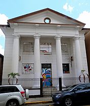
- First Baptist Church of Caguas: A historic church that is also a museum.
- Gautier Benítez High School: Another historic building from 1924, built in a classic style.
- La Asturiana: A historical bakery and café.
- Las Catalinas Mall: A shopping mall built where a sugarcane plantation used to be.
- Logia Unión y Amparo No. 44: A historic building for a masonic lodge.
- Old Telegraph: You can find this at the Casa del Rey building, next to the city hall.
- Panadería La Française: A popular bakery that is now a restaurant and pizza place.
- Paseo de las Artes Abelardo Díaz Alfaro: A lively walkway next to the performing arts center, known for its nightlife.
- Paseo Gautier Benítez: A street just for walking, with shops, restaurants, and bars.
- Plaza del Mercado de Caguas: The city's main market, now with food stores, restaurants, and cultural events.
- Plaza Juan Corujo Collazo: A small square and park.
- Taíno Heritage Monument: A statue often called La India de Caguas.
Gallery
Places in Caguas barrio-pueblo:
-
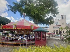
Carousel in Plaza Palmer (main town square) and the cathedral in the back
-
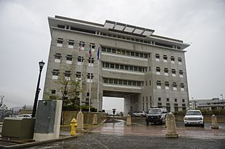
New Caguas City Hall
-
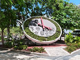
Floral clock with faces of famous past citizens of Caguas
-
Caguas Museum of Art
-
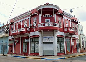
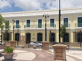
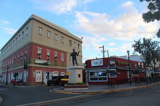
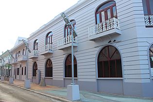
Typical architecture
-
Historic masonic lodge
-
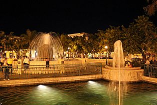
Fountain in Plaza Palmer.
-
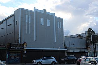
Old Caguas theater.
-
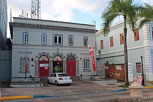
The old Telegraph building of Caguas.
-
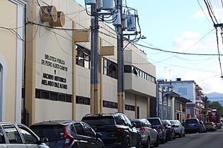
Dr. Pedro Albizu Campos Public Library and Caguas Historical Archives
-
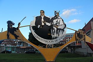
Monument to the Cadiz Constitution
-
Padial Street
-
Historic bank building in Plaza Palmer

.jpg)


See also
 In Spanish: Caguas (Caguas) para niños
- List of communities in Puerto Rico
