Camiña facts for kids
Quick facts for kids
Camiña
|
|||||
|---|---|---|---|---|---|
|
|||||
| Country | |||||
| Region | |||||
| Province | Tamarugal | ||||
| Government | |||||
| • Type | Municipality | ||||
| Area | |||||
| • Total | 2,200.2 km2 (849.5 sq mi) | ||||
| Elevation | 2,406 m (7,894 ft) | ||||
| Population
(2012 census)
|
|||||
| • Total | 1,156 | ||||
| • Density | 0.52541/km2 (1.3608/sq mi) | ||||
| • Urban | 0 | ||||
| • Rural | 1,275 | ||||
| Sex | |||||
| • Men | 676 | ||||
| • Women | 599 | ||||
| Time zone | UTC-4 (CLT) | ||||
| • Summer (DST) | UTC-3 (CLST) | ||||
| Area code(s) | (+56) 5 | ||||
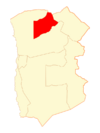
Camiña is a small village and a commune (a type of local government area) in Chile. It is located in the El Tamarugal Province within the Tarapacá Region.
In 2002, about 1,275 people lived in Camiña. The commune covers a large area of about 2,200 square kilometers (850 square miles).
People and Population
In 2002, a study by the National Statistics Institute showed that Camiña had 1,275 residents. This included 676 men and 599 women. The entire population of Camiña lives in rural (countryside) areas.
Between 1992 and 2002, the number of people living in Camiña went down by 10.3%. This means 147 fewer people lived there.
How Camiña is Governed
Camiña is a local government area in Chile. It is managed by a group called a municipal council. This council works to make decisions for the community.
The leader of the council is an alcalde, which is like a mayor. The people of Camiña vote directly for their alcalde every four years.
Representing Camiña in Government
Camiña is part of a larger area for voting in national elections.
- In the Chamber of Deputies: This is one part of Chile's national parliament. Camiña is in the 2nd electoral district. This district includes the whole Tarapacá Region.
- In the Senate: This is the other part of Chile's national parliament. Camiña is in the 1st senatorial constituency. This area includes both the Arica and Parinacota Region and the Tarapacá Region.
See also
 In Spanish: Camiña para niños
 | Roy Wilkins |
 | John Lewis |
 | Linda Carol Brown |


