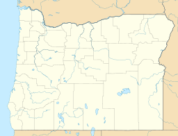
Camp Lake (Oregon) facts for kids
Quick facts for kids Camp Lake |
|
|---|---|
| Location | Deschutes County, Oregon, United States |
| Coordinates | 44°07′55″N 121°45′38″W / 44.13194°N 121.76056°W |
| Basin countries | United States |
| Surface area | 6.4 acres (2.6 ha) |
| Shore length1 | 0.4 miles (0.64 km) |
| Surface elevation | 6,968 feet (2,124 m) |
| 1 Shore length is not a well-defined measure. | |
Camp Lake is a beautiful, small lake found high up in the mountains of Oregon, a state in the United States. It's located in Deschutes County. This special lake sits between two large volcanic mountains called Middle Sister and South Sister.
The lake is about 7,000 feet (or 2,134 meters) above sea level. That's really high up! It's part of a wild and natural area called the Three Sisters Wilderness, which is in the Cascade Range of mountains. A path known as the Camp Lake Trail goes right along the northern edge of the lake.
All About Camp Lake
Camp Lake is quite small, covering an area of about 6.4 acres. That's roughly the size of five football fields! Its shoreline, or the distance around the lake, is about 0.4 miles (or 0.64 kilometers).
Where the Water Comes From
This lake is very important because it's where the south fork of Whychus Creek begins. This means Camp Lake is the "headwaters" for that creek. Think of it as the starting point for a small river. Whychus Creek then flows into the Deschutes River, which is a much larger river in Oregon.
Exploring the Area
The area around Camp Lake is part of the Three Sisters Wilderness. This is a protected natural space where you can find amazing wildlife and plants. It's a popular spot for hiking and enjoying nature. The Camp Lake Trail offers a great way to see the lake up close.


