Camp Springs, Maryland facts for kids
Quick facts for kids
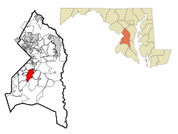
Camp Springs, Maryland
|
|
|---|---|

Location of Camp Springs, Maryland
|
|
| Country | |
| State | |
| County | |
| Area | |
| • Total | 7.69 sq mi (19.93 km2) |
| • Land | 7.68 sq mi (19.89 km2) |
| • Water | 0.01 sq mi (0.04 km2) |
| Elevation | 266 ft (81 m) |
| Population
(2020)
|
|
| • Total | 22,734 |
| • Density | 2,960.16/sq mi (1,142.95/km2) |
| Time zone | UTC−5 (Eastern (EST)) |
| • Summer (DST) | UTC−4 (EDT) |
| ZIP codes |
20746, 20748
|
| Area code(s) | 301, 240 |
| FIPS code | 24-12600 |
| GNIS feature ID | 0597172 |
Camp Springs is a community in Prince George's County, Maryland, in the United States. It's not an official town, but a "census-designated place" (CDP). This means it's an area the government defines for counting people. In 2020, about 22,734 people lived there. Camp Springs doesn't have its own post office. Instead, mail goes to nearby places like Temple Hills or Clinton.
Contents
History of Camp Springs
Camp Springs started in the mid-1800s. It was at a busy crossroads. This is where today's Branch Avenue and Allentown Road meet. By 1860, the area had shops, a blacksmith, a school, and a church.
How Camp Springs Got Its Name
Early maps called the area Allentown. This was after the Allen family, who owned a lot of land. But people soon called it Camp Springs. Local stories say soldiers used to camp there. They were traveling to Fort Meade from Washington, D.C. They liked the area because it had many springs for water.
Growth and Development
For many years, Camp Springs didn't grow much. But things changed after World War II. Andrews Air Force Base opened nearby. Also, many people needed homes after the war. Camp Springs was a great spot for new houses.
Most of the new homes were built in the 1940s and 1950s. Water and sewer lines were added later, in the late 1950s and early 1960s. This helped the area grow even more. Large neighborhoods like Glenn Hills and Westchester Estates were built. Many shops and restaurants also opened along Allentown Road. The biggest growth happened in the 1960s and 1970s. This was after the Capital Beltway was built.
Geography and Important Places
Camp Springs is located in Maryland. It covers about 7.7 square miles (19.9 square kilometers). Only a tiny part of this area is water.
Key Locations in Camp Springs
- Joint Base Andrews: This important air force base is right next to Camp Springs. It's home to Air Force One, the plane used by the President. The base helped Camp Springs grow a lot.
- Capital Beltway: This major highway passes through Camp Springs. It makes it easy to travel to other areas.
- Washington Metro: The Branch Avenue station is nearby. It's the end of the Green Line subway. This connects Camp Springs to Washington, D.C..
- Recreation: There's a public swimming pool on Allentown Road. It's open all year. The Camp Springs Senior Activity Center is also there.
- Climate: Camp Springs has a warm, humid climate in summer. Winters are usually mild.
Population and People
Camp Springs has grown quite a bit over the years. In 1970, about 22,776 people lived there. By 2020, the population was 22,734. The community is very diverse. Most residents are African American. There are also many people of Hispanic or Latino background.
Education
Students in Camp Springs go to schools in the Prince George's County Public Schools district.
Local Schools
- Elementary Schools: Children attend schools like Allenwood, Avalon, William Beanes, Hillcrest Heights, and Princeton.
- Middle Schools: Students go to Thurgood Marshall, Isaac J. Gourdine, or Drew-Freeman Middle Schools.
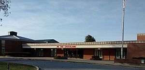
- High Schools: Most high school students attend Crossland High School. Some parts of Camp Springs are zoned for Dr. Henry A. Wise High School.
Some elementary schools in the area have closed over the years. Middleton Valley Elementary closed in 2010. Skyline Elementary closed in 2016.
See also
 In Spanish: Camp Springs para niños
 | Janet Taylor Pickett |
 | Synthia Saint James |
 | Howardena Pindell |
 | Faith Ringgold |


