Camp Wood, Texas facts for kids
Quick facts for kids
Camp Wood, Texas
|
|
|---|---|

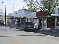
A glimpse of along Nueces Street (Texas State Highway 55) in Camp Wood, March 2011
|
|

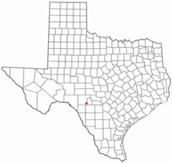
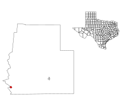
Location of Camp Wood, Texas
|
|
 |
|
| Country | United States |
| State | Texas |
| County | Real |
| Area | |
| • Total | 0.50 sq mi (1.30 km2) |
| • Land | 0.50 sq mi (1.30 km2) |
| • Water | 0.00 sq mi (0.00 km2) |
| Elevation | 1,463 ft (446 m) |
| Population
(2020)
|
|
| • Total | 517 |
| • Estimate
(2019)
|
731 |
| • Density | 1,450.40/sq mi (560.52/km2) |
| Time zone | UTC-6 (Central (CST)) |
| • Summer (DST) | UTC-5 (CDT) |
| ZIP code |
78833
|
| Area code | 830 |
| FIPS code | 48-12388 |
| GNIS feature ID | 2409970 |
Camp Wood is a small city in Real County, Texas, United States. It is located in the beautiful Texas Hill Country, which is a part of the Edwards Plateau. As of the 2020 census, about 517 people lived there.
Contents
Exploring Camp Wood's History
Camp Wood was officially started in the year 1920. It has grown into the community you see today.
Geography and Climate of Camp Wood
Camp Wood covers a total area of about 0.5 square miles (1.3 square kilometers). All of this area is land.
Understanding Camp Wood's Weather
The weather in Camp Wood is known for its hot and humid summers. Winters are usually mild to cool. This type of weather is called a humid subtropical climate. On special climate maps, it's often labeled as Cfa.
Who Lives in Camp Wood?
The 2020 United States census counted 517 people living in Camp Wood. There were 262 households and 179 families in the city.
Diversity in Camp Wood
The people living in Camp Wood come from many different backgrounds. Here's a quick look at the main groups:
- About 56.48% of the people are White (not Hispanic or Latino).
- Around 39.07% of the people are Hispanic or Latino.
- Smaller numbers of people are Black or African American, Asian, Pacific Islander, or from mixed racial backgrounds.
Learning in Camp Wood
Students in Camp Wood attend schools managed by the Nueces Canyon Consolidated Independent School District. This district helps provide education for the children and teens in the area.
See also
 In Spanish: Camp Wood para niños
 | Janet Taylor Pickett |
 | Synthia Saint James |
 | Howardena Pindell |
 | Faith Ringgold |

