Campo Alegre, Hatillo, Puerto Rico facts for kids
Quick facts for kids
Campo Alegre
|
|
|---|---|
|
Barrio
|
|

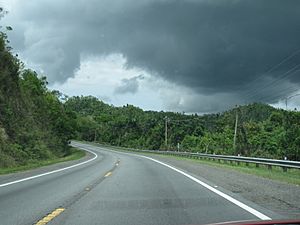
On PR-129 near Campo Alegre
|
|

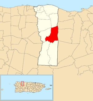
Location of Campo Alegre within the municipality of Hatillo shown in red
|
|
| Commonwealth | |
| Municipality | |
| Area | |
| • Total | 4.64 sq mi (12.0 km2) |
| • Land | 4.62 sq mi (12.0 km2) |
| • Water | 0.02 sq mi (0.05 km2) |
| Elevation | 591 ft (180 m) |
| Population
(2010)
|
|
| • Total | 5,210 |
| • Density | 1,125.3/sq mi (434.5/km2) |
| Source: 2010 Census | |
| Time zone | UTC−4 (AST) |
Campo Alegre is a rural barrio in the municipality of Hatillo, Puerto Rico. A barrio is like a district or neighborhood. In 2010, about 5,210 people lived in Campo Alegre. It's a quiet area known for its natural beauty in Puerto Rico.
How Many People Live in Campo Alegre?
The number of people living in Campo Alegre has changed quite a bit over the years. This information comes from the U.S. Census, which counts how many people live in different places every ten years.
| Historical population | |||
|---|---|---|---|
| Census | Pop. | %± | |
| 1900 | 995 | — | |
| 1910 | 1,037 | 4.2% | |
| 1920 | 1,311 | 26.4% | |
| 1930 | 1,591 | 21.4% | |
| 1940 | 1,653 | 3.9% | |
| 1950 | 2,718 | 64.4% | |
| 1980 | 3,781 | — | |
| 1990 | 4,214 | 11.5% | |
| 2000 | 4,829 | 14.6% | |
| 2010 | 5,210 | 7.9% | |
| U.S. Decennial Census 1899 (shown as 1900) 1910-1930 1930-1950 1980-2000 2010 |
|||
As you can see from the chart, the population of Campo Alegre has grown steadily. For example, in 1900, there were less than 1,000 people. By 2010, the population had grown to over 5,000 people. This shows how the community has developed over more than a century.
See also
 In Spanish: Campo Alegre (Hatillo) para niños
- List of communities in Puerto Rico
Black History Month on Kiddle
Famous African-American Inventors:
 | Lonnie Johnson |
 | Granville Woods |
 | Lewis Howard Latimer |
 | James West |

All content from Kiddle encyclopedia articles (including the article images and facts) can be freely used under Attribution-ShareAlike license, unless stated otherwise. Cite this article:
Campo Alegre, Hatillo, Puerto Rico Facts for Kids. Kiddle Encyclopedia.

