Candy Creek (Haw River tributary) facts for kids
Quick facts for kids Candy Creek |
|
|---|---|
|
Location of Candy Creek mouth
|
|
| Other name(s) | Tributary to Haw River |
| Country | United States |
| State | North Carolina |
| County | Rockingham Guilford |
| Physical characteristics | |
| Main source | divide between Candy Creek and Reedy Fork about 1 mile east of Monticello, North Carolina 780 ft (240 m) 36°13′17″N 079°39′31″W / 36.22139°N 79.65861°W |
| River mouth | Haw River about 5 miles south of Reidsville, North Carolina 675 ft (206 m) 36°15′54″N 079°38′56″W / 36.26500°N 79.64889°W |
| Length | 3.03 mi (4.88 km) |
| Basin features | |
| Progression | north-northeast |
| River system | Haw River |
| Basin size | 3.10 square miles (8.0 km2) |
| Tributaries |
|
| Bridges | Candy Creek Road, US 29 |
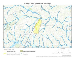
Candy Creek is a small stream in North Carolina, United States. It flows for about 3.1 miles (5 km). This creek is a "first order tributary," which means it's one of the smallest streams that flows directly into a larger river, in this case, the Haw River. Candy Creek is located in Rockingham and Guilford Counties.
Contents
What's in a Name?
Candy Creek has had a couple of other names over time. People have also called it:
- Kanady Creek
- Kenadys Branch
Where Does Candy Creek Flow?
Candy Creek starts in Guilford County. Its source is about 1 mile (1.6 km) east of a place called Monticello. This starting point is on a natural high ground that separates Candy Creek from another stream called Reedy Fork.
From there, Candy Creek flows generally towards the north-northeast. It then enters Rockingham County. Finally, it joins the Haw River about 5 miles (8 km) south of Reidsville, North Carolina.
Understanding the Watershed
A watershed is like a giant bowl. It's an area of land where all the rain and snowmelt drain into a common body of water, like a river or a creek. Candy Creek's watershed covers about 3.1 square miles (8 square kilometers).
This area gets a good amount of rain, about 46.2 inches (117 cm) each year. About 29% of the land in the Candy Creek watershed is covered by forests. These forests help keep the water clean and provide homes for wildlife.
Nature Around Candy Creek
One special spot in the Candy Creek watershed is called the Candy Creek Beaver Pond. This area is important locally because it's part of a larger wetland system. Wetlands are areas where water covers the soil, or is present either at or near the surface of the soil all year or for varying periods of time during the year. They are very important habitats for many plants and animals.
Images for kids
 | Georgia Louise Harris Brown |
 | Julian Abele |
 | Norma Merrick Sklarek |
 | William Sidney Pittman |


