Canoe Lake (Saskatchewan) facts for kids
Quick facts for kids Canoe Lake |
|
|---|---|

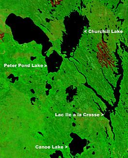
NASA map showing Canoe Lake
|
|
| Location | Saskatchewan |
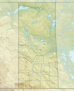
| Coordinates | 55°10′00″N 108°15′03″W / 55.16667°N 108.25083°W |
| Primary inflows | Arseneault Lake, Macallum Lake from the west |
| Primary outflows | Canoe River to Lac Île-à-la-Crosse |
| Catchment area | Churchill River |
| Basin countries | Canada |
| Islands | Cole Island |
| Settlements | Canoe Narrows, Cole Bay, Jans Bay |
Canoe Lake is a freshwater lake located in the northwestern part of Saskatchewan, Canada. It's an important natural feature in the region, surrounded by small communities and connected to other waterways.
Contents
About Canoe Lake
Canoe Lake is a significant body of water in Saskatchewan. It plays a role in the local environment and supports the communities that live around its shores.
Communities Around Canoe Lake
Several small communities are located right on the shores of Canoe Lake. These include Canoe Narrows, Cole Bay, and Jans Bay. These communities are home to people who live and work near the lake.
Getting to Canoe Lake
You can reach Canoe Lake by road using Highway 965 and Highway 903. These highways make it easier for people to visit the lake or travel between the nearby communities.
Waterways and Nearby Areas
Canoe Lake is part of a larger water system. Water flows into Canoe Lake from Arseneault Lake and Macallum Lake, which are located to the west. The Canoe River then flows out of Canoe Lake towards the east, eventually reaching Lac Île-à-la-Crosse. This connection means Canoe Lake is part of the larger Churchill River system.
To the west of Canoe Lake is the Primrose Lake Air Weapons Range. This area is used for training by the Canadian Armed Forces.
 | Sharif Bey |
 | Hale Woodruff |
 | Richmond Barthé |
 | Purvis Young |


