Cape Newenham Long Range Radar Site facts for kids
Quick facts for kids Cape Newenham Air Force StationCape Newenham Long Range Radar Site |
|
|---|---|
| Part of Eleventh Air Force (PACAF) | |
|
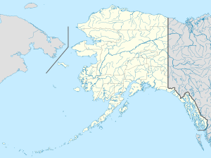
Location of Cape Newenham AFS, Alaska
|
|
| Coordinates | 58°37′36″N 162°04′34″W / 58.62667°N 162.07611°W |
| Type | Air Force Station |
| Site information | |
| Controlled by | |
| Site history | |
| Built | 1951 |
| In use | 1954-Present |
| Garrison information | |
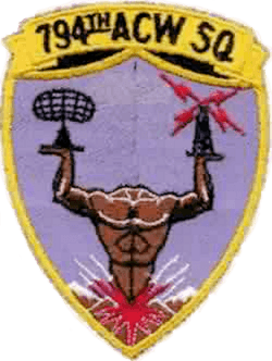
| Garrison | 794th Aircraft Control and Warning Squadron (1954-1983) |
Cape Newenham Air Force Station was an important military base in Alaska. It was a radar station used by the United States Air Force. Its main job was to watch for airplanes and missiles during the Cold War.
This station is located about 67.5 miles (108.6 km) west-southwest of Togiak, Alaska. It stopped being a full radar station on November 1, 1983. After that, it became a Long Range Radar (LRR) site. Today, it is still active as part of the Alaska NORAD Region. This means it helps protect the skies over North America. The 611th Air Support Group at Elmendorf AFB in Alaska manages it.
Contents
History of Cape Newenham Air Force Station
Cape Newenham Air Force Station was built to protect the United States. It was part of a system to give early warnings. This system would alert the Air Force if the Soviet Union tried to attack Alaska.
Building the Station
Construction started on September 12, 1950. Building the station was very difficult. The only way to get materials was by barges or Navy ships. These ships could only deliver supplies when the sea was not frozen. They had to unload about 2.2 miles (3.5 km) from the building site. There were no roads at first, so workers had to build them.
The station finally started working in April 1954. This was two years later than planned. The 794th Aircraft Control and Warning Squadron managed the station. This squadron had 107 military members.
Life at the Station
The main part of the station was in a valley between mountains. Soldiers had places to relax, like hobby shops and game rooms. They could also play sports such as skiing, skating, and basketball. All the buildings were connected by covered walkways. This meant people did not have to go outside in the cold winter.
Soldiers usually stayed at the station for only one year. This was because of the tough conditions and how isolated it was. Mail was delivered about twice a week.
The station used a special tramway to reach the radar antennas. These antennas were on a mountain peak 2,300 feet (700 meters) high. The tramway cables often broke because of strong winds and ice. Fixing them was dangerous due to fog and extreme cold. Sometimes, ice 16 inches (41 cm) thick would build up on the cables. A new, stronger tramway was put in place in 1962.
How the Radar Worked
Cape Newenham AFS first used an AN/FPS-3 radar. This was later updated to an AN/FPS-93A radar. The station collected information 24 hours a day, 7 days a week. This data was sent to the control center at King Salmon AFS. There, experts would figure out how far away planes were, their direction, height, and speed. They also determined if the planes were friendly or not.
In July 1965, a new computer system was installed. This system, called AN/FYQ-9, helped process data automatically. It made the job much faster and easier.
Supplies and Transport
The station received supplies once a year by sea. Large items were brought ashore by landing craft. Fuel was pumped from ships to storage tanks. This was part of an annual supply operation called "Cool Barge."
An airport was built in 1952. It was about 1.6 miles (2.6 km) north-northeast of the station. This airport helped bring in people and important supplies.
Communication Systems
At first, the station used a high-frequency radio system for communication. But this system was not always reliable because of weather. So, the Air Force built the White Alice Communications System. This was a network of radio sites. The Cape Newenham site for White Alice started working in December 1957.
In March 1979, the White Alice system was replaced. A new satellite system took over. This was part of a plan to use more modern technology.
Modernization and Closure
In the late 1970s, a new main building was constructed. This building cost $11.7 million. It was finished in 1980, but people could not move in until 1981 due to safety checks.
In 1977, the Air Force started using civilian contractors to help run the remote stations. This meant fewer military personnel were needed. By 1983, Cape Newenham received a new radar system called AN/FPS-117. This radar could work with very few people. It sent aircraft tracking data by satellite to the main control center at Elmendorf AFB.
Because of the new radar, the 794th Aircraft Control and Warning Squadron was closed on November 1, 1983. The station became a Long Range Radar (LRR) Site. Only civilian contractors were needed to keep the radar working. The new composite building was used to house the remaining staff and equipment.
In 1998, the Pacific Air Forces started "Operation Clean Sweep." This project cleaned up abandoned Cold War stations in Alaska. The goal was to return the land to its natural state. The cleanup at Cape Newenham was finished by 2005.
Current Status
Today, not much is left of the old Cape Newenham Air Force Station. The Pacific Air Forces 611th Air Support Group manages the site. It is usually empty, with only a few civilian contractors visiting. They fly to the Cape Newenham LRRS Airport when they need to maintain the radar system.
Climate
Cape Newenham has a subarctic climate, which is common in Alaska. However, because it is close to the Bering Sea, it also has some features of a polar climate. It gets a lot of rain and snow, similar to places near an ocean.
| Climate data for Cape Newenham (1961–1990 normals, extremes 1953–1984) | |||||||||||||
|---|---|---|---|---|---|---|---|---|---|---|---|---|---|
| Month | Jan | Feb | Mar | Apr | May | Jun | Jul | Aug | Sep | Oct | Nov | Dec | Year |
| Record high °F (°C) | 50 (10) |
50 (10) |
48 (9) |
47 (8) |
68 (20) |
66 (19) |
75 (24) |
67 (19) |
66 (19) |
55 (13) |
50 (10) |
50 (10) |
75 (24) |
| Mean maximum °F (°C) | 40.3 (4.6) |
38.0 (3.3) |
39.7 (4.3) |
41.9 (5.5) |
53.4 (11.9) |
59.9 (15.5) |
64.0 (17.8) |
61.8 (16.6) |
56.9 (13.8) |
48.6 (9.2) |
42.4 (5.8) |
40.8 (4.9) |
65.0 (18.3) |
| Mean daily maximum °F (°C) | 23.9 (−4.5) |
22.0 (−5.6) |
26.4 (−3.1) |
31.7 (−0.2) |
41.0 (5.0) |
49.3 (9.6) |
53.2 (11.8) |
53.2 (11.8) |
49.2 (9.6) |
39.0 (3.9) |
30.8 (−0.7) |
25.5 (−3.6) |
37.2 (2.9) |
| Daily mean °F (°C) | 19.2 (−7.1) |
16.8 (−8.4) |
22.2 (−5.4) |
27.2 (−2.7) |
37.3 (2.9) |
45.3 (7.4) |
49.7 (9.8) |
50.3 (10.2) |
46.7 (8.2) |
35.5 (1.9) |
29.0 (−1.7) |
20.5 (−6.4) |
33.3 (0.7) |
| Mean daily minimum °F (°C) | 14.7 (−9.6) |
12.9 (−10.6) |
17.2 (−8.2) |
23.5 (−4.7) |
33.3 (0.7) |
41.3 (5.2) |
45.8 (7.7) |
47.0 (8.3) |
43.3 (6.3) |
33.0 (0.6) |
23.8 (−4.6) |
16.4 (−8.7) |
29.5 (−1.4) |
| Mean minimum °F (°C) | −8.1 (−22.3) |
−8.6 (−22.6) |
−3.1 (−19.5) |
8.6 (−13.0) |
24.1 (−4.4) |
34.6 (1.4) |
40.8 (4.9) |
43.0 (6.1) |
35.7 (2.1) |
19.9 (−6.7) |
9.3 (−12.6) |
−4.4 (−20.2) |
−15.3 (−26.3) |
| Record low °F (°C) | −22 (−30) |
−28 (−33) |
−21 (−29) |
−6 (−21) |
15 (−9) |
29 (−2) |
36 (2) |
39 (4) |
28 (−2) |
9 (−13) |
−9 (−23) |
−19 (−28) |
−28 (−33) |
| Average precipitation inches (mm) | 1.83 (46) |
1.17 (30) |
1.47 (37) |
1.54 (39) |
2.19 (56) |
2.79 (71) |
3.65 (93) |
5.06 (129) |
4.94 (125) |
4.62 (117) |
3.40 (86) |
2.19 (56) |
34.84 (885) |
| Average snowfall inches (cm) | 12.4 (31) |
8.4 (21) |
9.7 (25) |
9.0 (23) |
3.5 (8.9) |
0.0 (0.0) |
0.0 (0.0) |
0.0 (0.0) |
trace | 4.6 (12) |
10.7 (27) |
11.3 (29) |
69.6 (177) |
| Average precipitation days (≥ 0.01 inch) | 13.3 | 11.2 | 14.1 | 14.4 | 11.6 | 12.7 | 15.1 | 18.6 | 19.4 | 17.9 | 17.1 | 15.5 | 180.9 |
| Average snowy days (≥ 0.1 inch) | 10.9 | 10.1 | 12.3 | 12.5 | 5.1 | 0.1 | 0.0 | 0.0 | 0.1 | 6.1 | 12.3 | 13.5 | 83.0 |
| Source 1: WRCC | |||||||||||||
| Source 2: XMACIS (snowfall) | |||||||||||||
Air Force Units and Assignments
This section explains which Air Force groups and squadrons were in charge of Cape Newenham.
Units
- The 794th Aircraft Control and Warning Squadron was officially created on November 3, 1952.
- It started working on December 8, 1952.
- The squadron was closed down on November 1, 1983.
Assignments
The 794th Squadron was part of different larger Air Force groups over the years:
- 531st Aircraft Control and Warning Group (from December 8, 1952)
- 10th Air Division (from April 13, 1953)
- 5039th Aircraft Control and Warning Group (later 5050th Aircraft Control) (from June 1, 1957)
- 10th Air Division (from November 1, 1959)
- 5070th Air Defense Wing (from August 1, 1960)
- Alaskan Air Command (from November 1, 1961)
- 531st Aircraft Control and Warning Group (later 11th Tactical Control Group, 11th Tactical Control Wing) (from November 15, 1977 until November 1, 1983)
 | Stephanie Wilson |
 | Charles Bolden |
 | Ronald McNair |
 | Frederick D. Gregory |


