Cape St facts for kids
Quick facts for kids
Cape St. Claire, Maryland
|
|
|---|---|

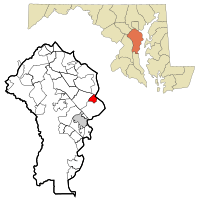
Location of Cape St. Claire, Maryland
|
|
| Country | |
| State | |
| County | |
| Area | |
| • Total | 2.5 sq mi (6.5 km2) |
| • Land | 2.0 sq mi (5.2 km2) |
| • Water | 0.5 sq mi (1.4 km2) |
| Elevation | 82 ft (25 m) |
| Population
(2010)
|
|
| • Total | 8,747 |
| • Density | 4,366/sq mi (1,685.9/km2) |
| Time zone | UTC-5 (Eastern (EST)) |
| • Summer (DST) | UTC-4 (EDT) |
| ZIP |
21409
|
| Area code(s) | 410, 443 |
| FIPS code | 24-12912 |
| GNIS feature ID | 0589888 |
Cape St. Claire is a community in Anne Arundel County, Maryland. It is a suburb of Annapolis. It is also known as a census-designated place (CDP). This means it is a special area the government uses to count people.
The main part of Cape St. Claire is inside this CDP. But the CDP also includes smaller neighborhoods. These are Atlantis, Walnut Ridge, Green Holly, and St. Claire Court. In 2010, about 8,747 people lived here.
Cape St. Claire has many fun places. There are three marinas, many parks, and beaches. You can also find a shopping center and a swim club. The community has schools like Broadneck High School and Cape St. Claire Elementary School. A volunteer fire company helps keep everyone safe. There are also three churches in the area.
Contents
Where is Cape St. Claire Located?
Cape St. Claire is located at 39°2′34″N 76°26′44″W / 39.04278°N 76.44556°W. It is bordered by several waterways. The Little Magothy River is to the east. The Magothy River is to the north. Deep Creek is to the west. College Parkway is to the south.
U.S. Route 50 runs just south of the community. This road can take you to Annapolis, which is about 7 miles (11 km) west. It also leads to the Chesapeake Bay Bridge, about 3 miles (5 km) east.
The total area of the CDP is about 2.5 square miles (6.5 square kilometers). Most of this is land, about 2.0 square miles (5.2 square kilometers). The rest is water, about 0.5 square miles (1.4 square kilometers).
Who Lives in Cape St. Claire?
In 2000, about 8,022 people lived in Cape St. Claire. There were 2,857 households, which are groups of people living in one home. Most people were White. There were also African American, Asian, and Native American residents. Some people were from two or more races. About 2% of the population was Hispanic or Latino.
Many families in Cape St. Claire have children. About 41.7% of households had kids under 18. The average household had about 2.79 people. The average family had about 3.19 people.
The community has people of all ages. About 28.6% of residents were under 18. About 32.7% were between 25 and 44 years old. The median age was 36 years. This means half the people were younger than 36, and half were older.
How Did Cape St. Claire Start?
Before the 1940s, the area of Cape St. Claire was mostly farmland. A few families owned and worked on this land in the late 1700s. Two old houses from that time are still standing today. One is the "Stinchcomb House" near the community clubhouse. The other is Goshen Farm, located near the elementary school.
In the early 1900s, a doctor named Hugh H. Young started buying up the farmland. He wanted to build a community there. His first try was called Persimmon Point, but it did not work out well. This was because of the Great Depression. After Dr. Young passed away, his children formed a company called the River Bay Company. They continued his plan to develop the land.
The River Bay Company officially planned the community of Cape St. Claire on June 14, 1949. They wanted it to be a summer getaway. People from Washington, D.C. and Baltimore could come here to relax. To help manage the community, the River Bay Company created the Cape St. Claire Club. This club was later renamed the Cape St. Claire Improvement Association in 1959.
In 1989, the county approved a special district for Cape St. Claire. This district allows the community to collect taxes from property owners. The money collected helps improve the community. It has been used to buy more common land and build a fishing pier. It also helps pay for extra security with off-duty police officers.
Community Groups
Besides the Cape St. Claire Improvement Association, there are many other groups in the community. These groups help people connect and offer services.
- Boy Scout Troop 2214
- Cub Scout Pack 707
- Junior Girl Scout Troop 1566
 | William M. Jackson |
 | Juan E. Gilbert |
 | Neil deGrasse Tyson |

