Carter Springs, Nevada facts for kids
Quick facts for kids
Carter Springs, Nevada
|
|
|---|---|
| Country | United States |
| State | Nevada |
| Area | |
| • Total | 2.80 sq mi (7.25 km2) |
| • Land | 2.80 sq mi (7.25 km2) |
| • Water | 0.00 sq mi (0.00 km2) |
| Elevation | 5,522 ft (1,683 m) |
| Population
(2020)
|
|
| • Total | 585 |
| • Density | 208.93/sq mi (80.67/km2) |
| Time zone | UTC-8 (Pacific (PST)) |
| • Summer (DST) | UTC-7 (PDT) |
| ZIP code |
89410
|
| Area code(s) | 775 |
| FIPS code | 32-10200 |
| GNIS feature ID | 2583913 |
Carter Springs is a small community in Douglas County, Nevada, United States. It is known as a census-designated place (CDP). This means it is an area identified by the U.S. Census Bureau for statistical purposes. It is not an officially incorporated town or city.
Where is Carter Springs?
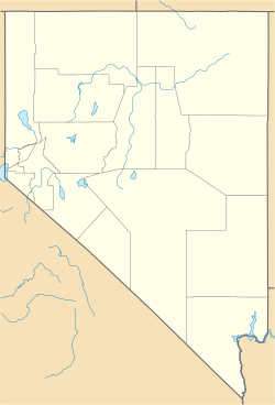
Carter Springs is located in the western part of Nevada. It is about 9 miles (14 kilometers) southeast of a town called Minden. The community is found on the north side of U.S. Route 395, which is a major highway.
The total area of Carter Springs is about 2.8 square miles (7.3 square kilometers). All of this area is land, meaning there are no large lakes or rivers within its boundaries.
How Many People Live There?
Carter Springs is a small community. The number of people living there has changed a bit over the years.
| Historical population | |||
|---|---|---|---|
| Census | Pop. | %± | |
| 2010 | 553 | — | |
| 2020 | 585 | 5.8% | |
| U.S. Decennial Census | |||
- In 2010, the population was 553 people.
- By 2020, the population had grown slightly to 585 people.
This information comes from the United States Census Bureau. They count how many people live in different areas every ten years.
See also
 In Spanish: Carter Springs (Nevada) para niños
 | Selma Burke |
 | Pauline Powell Burns |
 | Frederick J. Brown |
 | Robert Blackburn |


