Carys Creek (Little Nottoway River tributary) facts for kids
Quick facts for kids Carys Creek |
|
|---|---|
| Other name(s) | Tributary to the Little Nottoway River |
| Country | United States |
| State | Virginia |
| County | Nottoway Prince Edward |
| Physical characteristics | |
| Main source | divide between Little Nottoway River and Sandy River (Appomattox River) about 2 miles southwest of Burkeville, Virginia 535 ft (163 m) 37°10′38″N 078°14′33″W / 37.17722°N 78.24250°W |
| River mouth | Little Nottoway River (confluence with Mallorys Creek) about 2 miles southwest of Crewe, Virginia 338 ft (103 m) 37°08′30″N 078°08′57″W / 37.14167°N 78.14917°W |
| Length | 7.06 mi (11.36 km) |
| Basin features | |
| Progression | southeast |
| River system | Nottoway River |
| Basin size | 13.25 square miles (34.3 km2) |
| Tributaries |
|
| Bridges | Cary Shop Road Lone Pine Road Lewiston Plank Road |
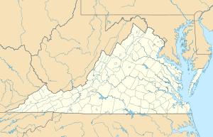
Carys Creek is a small stream, about 7.06 mi (11.36 km) long, located in the state of Virginia in the United States. It's like a smaller river that flows into a bigger one, which is called the Little Nottoway River.
Contents
What is Carys Creek?
Carys Creek is found in the south-central part of Virginia. It's an important part of a larger water system known as the Chowan-Albemarle drainage. Think of it as one piece of a big puzzle of rivers and streams that all connect.
Where Does the Water Come From?
The water in Carys Creek starts from an area called a watershed. A watershed is all the land where rain and snowmelt collect and drain into a specific river or stream. For Carys Creek, most of this land is covered by forests (about 74%). The rest is mostly farmland (about 25%) and other types of land.
Where Does it Go?
Carys Creek flows into the Little Nottoway River. This happens near a place called Crewe, Virginia. The Little Nottoway River then eventually joins the larger Nottoway River, which is part of the bigger water system that flows towards the Atlantic Ocean.
Location and Journey
Carys Creek begins about 2 miles southwest of Burkeville, Virginia. It starts at an elevation of about 535 feet (163 meters) above sea level. From there, it travels southeast.
Bridges Over the Creek
Several roads cross over Carys Creek. These include Cary Shop Road, Lone Pine Road, and Lewiston Plank Road. These bridges help people travel easily across the area.
 | Precious Adams |
 | Lauren Anderson |
 | Janet Collins |


