Castle Rings, Wiltshire facts for kids
Quick facts for kids Castle Rings |
|
|---|---|

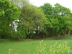
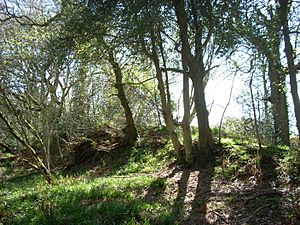
Ditch and rampart of Castle Rings
|
|
| General information | |
| Architectural style | Iron Age hill fort |
| Town or city | Donhead St Mary |
| Country | England |
| Coordinates | 51°01′30″N 2°09′38″W / 51.025046°N 2.160424°W |
| Technical details | |
| Size | 12.8 acres (5.2 ha) |
Castle Rings is an ancient hill fort located in Donhead St Mary, a village in Wiltshire, England. It is a special protected historical site because of its importance. This fort was built during the Iron Age, a very long time ago. It sits high up on sandstone hills, about 228 meters (748 feet) above sea level.
Most of Castle Rings is in the Donhead St Mary area. However, some of its outer earthworks are in the nearby Sedgehill and Semley parish. In the 1980s, someone using a metal detector found a hidden collection of ancient coins inside the fort. These coins belonged to the Durotriges tribe, who lived in this area long ago.
Exploring Castle Rings
Castle Rings is shaped like a rough oval. It covers an area of about 12.8 acres (5.2 hectares). The fort has a large wall, called a rampart, which is about 2.8 meters (9 feet) tall. There is also a ditch that is about 0.4 meters (1 foot) deep. This ditch is located between two earth banks. The ditch itself is about 16 meters (52 feet) wide and can be up to 4.4 meters (14 feet) deep. The inner rampart is about 8 meters (26 feet) wide. It stands about 1.9 meters (6 feet) above the ground inside the fort.
There is also an outer bank, called a counter-scarp bank. This bank is about 5 meters (16 feet) wide. Its height changes, from 3.1 meters (10 feet) in the southwest to between 0.8 and 1.5 meters (2.6 and 4.9 feet) in the northeast. In some places, this bank is so high it makes the fort look like it has two main walls.
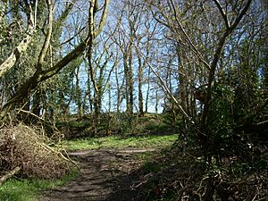
The fort has four openings in its ramparts, one in each main direction (north, south, east, west). We don't know for sure if all these openings were original entrances. Experts think the east and west openings were likely the main ways to get into the fort. The smaller openings on the north and south sides are probably newer paths. Today, the rampart is covered with trees and bushes. The inside of Castle Rings is flat and is used for grazing animals. There are no clear signs of Iron Age homes or buildings inside.
The Western Outlier
About 150 meters (492 feet) to the west of the main fort, there is another earthwork. This is like a long, curved bank of earth. It runs north to south, following the shape of the land. It stretches for about 340 meters (1,115 feet) and runs almost parallel to the fort's main rampart.
This outer earthwork goes across fields. It is easiest to see in Crates Wood, at its northern end. Here, it reaches a height of 2.8 meters (9 feet). It has a ditch on its west side that is 0.4 meters (1 foot) deep. The bank itself can be up to 6 meters (20 feet) wide. The ditch is between 3 and 5 meters (10 and 16 feet) wide. On its east side, the earthwork forms a field boundary and is about 1.8 meters (6 feet) high. In the southern fields, the bank is much lower because of farming. It is only about 0.6 meters (2 feet) high there, with faint signs of a ploughed-out ditch.
The Ancient Coin Discovery
A collection of ancient coins was found inside Castle Rings. These coins are believed to belong to the Durotriges tribe. They are now kept at the British Museum. The coins were discovered on October 13, 1985, along with twelve pieces of pottery. In total, 88 coins were found, with about 30 of them inside the broken pottery.
The pottery pieces were from a small cup made on a potter's wheel. This type of pottery is from the Roman period, made after AD 200. The pottery also had tiny bits of bronze, copper, and silver. However, the coins themselves are much older, dating from between 60 and 20 BC. This means there's a puzzle: why were much older Iron Age coins found inside Roman pottery? It's thought that the pot might have originally held different metal items. How the Iron Age coins ended up in this Romano-British collection is still a mystery.
Images for kids
 | Misty Copeland |
 | Raven Wilkinson |
 | Debra Austin |
 | Aesha Ash |


