Casto Creek facts for kids
Quick facts for kids Casto Creek |
|
|---|---|
|
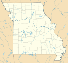
Location of the mouth within Missouri
|
|
| Country | United States |
| State | Missouri |
| Region | Douglas County |
| Physical characteristics | |
| Main source | Approximately 1,470 ft (450 m) 37°03′14″N 92°39′42″W / 37.05389°N 92.66167°W |
| River mouth | 1,109 ft (338 m) 36°59′14″N 92°42′11″W / 36.98722°N 92.70306°W. |
Casto Creek is a small creek located in the northwestern part of Douglas County, Missouri. It's a natural waterway that flows through the landscape, shaping the area around it.
Exploring Casto Creek: Where It Starts and Flows
Casto Creek begins its journey in the northern part of Douglas County. Its starting point, also known as its headwaters, is found just north of the town of Ava. This spot is very close to the border between Douglas County and Wright County.
From its beginning, Casto Creek flows generally south. It runs almost parallel to a road called Missouri Route B. As it continues, the creek makes a turn towards the southwest, passing by an area known as Mount Zion.
The creek keeps flowing southwest until it reaches its confluence, which means where it joins another body of water. Casto Creek meets Cowskin Creek just north of Missouri Route 14. This meeting point is about three miles west of Ava.
How Did Casto Creek Get Its Name?
Many places get their names from the people who first settled there. Casto Creek is one such example! It was named after a local family, the Casto family, who made their homes near the creek a long time ago.
 | John T. Biggers |
 | Thomas Blackshear |
 | Mark Bradford |
 | Beverly Buchanan |


