Wright County, Missouri facts for kids
Quick facts for kids
Wright County
|
|
|---|---|

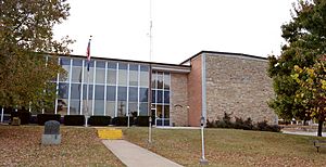
Wright County Courthouse in Hartville
|
|

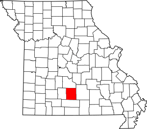
Location within the U.S. state of Missouri
|
|
 Missouri's location within the U.S. |
|
| Country | |
| State | |
| Founded | January 29, 1841 |
| Named for | Silas Wright |
| Seat | Hartville |
| Largest city | Mountain Grove |
| Area | |
| • Total | 683 sq mi (1,770 km2) |
| • Land | 682 sq mi (1,770 km2) |
| • Water | 1.4 sq mi (4 km2) 0.2% |
| Population
(2020)
|
|
| • Total | 18,188 |
| • Density | 26.630/sq mi (10.282/km2) |
| Time zone | UTC−6 (Central) |
| • Summer (DST) | UTC−5 (CDT) |
| Congressional district | 8th |
Wright County is a county located in the southern part of Missouri, a state in the United States. In 2020, about 18,188 people lived here. The main town, or county seat, is Hartville.
Wright County was officially started on January 29, 1841. It was named after Silas Wright. He was an important politician from New York. He served as a Congressman, a U.S. Senator, and even the Governor of New York.
In 2020, the U.S. Census Bureau found that the middle point of the entire U.S. population was in Wright County. This spot is close to the town of Hartville.
Contents
History of Wright County
Wright County is surrounded by other counties. To the north is Laclede County. To the east is Texas County. Douglas County is to the south, and Webster County is to the west. It's part of what people call Southwest Missouri.
The county was formed from a piece of Pulaski County in 1841. It was named for Silas Wright, a well-known politician. The county seat, Hartville, got its name from an early settler named Isaac Hart. Over the years, Wright County lost some of its land. Parts went to Texas County in 1845, to Laclede in 1849, and a large section to Webster in 1855.
It seems there were no permanent Native American villages here long ago. However, groups like the Delawares, Shawnees, and Piankashaws traveled through the area. The first known European-American settlers arrived around 1836. They were likely hunters. By 1840, some of the earliest settlers included Samuel Thompson, Robert Moore, and John W. Burns.
The county has faced several strong storms. A tornado hit in April 1880, affecting nearby Webster County. There was also a flood in April 1885. Another tornado caused damage in May 1888. Around the same time, a hailstorm reportedly left hail several inches deep. Some drifts of hail were even 5 to 8 feet high after falling for two hours!
A large part of Wright County is within the Mark Twain National Forest. The Gasconade River and its smaller streams flow through the county. This offers many chances for fun outdoor activities.
Geography and Nature
The U.S. Census Bureau says Wright County covers about 683 square miles. Most of this, about 682 square miles, is land. Only a small part, about 1.4 square miles, is water.
Wright County is in the Ozarks region, specifically the Salem Plateau. This means the land is moderately hilly. Most of the county's water flows into the Gasconade River, which moves north. The southern part of the county is drained by the beginning streams of the North Fork River, which flows south.
Neighboring Counties
- Laclede County (north)
- Webster County (west)
- Douglas County (south)
- Texas County (east)
Main Roads
Protected Natural Areas
- Mark Twain National Forest (part)
People and Population
| Historical population | |||
|---|---|---|---|
| Census | Pop. | %± | |
| 1850 | 3,387 | — | |
| 1860 | 4,508 | 33.1% | |
| 1870 | 5,684 | 26.1% | |
| 1880 | 9,712 | 70.9% | |
| 1890 | 14,484 | 49.1% | |
| 1900 | 17,519 | 21.0% | |
| 1910 | 18,315 | 4.5% | |
| 1920 | 17,733 | −3.2% | |
| 1930 | 16,741 | −5.6% | |
| 1940 | 17,967 | 7.3% | |
| 1950 | 15,834 | −11.9% | |
| 1960 | 14,183 | −10.4% | |
| 1970 | 13,667 | −3.6% | |
| 1980 | 16,188 | 18.4% | |
| 1990 | 16,758 | 3.5% | |
| 2000 | 17,955 | 7.1% | |
| 2010 | 18,815 | 4.8% | |
| 2020 | 18,188 | −3.3% | |
| U.S. Decennial Census 1790-1960 1900-1990 1990-2000 2010 |
|||
In 2000, there were 17,955 people living in Wright County. There were 7,081 households, which are groups of people living together. About 5,020 of these were families. The county had about 26 people per square mile.
Most people in the county were White (97.61%). A small number were Black (0.28%), Native American (0.66%), or Asian (0.14%). About 0.77% of the population were Hispanic or Latino.
About 33.10% of households had children under 18 living with them. Most households (58.50%) were married couples. About 26.30% of all households were single individuals. The average household had 2.50 people.
The population's age was spread out. About 27.20% were under 18 years old. About 16.50% were 65 years or older. The average age was 38 years.
The median income for a household was $30,685. For families, it was $37,139. This means half of the households earned more, and half earned less. About 21.70% of the people in the county lived below the poverty line.
Religion in Wright County
Wright County is part of the "Bible Belt." This means that many people here follow evangelical Protestant religions. The most common groups are Southern Baptists, National Association of Free Will Baptists, and Pentecostals.
2020 Census Information
| Race | Num. | Perc. |
|---|---|---|
| White (NH) | 16,654 | 91.57% |
| Black or African American (NH) | 111 | 0.6% |
| Native American (NH) | 73 | 0.4% |
| Asian (NH) | 48 | 0.26% |
| Pacific Islander (NH) | 5 | 0.03% |
| Other/Mixed (NH) | 927 | 5.1% |
| Hispanic or Latino | 370 | 2% |
Education in Wright County
Many adults in Wright County have completed their education. About 71.1% of adults aged 25 and older have a high school diploma or higher. About 9.8% have a bachelor's degree or higher.
Public Schools
- Hartville R-II School District - Hartville
- Grovespring Elementary School - Grovespring (Grades K-6)
- Hartville Elementary School (Grades PK-6)
- Hartville High School (Grades 7-12)
- Mansfield R-IV School District - Mansfield
- Wilder Elementary School (Grades PK-5)
- Mansfield Jr. High School (Grades 6-8)
- Mansfield High School (Grades 9-12)
- Mountain Grove R-III School District - Mountain Grove
- Mountain Grove Elementary School (Grades K-4)
- Mountain Grove Middle School (Grades 5-8)
- Mountain Grove High School (Grades 9-12)
- Norwood R-I School District - Norwood
- Norwood Elementary School (Grades PK-4)
- Norwood Middle School (Grades 5-8)
- Norwood High School (Grades 9-12)
- Manes R-V School District - Manes
- Manes Elementary School (Grades K-8)
Private Schools
- Mountain Grove Christian Academy - Mountain Grove (Grades PK-12) - A Christian school.
- Liberty Faith Christian Academy - Norwood (Grades K-12) - Another Christian school.
Special and Vocational Schools
- Ozark Mountain Technical Center - Mountain Grove (Grades 9-12) - This school teaches job skills.
- Ozark Regional Juvenile Detention Center - Mountain Grove (Grades 5-12) - A school for young people in detention.
- Skyview State School - Mountain Grove (Grades K-12) - A school for students with special needs.
Public Libraries
- Wright County Library
Towns and Communities
Cities
- Hartville (the main county town)
- Mansfield
- Mountain Grove (partly in Texas County)
- Norwood
Smaller Communities
See also
 In Spanish: Condado de Wright (Misuri) para niños
 | Bessie Coleman |
 | Spann Watson |
 | Jill E. Brown |
 | Sherman W. White |

