Gasconade River facts for kids
The Gasconade River is a long river in central and south-central Missouri. It stretches for about 280 miles (450 km). This makes it the longest river that stays completely within Missouri's borders.
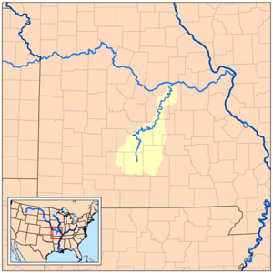
The Gasconade River starts in the beautiful Ozarks region. It begins southeast of Hartville in Wright County. From there, it flows mostly north and northeast. The river passes through several counties, including Wright, Laclede, Pulaski, Phelps, Maries, Osage, and Gasconade. It also winds through parts of the Mark Twain National Forest. Finally, the Gasconade River flows into the mighty Missouri River near the town of Gasconade. Near Rich Fountain, the river usually carries about 3,097 cubic feet of water per second.
What's in a Name?
The name Gasconade comes from the word "Gascon." This refers to people from a region in France called Gascony. People from Gascony were known for being a bit boastful or liking to brag.
Early French explorers gave this name to the river. They noticed that the Native American tribes living along its banks would often brag about their adventures. So, the river was named "Gasconade," meaning "to boast" or "to brag." The river's waters can also be quite lively and "boastful," which fits its name well!
The River's Journey
The Gasconade River begins in the southeastern part of Webster County. It starts northeast of Seymour, Missouri. The river then flows through ancient rock layers of dolomite and sandstone. These rocks are from the Ordovician Age.
As it flows, the river carves out amazing bluffs and winding turns called incised meanders. You can find many springs and caves along the river's path. Important smaller rivers that join the Gasconade include the Osage Fork, Roubidoux Creek, and Big Piney River. The Roubidoux and Big Piney rivers flow near Fort Leonard Wood, a large military base.
The land around the river can be very high. Near the middle of the river, the plateau surface is about 300 feet (91 meters) above the river bottom. This creates very scenic bluffs. Where the Gasconade meets the Missouri River, the river bottom is about 400 feet (122 meters) lower than the old plateau above it. The highest points near the river's start are over 1,700 feet (518 meters) high. The river meets the Missouri River at an elevation of about 500 feet (152 meters). This shows a big drop in elevation along its course.
The Gasconade River is famous for being one of the world's "crookedest" rivers. This means it has many twists and turns!
Fun on the River
The Gasconade River is a great place for outdoor activities. Many people enjoy canoeing, kayaking, and floating down the river. It is usually considered an easy river to float, with difficulty levels of I and II. This means the currents are mostly gentle.
One of the best things about the Gasconade is that it's often not crowded. You can float for many miles without seeing other boats. This makes it a peaceful place to enjoy nature. Along the river, you might spot wildlife and explore caves. It's also a very popular spot for anglers (people who fish). They often come to catch largemouth bass and smallmouth bass.
 | Calvin Brent |
 | Walter T. Bailey |
 | Martha Cassell Thompson |
 | Alberta Jeannette Cassell |


