Pulaski County, Missouri facts for kids
Quick facts for kids
Pulaski County
|
|
|---|---|

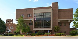
Old and new Pulaski County courthouses in Waynesville
|
|

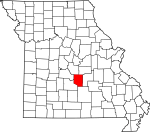
Location within the U.S. state of Missouri
|
|
 Missouri's location within the U.S. |
|
| Country | |
| State | |
| Founded | January 19, 1833 |
| Named for | Kazimierz Pułaski |
| Seat | Waynesville |
| Largest community | Fort Leonard Wood |
| Area | |
| • Total | 551 sq mi (1,430 km2) |
| • Land | 547 sq mi (1,420 km2) |
| • Water | 4.4 sq mi (11 km2) 0.8% |
| Population
(2020)
|
|
| • Total | 53,955 |
| • Density | 98/sq mi (38/km2) |
| Time zone | UTC−6 (Central) |
| • Summer (DST) | UTC−5 (CDT) |
| Congressional district | 4th |
Pulaski County is a county located in the state of Missouri, USA. In 2020, about 53,955 people lived here. The main town, or county seat, is Waynesville. The county was created in 1833. It was named after Kazimierz Pułaski, a Polish hero who fought in the American Revolution. Pulaski County is also home to Fort Leonard Wood, which is a big training base for the U.S. Army. This area is part of the Fort Leonard Wood, MO Micropolitan Statistical Area, where almost one-third of the county's population lives.
Contents
History of Pulaski County
The first people to live in Pulaski County were Native American tribes. These included the Quapaw, Missouria, and Osage people. After the Lewis and Clark Expedition in the early 1800s, settlers from other states arrived. Many came from Kentucky, Tennessee, and the Carolinas. The first pioneers settled around 1818. In 1833, the town of Waynesville was chosen as the county seat. Like the county, Waynesville is named after another American Revolutionary hero, Mad Anthony Wayne.
Geography of Pulaski County
Pulaski County covers a total area of about 551 square miles. Most of this is land, about 547 square miles. The rest, about 4.4 square miles, is water.
Neighboring Counties
- Miller County (to the northwest)
- Maries County (to the northeast)
- Phelps County (to the east)
- Texas County (to the south)
- Laclede County (to the southwest)
- Camden County (to the west)
Protected Natural Areas
- Mark Twain National Forest (a part of it is in Pulaski County)
Population and People
| Historical population | |||
|---|---|---|---|
| Census | Pop. | %± | |
| 1840 | 6,529 | — | |
| 1850 | 3,998 | −38.8% | |
| 1860 | 3,835 | −4.1% | |
| 1870 | 4,714 | 22.9% | |
| 1880 | 7,250 | 53.8% | |
| 1890 | 9,387 | 29.5% | |
| 1900 | 10,394 | 10.7% | |
| 1910 | 11,438 | 10.0% | |
| 1920 | 10,490 | −8.3% | |
| 1930 | 10,755 | 2.5% | |
| 1940 | 10,775 | 0.2% | |
| 1950 | 10,392 | −3.6% | |
| 1960 | 46,567 | 348.1% | |
| 1970 | 53,781 | 15.5% | |
| 1980 | 42,011 | −21.9% | |
| 1990 | 41,307 | −1.7% | |
| 2000 | 41,165 | −0.3% | |
| 2010 | 52,274 | 27.0% | |
| 2020 | 53,955 | 3.2% | |
| U.S. Decennial Census 1790-1960 1900-1990 1990-2000 2010 |
|||
In 2000, there were 41,165 people living in Pulaski County. The population density was about 75 people per square mile. The county's population is diverse. In 2000, about 78% of residents were White, and nearly 12% were Black or African American. About 5.8% of the population identified as Hispanic or Latino.
Many households in Pulaski County have children. In 2000, over 42% of households had children under 18 living with them. The average age of people in the county was 28 years old.
2020 Census Data
| Race | Num. | Perc. |
|---|---|---|
| White (NH) | 35,865 | 66.5% |
| Black or African American (NH) | 6,039 | 11.2% |
| Native American (NH) | 334 | 0.62% |
| Asian (NH) | 1,776 | 3.3% |
| Pacific Islander (NH) | 402 | 0.75% |
| Other/Mixed (NH) | 3,460 | 6.41% |
| Hispanic or Latino | 6,079 | 11.27% |
Transportation in Pulaski County
Air Travel
The Waynesville Regional Airport at Forney Field serves the area. Even though it's on Fort Leonard Wood, it's managed by the cities of Waynesville and St. Robert. It's open for private pilots and also has scheduled flights for passengers. The city of Richland also has a smaller airport with a 3000-foot runway.
Main Roads
 I-44
I-44 Route 7
 Route 17
 Route 28
 Route 133
News and Media
KFBD-FM and its sister station, KJPW, are the main radio stations for news in Pulaski County. They cover Fort Leonard Wood, Waynesville, and St. Robert. Another local station is KFLW Radio.
There are also online news sources. The Pulaski County Daily News is an internet newspaper. Allen Hilliard Sports is an internet sports website. The weekly Dixon Pilot newspaper is still published. Many other local newspapers have closed in recent years.
Education in Pulaski County
Pulaski County has several school districts. Many students are children of military personnel from Fort Leonard Wood.
School Districts
- Crocker R-II School District
- Dixon R-I School District
- Laquey R-V School District
- Newburg R-II School District
- Plato R-V School District
- Richland R-IV School District
- Waynesville R-VI Schools
- Gasconade C-4 School District (elementary only)
- Phelps County R-III School District (elementary only)
- Swedeborg R-III School District (elementary only)
The Waynesville R-VI School District is the largest. It serves the cities of Waynesville, St. Robert, and the Fort Leonard Wood army base. Other districts serve towns like Richland, Crocker, and Dixon.
Public Schools
- Crocker R-II School District – Crocker
- Crocker Elementary School (Grades PK-6)
- Crocker High School (Grades 7-12)
- Dixon R-I School District – Dixon
- Dixon Elementary School (Grades PK-5)
- Dixon Middle School (Grades 6-8)
- Dixon High School (Grades 9-12)
- Laquey R-V School District – Laquey
- Laquey Elementary School (Grades PK-5)
- Laquey Middle School (Grades 6-8)
- Laquey High School (Grades 9-12)
- Swedeborg R-VIII School District – Swedeborg
- Swedeborg Elementary School (Grades PK-8)
- Richland R-IV School District – Richland
- Richland Elementary School (Grades K-6)
- Richland Junior High School (Grades 7-8)
- Richland High School (Grades 9-12)
- Waynesville R-VI School District – Waynesville
- Williams Early Childhood Center (PK) – Ft. Leonard Wood
- East Elementary School (Grades K-5) - Waynesville
- Freedom Elementary School (Grades K-5) – St. Robert
- Partridge Elementary School (Grades K-5) – Ft. Leonard Wood
- Thayer Elementary School (Grades K-5) – Ft. Leonard Wood
- Wood Elementary School (Grades K-5) – Ft. Leonard Wood
- Waynesville Sixth Grade Center (Grade 6) — Waynesville
- Waynesville Middle School (Grades 7-8) — Waynesville
- Waynesville High School (Grades 9-12) — Waynesville
Private Schools
- Maranatha Baptist Academy – St. Robert (Grades K4-12) – Baptist
- Westside Christian Academy – Waynesville (Grades K4-12) – Baptist
Public Libraries
- Pulaski County Library
Towns and Communities
Cities
- Crocker
- Dixon
- Richland (small parts are in Camden and Laclede counties)
- St. Robert
- Waynesville (the county seat)
Census-Designated Place
Other Communities
Notable People
- Bill Hardwick: A Missouri State Representative. He is also a veteran and an attorney.
Politics in Pulaski County

In the past, the Democratic Party was usually in charge of local politics in Pulaski County. However, since 2002, the Republican Party has become much stronger. This change is often because more military personnel retire in the area and register to vote in Pulaski County.
Over the years, many Republican candidates have won local elections. For example, in 2002, Republicans won offices like county clerk and treasurer. This trend continued in later elections, with more Republicans being elected to county positions.
As of 2025, the Republican Party holds most of the elected positions in Pulaski County. There are only a few exceptions, like the circuit clerk and recorder of deeds, which are held by a Democrat.
| Pulaski County, Missouri | ||||
|---|---|---|---|---|
| Elected countywide officials | ||||
| Assessor | Dan Whittle | Republican | ||
| Circuit Clerk | Rachelle Beasley | Democratic | ||
| County Clerk | Dave Ernst | Republican | ||
| Collector | Terri Mitchell | Republican | ||
| Commissioner (Presiding) |
Gene Newkirk | Republican | ||
| Commissioner (District 1) |
Charles Bassett | Republican | ||
| Commissioner (District 2) |
Andy Helms | Republican | ||
| Coroner | Roger Graves | Republican | ||
| Prosecuting Attorney | Kevin Hillman | Republican | ||
| Public Administrator | Loretta Rouse | Republican | ||
| Recorder | Rachelle Beasley | Democratic | ||
| Sheriff | Jimmy Bench | Republican | ||
| Surveyor | Vacant | |||
| Treasurer | Mack Wilkerson | Republican | ||
State Politics
Pulaski County is part of three different districts in the Missouri House of Representatives. All of these districts are currently represented by Republicans.
- District 121: Don Mayhew (Republican) represents Crocker, Dixon, and Richland.
- District 122: Steve Lynch (Republican) represents the northern part of Fort Leonard Wood, St. Robert, and Waynesville.
- District 142: Robert Ross (Republican) represents the southern part of Fort Leonard Wood and Devils Elbow.
The entire county is also part of Missouri's 16th District in the Missouri Senate. This district is represented by Dan Brown (Republican).
National Politics
Pulaski County is part of Missouri's 4th Congressional District. This district is represented by Vicky Hartzler (Republican) in the U.S. House of Representatives.
When it comes to presidential elections, Pulaski County has mostly voted for Republican candidates in recent years. For example, in the 2024 presidential election, the Republican candidate received about 73% of the votes in Pulaski County.
| Year | Republican | Democratic | Third party | |||
|---|---|---|---|---|---|---|
| No. | % | No. | % | No. | % | |
| 2024 | 11,579 | 74.21% | 3,765 | 24.13% | 260 | 1.67% |
| 2020 | 10,329 | 71.53% | 3,740 | 25.90% | 372 | 2.58% |
| 2016 | 9,876 | 72.71% | 2,922 | 21.51% | 784 | 5.77% |
| 2012 | 9,092 | 67.00% | 4,199 | 30.94% | 280 | 2.06% |
| 2008 | 9,552 | 63.68% | 5,249 | 34.99% | 199 | 1.33% |
| 2004 | 8,618 | 70.52% | 3,551 | 29.06% | 52 | 0.43% |
| 2000 | 6,531 | 62.02% | 3,800 | 36.08% | 200 | 1.90% |
| 1996 | 4,089 | 45.04% | 3,783 | 41.67% | 1,207 | 13.29% |
| 1992 | 3,793 | 37.98% | 4,113 | 41.18% | 2,082 | 20.85% |
| 1988 | 4,642 | 57.22% | 3,446 | 42.48% | 24 | 0.30% |
| 1984 | 5,330 | 65.04% | 2,865 | 34.96% | 0 | 0.00% |
| 1980 | 3,998 | 50.79% | 3,707 | 47.10% | 166 | 2.11% |
| 1976 | 2,865 | 39.42% | 4,370 | 60.13% | 32 | 0.44% |
| 1972 | 4,243 | 69.04% | 1,903 | 30.96% | 0 | 0.00% |
| 1968 | 2,555 | 45.82% | 2,303 | 41.30% | 718 | 12.88% |
| 1964 | 1,856 | 35.43% | 3,383 | 64.57% | 0 | 0.00% |
| 1960 | 3,285 | 51.48% | 3,096 | 48.52% | 0 | 0.00% |
| 1956 | 2,532 | 46.31% | 2,936 | 53.69% | 0 | 0.00% |
| 1952 | 2,678 | 46.88% | 3,026 | 52.98% | 8 | 0.14% |
| 1948 | 1,644 | 36.43% | 2,858 | 63.33% | 11 | 0.24% |
| 1944 | 2,345 | 43.43% | 3,048 | 56.44% | 7 | 0.13% |
| 1940 | 2,367 | 46.17% | 2,752 | 53.68% | 8 | 0.16% |
| 1936 | 2,177 | 42.89% | 2,886 | 56.86% | 13 | 0.26% |
| 1932 | 1,489 | 31.24% | 3,260 | 68.40% | 17 | 0.36% |
| 1928 | 2,229 | 53.44% | 1,934 | 46.37% | 8 | 0.19% |
| 1924 | 1,578 | 40.81% | 2,127 | 55.00% | 162 | 4.19% |
| 1920 | 1,853 | 47.88% | 1,978 | 51.11% | 39 | 1.01% |
| 1916 | 1,003 | 41.95% | 1,339 | 56.00% | 49 | 2.05% |
| 1912 | 631 | 28.19% | 1,268 | 56.66% | 339 | 15.15% |
| 1908 | 988 | 40.31% | 1,418 | 57.85% | 45 | 1.84% |
| 1904 | 837 | 40.95% | 1,190 | 58.22% | 17 | 0.83% |
| 1900 | 728 | 36.02% | 1,282 | 63.43% | 11 | 0.54% |
| 1896 | 802 | 36.19% | 1,410 | 63.63% | 4 | 0.18% |
| 1892 | 663 | 37.50% | 1,046 | 59.16% | 59 | 3.34% |
| 1888 | 662 | 37.42% | 1,048 | 59.24% | 59 | 3.34% |
See also
 In Spanish: Condado de Pulaski (Misuri) para niños
 | William M. Jackson |
 | Juan E. Gilbert |
 | Neil deGrasse Tyson |

