Buckhorn, Pulaski County, Missouri facts for kids
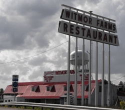
Buckhorn is a small community found in Pulaski County, Missouri, in the United States. It is located on Route 17, just south of where it connects with Interstate 44. Buckhorn is also on the famous historic U.S. Route 66. This area is part of the beautiful Mark Twain National Forest. The northwest corner of Fort Leonard Wood is only about three miles to the east. Nearby towns include Waynesville, which is six miles northeast, and Laquey, two miles southwest.
History of Buckhorn
How Buckhorn Got Its Name
The community of Buckhorn received its name from a special sign. Long ago, there was a local tavern, which is like a restaurant or inn, in the area. This tavern had an image of a buckhorn on its sign. A buckhorn is the antler of a male deer. People started calling the community "Buckhorn" because of this well-known sign.
Decker Cave Archeological Site
An important historical spot near Buckhorn is the Decker Cave Archeological Site. This site was officially added to the National Register of Historic Places in 1971. An archeological site is a place where scientists called archeologists study human history. They do this by digging up and examining old objects and remains. Being on the National Register of Historic Places means the site is very important for understanding the history and culture of the United States.
 | Audre Lorde |
 | John Berry Meachum |
 | Ferdinand Lee Barnett |


