
St. Robert, Missouri facts for kids
Quick facts for kids
St. Robert, Missouri
|
|
|---|---|
| City of St. Robert | |
 |
|

Location of St. Robert, Missouri
|
|
| Country | United States |
| State | Missouri |
| County | Pulaski |
| Area | |
| • Total | 8.43 sq mi (21.82 km2) |
| • Land | 8.42 sq mi (21.80 km2) |
| • Water | 0.01 sq mi (0.02 km2) |
| Elevation | 1,076 ft (328 m) |
| Population
(2020)
|
|
| • Total | 5,192 |
| • Estimate
(2023)
|
5,457 |
| • Density | 616.77/sq mi (238.13/km2) |
| Time zone | UTC-6 (Central (CST)) |
| • Summer (DST) | UTC-5 (CDT) |
| FIPS code | 29-65144 |
| GNIS feature ID | 2396519 |
St. Robert or Saint Robert is a city in Pulaski County, Missouri, United States. In 2020, about 5,192 people lived there. The city is known as a main entrance to Fort Leonard Wood, a big base for the United States Army.
Contents
Where is St. Robert Located?
St. Robert is in Missouri, at coordinates 37°49′28″N 92°8′1″W / 37.82444°N 92.13361°W.
The city covers about 7.84 square miles (20.31 square kilometers). Most of this area is land, with only a small part being water. A famous old road, Historic Route 66, goes right through St. Robert.
How Many People Live in St. Robert?
| Historical population | |||
|---|---|---|---|
| Census | Pop. | %± | |
| 1960 | 860 | — | |
| 1970 | 1,465 | 70.3% | |
| 1980 | 1,735 | 18.4% | |
| 1990 | 1,730 | −0.3% | |
| 2000 | 2,760 | 59.5% | |
| 2010 | 4,340 | 57.2% | |
| 2020 | 5,192 | 19.6% | |
| U.S. Decennial Census | |||
The number of people living in St. Robert has grown a lot over the years. In 1960, there were only 860 residents. By 2020, the population had grown to 5,192 people.
Population in 2010
In 2010, St. Robert had 4,340 residents living in 1,827 households. About 36% of these households had children under 18. The average age of people in the city was about 30 years old. Many residents were between 25 and 44 years old.
Getting Around St. Robert
There are several ways to travel in and out of St. Robert.
Air Travel
The Waynesville Regional Airport at Forney Field serves St. Robert. Even though it's on Fort Leonard Wood, both Waynesville and St. Robert help run it. This airport is open for private pilots and also has scheduled flights for passengers.
Major Roads
The main highway that runs east to west is ![]() Interstate 44. Before Interstate 44, the most important road was
Interstate 44. Before Interstate 44, the most important road was ![]() U.S. Route 66. This historic road still exists as a scenic route. It passes through several towns like Devil's Elbow, St. Robert, and Waynesville. You might hear it called by different names, like Teardrop Road or Historic Route 66.
U.S. Route 66. This historic road still exists as a scenic route. It passes through several towns like Devil's Elbow, St. Robert, and Waynesville. You might hear it called by different names, like Teardrop Road or Historic Route 66.
Important roads that run north to south near St. Robert include:
 Route 28: This road crosses Interstate 44 at exit 163. It then goes north through Dixon.
 Highway Y: This road starts at exit 161 of Interstate 44 in St. Robert. It runs north and eventually becomes
  Highway O.
News and Media
Pulaski County, where St. Robert is located, used to have several newspapers. Now, there is one weekly newspaper, the Dixon Pilot, and an online newspaper, the Pulaski County Daily News. There is also an online discussion site called the Pulaski County Insider.
Radio Stations
KFBD-FM and its sister station, KJPW, are the main radio stations for news in the Pulaski County area. This area includes Fort Leonard Wood, Waynesville, and St. Robert. Another local station is KFLW Radio.
Past Newspapers
The Daily Guide, which was based in St. Robert, closed in 2018. It used to serve the entire county. The Fort Leonard Wood Guidon, a military newspaper, also stopped being produced. The Pulaski County Mirror closed in 2017.
Education in St. Robert
Students who live in St. Robert attend schools in the Waynesville R-VI School District.
Images for kids
-
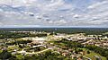
A view of St. Robert from above.
-
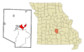
Map showing St. Robert's location in Pulaski County, Missouri.
-
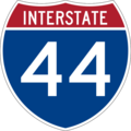
Interstate 44 highway sign.
-
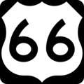
U.S. Route 66 highway sign.
-

Missouri Route 28 highway sign.
-

Missouri Supplemental Route Y highway sign.
-

Missouri Supplemental Route O highway sign.


See also
 In Spanish: St. Robert (Misuri) para niños
