
Miller County, Missouri facts for kids
Quick facts for kids
Miller County
|
|
|---|---|

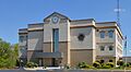
The Miller County Courthouse in Tuscumbia
|
|

Location within the U.S. state of Missouri
|
|
 Missouri's location within the U.S. |
|
| Country | |
| State | |
| Founded | February 6, 1837 |
| Named for | John Miller |
| Seat | Tuscumbia |
| Largest city | Eldon |
| Area | |
| • Total | 600 sq mi (2,000 km2) |
| • Land | 593 sq mi (1,540 km2) |
| • Water | 7.4 sq mi (19 km2) 1.2% |
| Population
(2020)
|
|
| • Total | 24,722 |
| • Density | 41/sq mi (15.9/km2) |
| Time zone | UTC−6 (Central) |
| • Summer (DST) | UTC−5 (CDT) |
| Congressional district | 3rd |

Miller County is a special area in the northern Ozarks region of Missouri. In 2020, about 24,722 people lived here. The main town, or county seat, is Tuscumbia. Miller County was officially started on February 6, 1837. It was named after John Miller. He was a very important person who used to be a U.S. Representative and even the Governor of Missouri.
Contents
Exploring Miller County's Geography
Miller County covers a total area of 600 square miles. Most of this area, about 593 square miles, is land. The rest, about 7.4 square miles, is water. This means about 1.2% of the county is covered by water.
Neighboring Counties Around Miller County
Miller County shares its borders with several other counties. Knowing these helps you understand where it is located on a map.
- Moniteau County is to the north.
- Cole County is to the northeast.
- Osage County is also to the northeast.
- Maries County is to the east.
- Pulaski County is to the south.
- Camden County is to the southwest.
- Morgan County is to the west.
Main Roads in Miller County
These are the most important roads that run through Miller County. They help people travel around the area.
 U.S. Route 54
 Route 17
 Route 42
 Route 52
 Route 87
 Route 134
 Route 242
Miller County's Population Over Time
| Historical population | |||
|---|---|---|---|
| Census | Pop. | %± | |
| 1840 | 2,282 | — | |
| 1850 | 3,834 | 68.0% | |
| 1860 | 6,812 | 77.7% | |
| 1870 | 6,616 | −2.9% | |
| 1880 | 9,805 | 48.2% | |
| 1890 | 14,162 | 44.4% | |
| 1900 | 15,187 | 7.2% | |
| 1910 | 16,717 | 10.1% | |
| 1920 | 15,567 | −6.9% | |
| 1930 | 16,728 | 7.5% | |
| 1940 | 14,798 | −11.5% | |
| 1950 | 13,734 | −7.2% | |
| 1960 | 13,800 | 0.5% | |
| 1970 | 15,026 | 8.9% | |
| 1980 | 18,532 | 23.3% | |
| 1990 | 20,700 | 11.7% | |
| 2000 | 23,564 | 13.8% | |
| 2010 | 24,748 | 5.0% | |
| 2020 | 24,722 | −0.1% | |
| U.S. Decennial Census 1790-1960 1900-1990 1990-2000 2010-2015 |
|||
In 2000, there were 23,564 people living in Miller County. These people lived in 9,284 households. About 6,443 of these were families. The county had about 40 people per square mile. There were also 11,263 homes, with about 19 homes per square mile.
Most people in the county were White (97.99%). A smaller number were Black or African American (0.28%). Some were Native American (0.46%) or Asian (0.13%). About 0.98% of the population were Hispanic or Latino.
About 32.60% of households had children under 18 living there. Many households (56.00%) were married couples. About 30.60% were not families. The average household had 2.50 people, and families had 3.00 people.
The population was spread out by age. About 26.30% were under 18 years old. About 15.30% were 65 years or older. The average age was 37 years. For every 100 females, there were about 97 males.
The average income for a household was $30,977. For families, it was $36,770. About 14.20% of the people in the county lived below the poverty line. This included 19.30% of those under 18.
Miller County's Population in 2020
In 2020, the population of Miller County was 24,722. Here is a quick look at the different groups of people living there:
| Race | Number of People | Percentage |
|---|---|---|
| White (Not Hispanic) | 22,908 | 92.7% |
| Black or African American (Not Hispanic) | 117 | 0.47% |
| Native American (Not Hispanic) | 113 | 0.46% |
| Asian (Not Hispanic) | 64 | 0.26% |
| Pacific Islander (Not Hispanic) | 24 | 0.1% |
| Other/Mixed (Not Hispanic) | 1,030 | 4.17% |
| Hispanic or Latino | 466 | 1.9% |
Learning in Miller County: Schools and Libraries
Miller County has many schools for students of all ages. There are public schools and private schools.
Public Schools in Miller County
These schools are open to everyone and are supported by the public.
- Eldon R-I School District in Eldon
- South Elementary School (Grades PK-03)
- Eldon Upper Elementary School (Grades 04-06)
- Eldon Middle School (Grades 07-08)
- Eldon High School (Grades 09-12)
- Iberia R-V School District in Iberia
- Iberia Elementary School (Grades PK-06)
- Iberia High School (Grades 07-12)
- Miller County R-III School District in Tuscumbia
- Miller County Elementary School (Grades K-08)
- Tuscumbia High School (Grades 09-12)
- School of the Osage in Lake Ozark
- Leland O. Mills Elementary School (Grades PK-02)
- Osage Upper Elementary School (Grades 03-05)
- Osage Middle School (Grades 06-08)
- Osage High School (Grades 09-12)
- St. Elizabeth R-IV School District in St. Elizabeth
- St. Elizabeth Elementary School (Grades K-06)
- St. Elizabeth High School (Grades 07-12)
Private Schools in Miller County
These schools are run by private organizations or groups.
- Lakeview Christian Academy in Lake Ozark (Grades K-10) – This is a Nondenominational Christian school.
- Our Lady of the Snows School in Eugene (Grades K-08) – This is a Roman Catholic school.
- Eldon Montessori Children's House in Eldon (Grades PK-K) – This school is not connected to any religion.
- The King's Academy - Christ the King Lutheran School in Lake Ozark (Preschool-8) – This is a Lutheran school.
Public Libraries
- Heartland Regional Library System helps people in Miller County find books and information.
Towns and Villages in Miller County
Miller County has several cities and towns where people live.
- Bagnell
- Brumley
- Eldon (This is the largest city in the county.)
- Iberia
- Lake Ozark
- Lakeside
- Olean
- Osage Beach
- St. Elizabeth
- Tuscumbia (This is the county seat, where the main government offices are.)
Smaller Communities in Miller County
These are smaller places that are not officially cities or towns.
Images for kids
-
The Miller County Courthouse in Tuscumbia
See also
 In Spanish: Condado de Miller (Misuri) para niños
