Lake Ozark, Missouri facts for kids
Quick facts for kids
Lake Ozark, Missouri
|
|
|---|---|

|
|

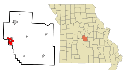
Location in Miller County and the state of Missouri
|
|
| Country | United States |
| State | Missouri |
| Counties | Miller, Camden |
| Named for | Lake of the Ozarks |
| Area | |
| • Total | 7.91 sq mi (20.48 km2) |
| • Land | 7.19 sq mi (18.62 km2) |
| • Water | 0.72 sq mi (1.87 km2) |
| Elevation | 623 ft (190 m) |
| Population
(2020)
|
|
| • Total | 2,077 |
| • Density | 288.95/sq mi (111.57/km2) |
| Time zone | UTC-6 (Central (CST)) |
| • Summer (DST) | UTC-5 (CDT) |
| ZIP code |
65049
|
| Area code(s) | 573 |
| FIPS code | 29-40034 |
| GNIS feature ID | 2395596 |
Lake Ozark is a city in the state of Missouri, United States. It is located in both Camden and Miller counties. The city is named after the nearby Lake of the Ozarks. In 2020, about 2,077 people lived there.
Contents
History of Lake Ozark
A post office, which is where you send and receive mail, opened in Lake Ozark in 1932. The community got its name from the large lake nearby, the Lake of the Ozarks.
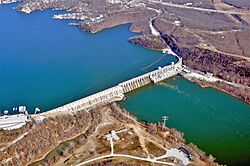
The famous Bagnell Dam is a big part of the city's history. It was added to the National Register of Historic Places in 2008. This means it is a special place recognized for its historical importance.
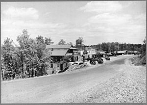
A part of Bagnell Dam Boulevard is known as the "Bagnell Dam Strip." This area once had two large statues called "muffler men." These are giant fiberglass statues often used for advertising. One was named Injun Joe, and the other was Country Bumpkin. Country Bumpkin was gone for many years but returned in 2024. Sadly, it was damaged by vandals soon after it came back.
Geography and Location
Lake Ozark is mostly in western Miller County, but a small part of it extends into eastern Camden County. The city is located at the northeast end of the Lake of the Ozarks. The lake's shoreline forms some of the city's western border.
To the northeast, Lake Ozark is next to the town of Bagnell. To the south, it borders the city of Osage Beach. Interestingly, Lake Ozark completely surrounds a smaller, no longer active city called Lakeside.
Roads and Travel
U.S. Route 54 runs through the eastern side of Lake Ozark. Another road, Route 54 Business, goes through the center of the city. US 54 goes north about 12 miles (19 km) to Eldon and northeast about 41 miles (66 km) to Jefferson City, which is the state capital. If you go south on US 54, you will pass through Osage Beach and reach Camdenton about 12 miles (19 km) away.
The Lake of the Ozarks Community Bridge connects Highway MM across the lake from the southwest part of the city. This highway leads west about 9 miles (14 km) to Sunrise Beach.
Land and Water Area
The U.S. Census Bureau says that the city of Lake Ozark covers a total area of about 7.91 square miles (20.49 km2). Most of this is land, about 7.19 square miles (18.62 km2). The rest, about 0.72 square miles (1.86 km2), is water. This means about 9.10% of the city's total area is water.
Climate and Weather
Lake Ozark has a humid subtropical climate. This means it has hot and humid summers. Thunderstorms and other strong weather are common during this time.
Winters are usually cold, but there can be mild periods. The large lake can affect the local weather, sometimes causing heavy fog and making the weather milder than in other towns farther from the lake. Lake Ozark also gets some snow in winter, usually about 10 inches per year.
| Climate data for Lake Ozark, Missouri (1991–2020 normals, extremes 1931–present) | |||||||||||||
|---|---|---|---|---|---|---|---|---|---|---|---|---|---|
| Month | Jan | Feb | Mar | Apr | May | Jun | Jul | Aug | Sep | Oct | Nov | Dec | Year |
| Record high °F (°C) | 79 (26) |
81 (27) |
87 (31) |
94 (34) |
102 (39) |
106 (41) |
114 (46) |
110 (43) |
106 (41) |
95 (35) |
87 (31) |
79 (26) |
114 (46) |
| Mean maximum °F (°C) | 65.8 (18.8) |
70.8 (21.6) |
78.1 (25.6) |
84.4 (29.1) |
88.3 (31.3) |
92.1 (33.4) |
96.9 (36.1) |
97.2 (36.2) |
91.7 (33.2) |
85.9 (29.9) |
75.4 (24.1) |
67.7 (19.8) |
98.6 (37.0) |
| Mean daily maximum °F (°C) | 44.0 (6.7) |
48.7 (9.3) |
59.0 (15.0) |
69.1 (20.6) |
76.9 (24.9) |
85.0 (29.4) |
89.4 (31.9) |
88.3 (31.3) |
81.1 (27.3) |
70.5 (21.4) |
58.5 (14.7) |
47.9 (8.8) |
68.2 (20.1) |
| Daily mean °F (°C) | 34.6 (1.4) |
38.7 (3.7) |
48.0 (8.9) |
57.9 (14.4) |
66.3 (19.1) |
75.0 (23.9) |
79.5 (26.4) |
78.2 (25.7) |
70.8 (21.6) |
59.9 (15.5) |
48.7 (9.3) |
38.9 (3.8) |
58.0 (14.4) |
| Mean daily minimum °F (°C) | 25.3 (−3.7) |
28.6 (−1.9) |
37.1 (2.8) |
46.8 (8.2) |
55.7 (13.2) |
65.0 (18.3) |
69.5 (20.8) |
68.2 (20.1) |
60.5 (15.8) |
49.2 (9.6) |
38.9 (3.8) |
29.9 (−1.2) |
47.9 (8.8) |
| Mean minimum °F (°C) | 5.5 (−14.7) |
10.2 (−12.1) |
18.7 (−7.4) |
30.7 (−0.7) |
40.5 (4.7) |
53.0 (11.7) |
59.2 (15.1) |
58.2 (14.6) |
45.7 (7.6) |
33.1 (0.6) |
22.3 (−5.4) |
11.8 (−11.2) |
2.5 (−16.4) |
| Record low °F (°C) | −15 (−26) |
−13 (−25) |
−10 (−23) |
18 (−8) |
30 (−1) |
41 (5) |
45 (7) |
43 (6) |
33 (1) |
19 (−7) |
6 (−14) |
−15 (−26) |
−15 (−26) |
| Average precipitation inches (mm) | 2.15 (55) |
2.05 (52) |
2.99 (76) |
4.98 (126) |
5.54 (141) |
4.16 (106) |
3.83 (97) |
4.20 (107) |
4.16 (106) |
3.42 (87) |
2.97 (75) |
2.12 (54) |
42.57 (1,081) |
| Average snowfall inches (cm) | 1.7 (4.3) |
0.6 (1.5) |
0.3 (0.76) |
0.0 (0.0) |
0.0 (0.0) |
0.0 (0.0) |
0.0 (0.0) |
0.0 (0.0) |
0.0 (0.0) |
0.0 (0.0) |
0.0 (0.0) |
1.7 (4.3) |
4.3 (11) |
| Average precipitation days (≥ 0.01 in) | 6.6 | 6.3 | 9.6 | 10.4 | 11.8 | 9.4 | 7.9 | 7.9 | 7.6 | 7.7 | 7.1 | 6.5 | 98.8 |
| Average snowy days (≥ 0.1 in) | 1.1 | 0.3 | 0.1 | 0.0 | 0.0 | 0.0 | 0.0 | 0.0 | 0.0 | 0.0 | 0.0 | 0.4 | 1.9 |
| Source: NOAA | |||||||||||||
Population and People
| Historical population | |||
|---|---|---|---|
| Census | Pop. | %± | |
| 1970 | 507 | — | |
| 1980 | 534 | 5.3% | |
| 1990 | 681 | 27.5% | |
| 2000 | 1,489 | 118.6% | |
| 2010 | 1,586 | 6.5% | |
| 2020 | 2,077 | 31.0% | |
| U.S. Decennial Census | |||
The number of people living in Lake Ozark has grown over the years. In 1970, there were 507 residents. By 2020, the population had increased to 2,077.
2020 Census Information
According to the 2020 census, the total population of Lake Ozark was 2,077 people.
2010 Census Details
The census in 2010 counted 1,586 people living in Lake Ozark. These people lived in 715 households, and 455 of these were families. The city had about 219.4 inhabitants per square mile (84.7/km2) people per square mile. There were also 1,688 housing units, which are places where people can live.
Most of the people in the city were White (96.5%). A small number were African American (0.2%), Native American (0.7%), or Asian (0.8%). About 1.2% of the population identified as Hispanic or Latino.
About 25.5% of households had children under 18 living with them. More than half (52.9%) were married couples. The average household had 2.22 people, and the average family had 2.71 people.
The average age of people in the city was 48 years old. About 19.2% of residents were under 18. About 17.7% were 65 years old or older. The city had slightly more males (51.3%) than females (48.7%).
City Infrastructure
Roads and Highways
Route 242 (MO 242) is a four-lane highway in Lake Ozark. It connects the Lake of the Ozarks Community Bridge to U.S. Highway 54. This highway was opened in December 2011.
In 2021, a new interchange was built at the meeting point of US 54 and Route W in the northern part of Lake Ozark. An interchange is a system of roads that allows traffic to move between different highways without stopping. This new interchange replaced an older intersection that had traffic lights.
See also
 In Spanish: Lake Ozark (Misuri) para niños
 | Precious Adams |
 | Lauren Anderson |
 | Janet Collins |


