Ava, Missouri facts for kids
Quick facts for kids
Ava, Missouri
|
|
|---|---|
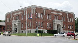
Douglas County court house on the southeast corner of the Ava square
|
|

Location of Ava, Missouri
|
|
| Country | United States |
| State | Missouri |
| County | Douglas |
| Area | |
| • Total | 3.33 sq mi (8.62 km2) |
| • Land | 3.32 sq mi (8.60 km2) |
| • Water | 0.00 sq mi (0.01 km2) |
| Elevation | 1,270 ft (390 m) |
| Population
(2020)
|
|
| • Total | 2,894 |
| • Density | 871.16/sq mi (336.34/km2) |
| Time zone | UTC-6 (Central (CST)) |
| • Summer (DST) | UTC-5 (CDT) |
| ZIP code |
65608
|
| Area codes | 417 |
| FIPS code | 29-02674 |
| GNIS feature ID | 2394040 |
| Website | avamissouri.org |
Ava is a city in Douglas County, Missouri, in the United States. It's the only official city in Douglas County and is also its county seat, which means it's where the main government offices are. In 2020, about 2,894 people lived there. The city was started in 1871 and was first called "Militia Springs." It was renamed Ava in 1881.
Contents
Geography of Ava
Ava is located in the southern part of the Missouri Ozarks. This area is known for its beautiful hills and forests. South of Ava, you'll find lakes that are part of the White River basin. This river flows through both southern Missouri and northern Arkansas.
Location and Size
The city is easy to get to because it's at the meeting point of three Missouri highways: Route 5, Route 14, and Route 76. Mansfield is about 13 miles north, and Gainesville is about 30 miles south.
Ava sits at an elevation that ranges from about 1,150 to 1,400 feet above sea level. The United States Census Bureau says the city covers a total area of about 3.30 square miles, and all of it is land.
Local Radio Stations
Ava is home to two radio stations that share ownership: KKOZ 1430 AM and KKOZ 92.1 FM.
History of Ava
The area where Ava is now was first settled in the 1830s. Douglas County was officially formed in 1857. At that time, the county seat was a town called Vera Cruz.
Founding of Militia Springs
In 1864, a new town called Militia Springs was founded. It became the new county seat in 1870. The town was officially laid out in 1871 and then renamed Ava in 1881. However, it wasn't officially incorporated as a city until 1908. Militia Springs got its name because it was a camp for Union soldiers or Missouri Militia during the American Civil War.
County Seat Disputes and Courthouses
During and after the Civil War, there was a disagreement about where the county seat should be. Some wanted it in Vera Cruz to the east, while others preferred Arno to the west. In 1871, the people of Militia Springs built a court house building. They moved the county records there as a way to solve the argument.
However, this first courthouse building was burned down. It was then rebuilt using hand-cut timbers and reopened in January 1873. The courthouse burned down again in 1886. A new one was built in 1888. The current courthouse, which you can see on the southeast corner of the town square, was built in 1937.
Railroad and Parks
In 1910, the Kansas City, Ozark and Southern Railroad was extended from Mansfield south to Ava. This helped the growing farming and lumber industries in Douglas County. The railroad operated until 1935.
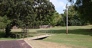
A city park called Militia Springs Park was created in 2004. It's located along Prairie Creek on North Spring Street. This spot is believed to be where the Civil War military camp once stood. The park has a play area and a covered picnic spot.
Missouri Fox Trotter Association
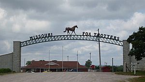
The Missouri Fox Trotter horse association was started in Ava in 1948. This group holds its yearly horse shows at its property just north of Ava.
Historic Places
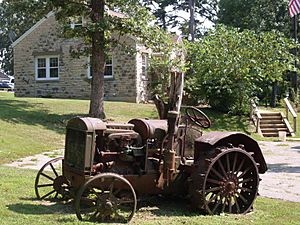
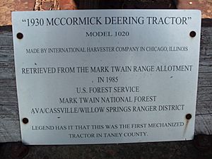
The Ava Ranger Station Historic District is a special area in Ava. It is listed on the National Register of Historic Places because of its historical importance.
Population of Ava
| Historical population | |||
|---|---|---|---|
| Census | Pop. | %± | |
| 1880 | 134 | — | |
| 1890 | 221 | 64.9% | |
| 1910 | 713 | — | |
| 1920 | 845 | 18.5% | |
| 1930 | 1,041 | 23.2% | |
| 1940 | 1,393 | 33.8% | |
| 1950 | 1,611 | 15.6% | |
| 1960 | 1,581 | −1.9% | |
| 1970 | 2,504 | 58.4% | |
| 1980 | 2,761 | 10.3% | |
| 1990 | 2,938 | 6.4% | |
| 2000 | 3,021 | 2.8% | |
| 2010 | 2,993 | −0.9% | |
| 2020 | 2,894 | −3.3% | |
| U.S. Decennial Census | |||
What the 2010 Census Showed
In 2010, the census counted 2,993 people living in Ava. There were 1,296 households, and 753 of these were families. The city had about 907 people per square mile. Most of the people living in Ava were White (97.6%).
About 28.4% of households had children under 18 living with them. Many households were married couples, but there were also many single-parent homes. The average age of people in Ava was 40.8 years old. About 22.8% of residents were under 18, and 22.9% were 65 or older.
Education in Ava
The Ava R-I School District is in charge of the schools in the city. It runs one elementary school, one middle school, and Ava High School.
The town also has a public library called the Douglas County Public Library. It's a place where you can borrow books and learn new things.
Notable Person from Ava
- Marilyn Cade (1947-2020) - She was an activist and helped start ICANN, an organization that manages internet addresses.
See also
 In Spanish: Ava (Misuri) para niños
 | Kyle Baker |
 | Joseph Yoakum |
 | Laura Wheeler Waring |
 | Henry Ossawa Tanner |


