Cayo Levisa facts for kids
 |
|
| Geography | |
|---|---|
| Location | Pinar del Río Province |
| Coordinates | 22°53′04″N 83°31′27″W / 22.88444°N 83.52417°W |
| Area | 1.5 km2 (0.58 sq mi) |
| Length | 42 km (26.1 mi) |
| Administration | |
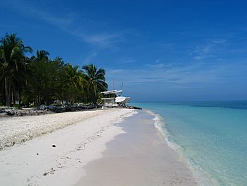
Cayo Levisa is a beautiful small island, called a cay, located in the Pinar del Río Province of Cuba. It's a special place known for its amazing white sand beaches on the north side. You can only get there by boat from a place called Palma Rubia. Many people visit Cayo Levisa to enjoy fun activities like snorkeling and diving. This island is part of the Colorados Archipelago, which is a large coral reef system. It's especially famous for its unique black coral.
Contents
Island Geography
Cayo Levisa is about 1.5 square kilometers (150 hectares) in size. It stretches for about 4.2 kilometers long. The island is usually several hundred yards wide. Its widest point is 750 meters, and its narrowest is 280 meters.
The island is located about 150 kilometers west of Havana, a major city in Cuba. A big part of Cayo Levisa, more than three-quarters, is covered by swamps. The southern side of the island is hard to reach because of a thick forest of mangroves.
Climate and Weather
The weather on Cayo Levisa is usually warm and pleasant. The average temperature is between 21 °C and 33 °C. The ocean water temperature is also quite warm, usually between 1 °C and 3 °C. This makes it perfect for swimming and water activities all year round.
Underwater World: Coral Reefs
Cayo Levisa is famous for its amazing coral reefs. Scientists studied these reefs in 2002 and 2003. They found that more than half of the ocean floor in the reef area is covered by different types of algae. These include leafy algae and hard, calcium-rich algae.
About 30% to 40% of the reef is covered by live coral. There are ten main types of coral that grow here. They are more common than other sea creatures like sponges and gorgonians, which are soft corals that look like plants.
Scientists also looked for diseases in the coral. They found that less than 3% of the coral colonies were sick. The most common disease they saw was called white plague. This disease can harm corals, but it was not widespread here.
Visiting the Island
Cayo Levisa is a popular spot for tourists. It has been developed more for visitors compared to other nearby islands in the Colorados Archipelago, like Cayo Jutías.
To get to Cayo Levisa, you need to take a boat. Boats leave from a place called Palma Rubia. A boat usually departs at 11:00 a.m. and returns at 5:00 p.m.
Once on the island, you can stay at a hotel. The hotel has 20 small cabins where visitors can sleep. There is also a restaurant where you can eat and a special center for diving.
Cayo Levisa is the only island in this group that offers diving trips. You can explore the beautiful coral reefs at different depths, from 5 meters to 30 meters deep. It's a great place to see colorful fish and amazing underwater life.
See also
 In Spanish: Cayo Levisa para niños
- Geography of Cuba
- Geography of North America
 | Ernest Everett Just |
 | Mary Jackson |
 | Emmett Chappelle |
 | Marie Maynard Daly |

