Cedar Creek (Delaware Bay tributary, Delaware) facts for kids
Quick facts for kids Cedar Creek |
|
|---|---|
|
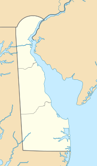
Location of Cedar Creek mouth
|
|
| Other name(s) | Tributary to Delaware Bay |
| Country | United States |
| State | Delaware |
| County | Sussex Kent |
| Physical characteristics | |
| Main source | Gum Branch divide about 1 mile west of Hudson Pond Acres, Delaware 0 ft (0 m) 38°48′57″N 075°27′17″W / 38.81583°N 75.45472°W |
| River mouth | Delaware Bay Mispillion Light, Delaware 55 ft (17 m) 38°56′52″N 075°18′48″W / 38.94778°N 75.31333°W |
| Length | 16.09 mi (25.89 km) |
| Basin features | |
| Progression | northeast |
| River system | Delaware Bay |
| Basin size | 50.01 square miles (129.5 km2) |
| Tributaries |
|
| Bridges | North Union Church Road, US 113, DE 213, Greentop Road, Clendaniel Pond Road, Fleatown Road, DE 30, DE 1, Bay Avenue (DE 36) |
Cedar Creek is a cool waterway in Delaware! It's about 16 miles (26 kilometers) long and flows into the big Delaware Bay. This creek is located in Sussex and Kent Counties, which are in Delaware. It's an important part of the local water system.
What's in a Name?
Sometimes, creeks and rivers have more than one name. Cedar Creek is one of those!
- Historically, it has also been known as Slaughter Creek.
This information comes from the Geographic Names Information System, which keeps track of names for places.
Where Does Cedar Creek Flow?
Cedar Creek starts its journey about 1 mile (1.6 kilometers) west of a place called Hudson Pond Acres in Delaware. It begins near the Gum Branch divide. A "divide" is like a high point that separates different water systems. From there, Cedar Creek flows generally towards the northeast. Its journey ends when it meets the Delaware Bay near a landmark called Mispillion Light.
The Cedar Creek Area
The land area that Cedar Creek drains is called its watershed.
- The Cedar Creek watershed covers about 50 square miles (130 square kilometers).
- This area gets about 45.5 inches (115.6 centimeters) of rain each year.
- About 9% of the land in this watershed is covered by forests.
This means the creek is surrounded by a mix of open land and trees, which is important for the plants and animals that live there.
 | Toni Morrison |
 | Barack Obama |
 | Martin Luther King Jr. |
 | Ralph Bunche |


