
Centerfield, Utah facts for kids
Quick facts for kids
Centerfield, Utah
|
|
|---|---|

Centerfield City Hall, June 2005
|
|

Location in Sanpete County and the state of Utah.
|
|
| Country | United States |
| State | Utah |
| County | Sanpete |
| Settled | 1869 |
| Incorporated | 1909 |
| Area | |
| • Total | 1.91 sq mi (4.93 km2) |
| • Land | 1.91 sq mi (4.93 km2) |
| • Water | 0.00 sq mi (0.00 km2) |
| Elevation | 5,099 ft (1,554 m) |
| Population
(2010)
|
|
| • Total | 1,367 |
| • Estimate
(2019)
|
1,495 |
| • Density | 784.78/sq mi (303.03/km2) |
| Time zone | UTC-7 (Mountain (MST)) |
| • Summer (DST) | UTC-6 (MDT) |
| ZIP code |
84622
|
| Area code(s) | 435 |
| FIPS code | 49-11870 |
| GNIS feature ID | 1426506 |
Centerfield is a city located in southwestern Sanpete County, Utah, United States. In 2020, about 1,341 people lived there. Centerfield was once a town, but it is now classified as a city. It got its name because it is in the middle of a large valley.
Contents
Geography and Climate
Centerfield covers about 1.8 square miles (4.7 square kilometers) of land.
What is Centerfield's Climate Like?
Centerfield has a semi-arid climate. This means it's usually dry, but not a desert. It gets some rain, but not a lot.
Population and People
| Historical population | |||
|---|---|---|---|
| Census | Pop. | %± | |
| 1910 | 841 | — | |
| 1920 | 566 | −32.7% | |
| 1930 | 554 | −2.1% | |
| 1940 | 598 | 7.9% | |
| 1950 | 601 | 0.5% | |
| 1960 | 475 | −21.0% | |
| 1970 | 419 | −11.8% | |
| 1980 | 653 | 55.8% | |
| 1990 | 766 | 17.3% | |
| 2000 | 1,048 | 36.8% | |
| 2010 | 1,367 | 30.4% | |
| 2019 (est.) | 1,495 | 9.4% | |
| U.S. Decennial Census | |||
In 2000, there were 1,048 people living in Centerfield. The population density was about 581 people per square mile. Most people were White, with a smaller number of Native American, Asian, and other races. About 8.5% of the population was of Hispanic or Latino background.
Many households had children under 18 living with them. The average household had about 3.4 people. The average age of people in Centerfield was 25 years old. This means it's a relatively young community.
History of Centerfield

Centerfield was first settled in 1869. It was known by a few different names before it became Centerfield.
What was Centerfield Called Before?
Around 1880, Centerfield was sometimes called "Skin Town." This unusual name came from a time when many cattle died during a harsh winter. Ranchers saved the cowhides and hung them on fences to dry using a new tanning method. So many hides were drying that the fences looked like they were covered in "skins."
It was also known as South Gunnison or Twin Town. When the town officially became a city in 1907, residents chose the name Centerfield. They picked this name because of its central spot in the valley.
How Did Centerfield Grow?
Centerfield started as a small farming community south of Gunnison. Farmers worked small plots of land with simple tools. After conflicts with Native Americans ended, people began building log and adobe houses.
In 1876, residents asked for a school closer to their homes. By 1882, a log cabin was built. It served as a school, church, and community hall. A stone church was built in 1886-87, showing the strong community spirit.
The Sugar Factory in Centerfield
In 1918, the Gunnison Valley Sugar Company built a large sugar factory in Centerfield. This factory helped process sugar beets grown in the area. The equipment for this factory came from a plant in Washington State.
Later, in 1920, the William Wrigley Jr. Company bought the factory. They used the sugar to make chewing gum! The factory changed hands again in 1940. It closed in 1956, reopened for a few years, and then was sold for parts in 1966.
Education
Students in Centerfield attend schools in the South Sanpete School District.
Images for kids
-
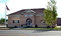
Centerfield City Hall, June 2005
-
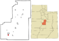
Location in Sanpete County and the state of Utah.
-
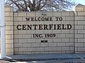
Welcome to Centerfield sign, November 2015
See also
 In Spanish: Centerfield (Utah) para niños
