Central High, Oklahoma facts for kids
Quick facts for kids
Central High, Oklahoma
|
|
|---|---|

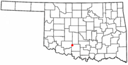
Location of Central High, Oklahoma
|
|
| Country | United States |
| State | Oklahoma |
| County | Stephens |
| Area | |
| • Total | 53.88 sq mi (139.54 km2) |
| • Land | 52.90 sq mi (137.02 km2) |
| • Water | 0.98 sq mi (2.53 km2) |
| Elevation | 1,171 ft (357 m) |
| Population
(2020)
|
|
| • Total | 1,181 |
| • Density | 22.32/sq mi (8.62/km2) |
| Time zone | UTC-6 (Central (CST)) |
| • Summer (DST) | UTC-5 (CDT) |
| FIPS code | 40-13135 |
| GNIS feature ID | 2413188 |
Central High is a town in Stephens County, Oklahoma, United States. It is a small community. In 2020, the town had 1,181 people living there.
Contents
History of Central High
How the Town Got Its Name
The town of Central High got its name in 1921. It was named because it was located near the center of a new high school district. This district was formed by joining four smaller school areas. Before this, students in the area could only go to school up to the eighth grade.
The First School
When Central High was created, a new school was built. It was called Central High School. This school had four rooms for junior high and senior high students. Younger students still went to elementary schools in their old districts. This setup lasted until the late 1930s. Sadly, the original Central High School building was destroyed by a fire in 1952.
Becoming an Official Town
Central High officially became a town in 1995. People wanted it to become a town for a few reasons. One big reason was to stop larger nearby towns, like Duncan or Lawton, from taking over their area. Becoming an official town also allowed Central High to apply for special money from the government. This money helps towns with projects and services.
Geography of Central High
Where is Central High Located?
Central High is located in Oklahoma. It is about 8.5 miles (13.7 km) west of a town called Marlow. It is also about 1 mile (1.6 km) north of State Highway 7.
Land and Water Area
The town covers a total area of about 53.8 square miles (139 km2). Most of this area is land, which is about 53.6 square miles (139 km2). A small part of the town, about 0.1 square miles (0.26 km2), is covered by water.
Population of Central High
How Many People Live Here?
| Historical population | |||
|---|---|---|---|
| Census | Pop. | %± | |
| 2000 | 954 | — | |
| 2010 | 1,199 | 25.7% | |
| 2020 | 1,181 | −1.5% | |
| U.S. Decennial Census | |||
The number of people living in Central High has changed over the years. In 2000, there were 954 people. By 2010, the population grew to 1,199 people. In the most recent count in 2020, there were 1,181 people living in the town.
Who Lives in Central High?
In 2000, there were 352 households in Central High. A household is a group of people living together. Many of these households, about 73.9%, were married couples. About 37.5% of households had children under 18 living with them. The average household had about 2.71 people.
The people living in Central High come from different backgrounds. Most residents are White. There are also people who identify as Native American, African American, or from other racial backgrounds. Some residents also identify as Hispanic or Latino.
See also
 In Spanish: Central High (Oklahoma) para niños
 | Calvin Brent |
 | Walter T. Bailey |
 | Martha Cassell Thompson |
 | Alberta Jeannette Cassell |

