
Lawton, Oklahoma facts for kids
Quick facts for kids
Lawton, Oklahoma
|
|
|---|---|

Lawton City Hall (2010)
|
|

Location in the state of Oklahoma
|
|
| Country | United States |
| State | Oklahoma |
| County | Comanche |
| Founded | August 6, 1901 |
| Named for | Henry Ware Lawton |
| Government | |
| • Type | Council–manager |
| Area | |
| • City | 81.47 sq mi (211.00 km2) |
| • Land | 81.44 sq mi (210.92 km2) |
| • Water | 0.03 sq mi (0.09 km2) 0.04% |
| Elevation | 1,145 ft (349 m) |
| Population
(2020)
|
|
| • City | 90,381 |
| • Rank | US: 304th |
| • Density | 1,109.85/sq mi (428.52/km2) |
| • Urban | 87,464 (US: 336th) |
| • Metro | 131,089 (US: 300th) |
| Time zone | UTC−6 (CST) |
| • Summer (DST) | UTC−5 (CDT) |
| ZIP codes |
73501–73503, 73505-73507
|
| Area code(s) | 580 |
| FIPS code | 40-41850 |
| GNIS feature ID | 2411638 |
| Website | City of Lawton |
Lawton is a city in Oklahoma, United States. It is the main city of the Lawton, Oklahoma, metropolitan area. In 2020, about 90,381 people lived there, making it the sixth-largest city in the state. It is the biggest city in Western Oklahoma.
Lawton was built on land that used to be reservation lands for the Kiowa, Comanche, and Apache peoples. The city was officially started in 1901. It was named after Major General Henry Ware Lawton. He was a hero in the Civil War and later died in a war in the Philippines.
The land around Lawton looks like a typical Great Plains area, with flat ground and gentle hills. North of the city, you can see the Wichita Mountains.
Lawton's economy and population have been stable for a long time because it is very close to the Fort Sill Military Reservation. This was once the main area for the Apache people before Oklahoma became a state.
Even though Fort Sill is still very important to Lawton's economy, the city also has other businesses. These include manufacturing, colleges, hospitals, and stores. The city is run by a council-manager government. This means people elect city council members and a mayor, and they hire a professional city manager to handle the city's daily tasks.
You can get to Lawton by Interstate 44 and three major U.S. highways. The Lawton-Fort Sill Regional Airport offers air travel. For bus service, Greyhound Lines provides long-distance trips, and the Lawton Area Transit System helps people get around the city.
Contents
History of Lawton
The land where Oklahoma is today was home to ancient Native American cultures for thousands of years. These included the Clovis, Folsom, and Plainview cultures.
Later, around 800 CE, the Caddoan Mississippian culture grew in the valleys of the Arkansas River and Red River. These people built large earth mounds and lived in settled communities. They were the ancestors of the Caddo and Wichita tribes.
In 1541, the Spanish explorer Francisco Vásquez de Coronado visited the area. Around the 1700s, the Comanche and Kiowa tribes moved to the Oklahoma and Texas regions from the north.
For most of the 1700s, France had some control over the Oklahoma area as part of French Louisiana. There was not much interaction between Native Americans and Europeans, mostly focused on fur trading.
In 1803, the United States bought this land from France as part of the Louisiana Purchase. More European Americans moved into the area, wanting land for farming. In 1830, the U.S. government passed the Indian Removal Act. This law forced many Native American tribes from the Southeast to move to Indian Territory west of the Mississippi River.
After the Civil War, in 1867, new treaties were made. The southwest part of the land was given to the Comanche, Kiowa, and Apache tribes. They had been forced to move from East Texas and nearby parts of Arkansas.
Fort Sill was built in 1869 by Major General Philip Sheridan. He was trying to stop raids by Native American tribes into Texas. In 1874, the Red River War happened when the Comanche, Kiowa, and Southern Cheyenne left their reservation. The U.S. Army eventually forced them back in 1875.
In 1891, the U.S. Congress wanted to allow White settlers into the area. After years of talks and legal issues, President William McKinley announced on July 4, 1901, that the government would control about 2 million acres of Native American land. This land was left over after tribal lands were given to individual families. These actions helped prepare Oklahoma to become a state in 1907.

Lawton was chosen as the county seat for Comanche County. The town was named after Major General Henry W. Lawton. He was a quartermaster at Fort Sill and helped capture the Apache chief Geronimo.
The city officially opened for settlement on August 6, 1901, with an auction of town lots. By September 25, 1901, the Rock Island Railroad reached Lawton, followed by the Frisco Line. The first city elections were held on October 24, 1901.
When the United States entered World War I, Fort Sill and Lawton grew quickly. A large amount of water from Lake Lawtonka helped the War Department build a major military camp called Camp Doniphan. It was used until 1922.
Similarly, World War II also caused Fort Sill and Lawton to expand. The city's population grew from 18,055 in 1940 to 34,757 in 1950. By the 1960s, it reached 61,697 people.
.jpg)
After the war, Lawton continued to grow a lot in the late 1940s and 1950s. City leaders looked for more water sources. In the late 1950s, the city bought land to build a new lake, Lake Ellsworth, which was finished in 1959. This lake provided more water, places for fun activities, and helped control floods.
In 1966, Lawton added more land to its borders. On March 1, 1964, the northern part of the H. E. Bailey Turnpike was finished, connecting Lawton directly to Oklahoma City. The southern part, leading to Texas, was completed on April 23, 1964.
In the 1970s, efforts to improve downtown Lawton changed the area. Many old buildings were torn down to build an enclosed shopping mall. This was done to attract more shoppers.
On June 23, 1998, Lawton grew even more when it officially included Fort Sill. In 2005, a military plan called Base Realignment and Closure moved more military activities and people to Fort Sill. This is expected to help Lawton's population and economy grow even more in the future.
Lawton's Geography
Lawton is the fifth-largest city in Oklahoma. It covers about 75.1 square miles of land. Lawton is about 84 miles southwest of Oklahoma City. Other nearby cities include Wichita Falls, Texas (about 47 miles south), Duncan, Oklahoma (about 33 miles east), and Altus, Oklahoma (about 56 miles west).
The area around Lawton looks like a typical Great Plains region. It has prairies, not many trees, and mostly flat land with gentle hills. North of the city, you can find the Wichita Mountains, which include Mount Scott and Mount Pinchot, the highest points in the area. The ground in the northern part of the city is mostly Permian limestone. In the southern parts, you'll often find Permian Garber Sandstone and some Hennessey Group shale.
Lawton's Climate
Lawton has a humid subtropical climate, which means it has hot, dry summers and mild winters. The weather can change a lot from day to day, except in the summer when it's usually hot and dry. Strong winds often blow from the south or southeast in the summer, which helps make the hot weather feel a little cooler. In winter, winds from the north can make it very cold sometimes.
The average temperature for southwest Oklahoma is about 62.6°F (17.0°C). Summers can be quite hot, with Lawton having about 21 days a year where temperatures reach 100°F (37.8°C) or higher. Winters are usually mild, but it can get extremely cold at times. On average, Lawton has about eight days a year where the temperature stays below freezing. The city gets about 27.47 inches of rain and less than 3 inches of snow each year.
Lawton is located in an area called Tornado Alley, so it can have severe weather from late April to early June. Two notable tornadoes hit the southern part of the city: an F4 tornado in 1957 and an F3 tornado in 1979.
| Climate data for Lawton (1991–2020 normals, extremes 1912–present) | |||||||||||||
|---|---|---|---|---|---|---|---|---|---|---|---|---|---|
| Month | Jan | Feb | Mar | Apr | May | Jun | Jul | Aug | Sep | Oct | Nov | Dec | Year |
| Record high °F (°C) | 85 (29) |
95 (35) |
98 (37) |
100 (38) |
108 (42) |
114 (46) |
114 (46) |
115 (46) |
111 (44) |
104 (40) |
90 (32) |
88 (31) |
115 (46) |
| Mean maximum °F (°C) | 73.8 (23.2) |
79.4 (26.3) |
86.5 (30.3) |
89.9 (32.2) |
96.8 (36.0) |
100.9 (38.3) |
105.4 (40.8) |
104.7 (40.4) |
99.4 (37.4) |
92.0 (33.3) |
81.5 (27.5) |
74.2 (23.4) |
107.1 (41.7) |
| Mean daily maximum °F (°C) | 53.7 (12.1) |
58.0 (14.4) |
66.8 (19.3) |
74.8 (23.8) |
83.2 (28.4) |
92.0 (33.3) |
97.2 (36.2) |
96.4 (35.8) |
87.6 (30.9) |
76.5 (24.7) |
64.1 (17.8) |
54.3 (12.4) |
75.4 (24.1) |
| Daily mean °F (°C) | 40.5 (4.7) |
44.9 (7.2) |
53.7 (12.1) |
61.7 (16.5) |
71.0 (21.7) |
80.0 (26.7) |
84.4 (29.1) |
83.6 (28.7) |
75.1 (23.9) |
63.4 (17.4) |
51.2 (10.7) |
41.7 (5.4) |
62.6 (17.0) |
| Mean daily minimum °F (°C) | 27.4 (−2.6) |
31.9 (−0.1) |
40.5 (4.7) |
48.5 (9.2) |
58.9 (14.9) |
68.1 (20.1) |
71.5 (21.9) |
70.7 (21.5) |
62.6 (17.0) |
50.3 (10.2) |
38.2 (3.4) |
29.1 (−1.6) |
49.8 (9.9) |
| Mean minimum °F (°C) | 12.9 (−10.6) |
17.5 (−8.1) |
22.2 (−5.4) |
32.1 (0.1) |
43.0 (6.1) |
57.3 (14.1) |
63.9 (17.7) |
62.0 (16.7) |
47.5 (8.6) |
33.3 (0.7) |
22.1 (−5.5) |
15.2 (−9.3) |
8.9 (−12.8) |
| Record low °F (°C) | −11 (−24) |
−12 (−24) |
6 (−14) |
22 (−6) |
30 (−1) |
45 (7) |
53 (12) |
50 (10) |
35 (2) |
16 (−9) |
11 (−12) |
−8 (−22) |
−12 (−24) |
| Average precipitation inches (mm) | 1.04 (26) |
0.89 (23) |
1.89 (48) |
2.46 (62) |
3.72 (94) |
3.98 (101) |
2.00 (51) |
3.21 (82) |
2.80 (71) |
2.52 (64) |
1.50 (38) |
1.46 (37) |
27.47 (698) |
| Average snowfall inches (cm) | 1.4 (3.6) |
0.4 (1.0) |
0.0 (0.0) |
0.0 (0.0) |
0.0 (0.0) |
0.0 (0.0) |
0.0 (0.0) |
0.0 (0.0) |
0.0 (0.0) |
0.0 (0.0) |
0.3 (0.76) |
0.2 (0.51) |
2.3 (5.8) |
| Average precipitation days (≥ 0.01 in) | 3.7 | 4.5 | 5.6 | 6.5 | 8.5 | 7.3 | 4.7 | 5.3 | 5.4 | 6.9 | 4.9 | 4.5 | 67.8 |
| Average snowy days (≥ 0.1 in) | 0.3 | 0.2 | 0.0 | 0.0 | 0.0 | 0.0 | 0.0 | 0.0 | 0.0 | 0.0 | 0.1 | 0.1 | 0.7 |
| Source 1: NOAA (snow/snow days 1981–2010) | |||||||||||||
| Source 2: National Weather Service | |||||||||||||
Lawton's Population
| Historical population | |||
|---|---|---|---|
| Census | Pop. | %± | |
| 1910 | 7,788 | — | |
| 1920 | 8,930 | 14.7% | |
| 1930 | 12,121 | 35.7% | |
| 1940 | 18,055 | 49.0% | |
| 1950 | 34,757 | 92.5% | |
| 1960 | 61,697 | 77.5% | |
| 1970 | 74,470 | 20.7% | |
| 1980 | 80,054 | 7.5% | |
| 1990 | 80,561 | 0.6% | |
| 2000 | 92,757 | 15.1% | |
| 2010 | 96,867 | 4.4% | |
| 2020 | 90,381 | −6.7% | |
| 2022 (est.) | 91,542 | −5.5% | |
| U.S. Decennial Census 2018 Estimate |
|||
In 2010, Lawton had 96,867 people living in 34,901 households. The city's population density was about 1,195 people per square mile.
The people living in Lawton come from many different backgrounds. In 2010, about 60.3% of the population was White, 21.4% African American, 4.7% Native American, and 2.6% Asian. About 12.6% of the population was Hispanic or Latino.
About 24.9% of the people in Lawton were under 18 years old. The average age was 29 years. The median income for a household in the city was about $41,566.
Lawton's Economy

Lawton's economy mainly depends on government jobs, manufacturing, and retail stores. The Lawton area's total economic output was about $4.2 billion in 2008. A large part of this, about $2.1 billion, came from the government sector, mostly because of the military.
Fort Sill is the biggest employer in Lawton, with over 5,000 full-time workers. In the private sector, the largest employer is Goodyear Tire and Rubber Company, which has 2,400 full-time employees. Other big employers in Lawton include Lawton Public Schools, Comanche County Memorial Hospital, Southwestern Hospital, the City of Lawton, Cameron University, and Bar S Foods.
Lawton has two main industrial parks. One is in the southwest part of town, and the other is near the Lawton-Fort Sill Regional Airport.
In 2010, the city started a Downtown Revitalization Project. The goal was to make the downtown area more attractive and easier for people to walk around. This was done to help businesses grow in the area.
As of the 2010 Census, Lawton had 35,374 people working. Most of these jobs were in private companies. About 13.3% of workers had federal government jobs, and others worked for state or local governments.
Arts and Culture in Lawton
Events and Festivals
Every May, Lawton Arts for All, Inc. holds the Arts for All Festival. This festival features art competitions and live entertainment. It usually takes place at Shepler Park. In late September, the city hosts The International Festival. This event started in 1979 and celebrates the many different cultures, arts, and music found in the community.
Museums to Visit
Lawton has three public museums. The Museum of the Great Plains teaches about the natural history and early settlement of the Great Plains. Outside, you can see a copy of the Red River Trading Post, an old schoolhouse, and a train depot with a Frisco train.
The Fort Sill Museum is located on the military base. It includes the old Fort Sill corral and several historic buildings, like the old guardhouse, chapel, and barracks. It also has different types of artillery. The old fort is a National Historic Landmark, which means it's a very important historical site.
The Comanche National Museum and Cultural Center is run by the Comanche Nation Tribe. It has exhibits and art that show the Comanche culture. This museum also hosts traveling exhibits about Native Americans from places like the Smithsonian Institution.
Historic Buildings
The National Register of Historic Places lists several important buildings in Lawton. These include the Mattie Beal House, the Carnegie Library, the First Christian Church, the First Presbyterian Church of Lawton, the Mahoney-Clark House, and the Methodist Episcopal Church, South. Old Fort Sill is also a National Historic Landmark.
Sports in Lawton
Lawton used to be home to the Lawton-Fort Sill Cavalry, a basketball team. The team moved to Lawton in 2007 and won two championships in the Continental Basketball Association and one in the Premier Basketball League. The Cavalry stopped playing in 2011.
Parks and Fun in Lawton
Lawton has 80 parks and recreation areas of different sizes. The largest one is Elmer Thomas Park.
The Lawton branch of the YMCA offers many fun programs for its members. The Lawton Country Club has an 18-hole golf course. You can also find many amateur sports leagues in Lawton, including adult softball, youth baseball, soccer, softball, and volleyball.
Education in Lawton
Colleges and Universities

Cameron University is the biggest four-year state university in southwest Oklahoma. It offers over 50 different degree programs in areas like business, education, and science. Cameron was founded in 1909 and usually has about 6,000 students.
Other colleges in Lawton include Comanche Nation College. This college started in 2004 and offers programs for the Comanche Nation and the public.
Lawton is also served by the Great Plains Technology Center. This center provides job training and development opportunities for people in the area.
Schools for Kids
Lawton Public Schools serves most of the city of Lawton. The school district has two pre-kindergarten centers, 24 elementary schools, four middle schools, and three high schools. The high schools are Eisenhower, Lawton, and MacArthur. In 2008, Lawton Public Schools had about 16,000 students and 1,000 teachers.
A few other school districts, like Bishop and Flower Mound, serve small parts of Lawton. Students from these districts usually go to Lawton Public Schools for high school.
There are also private schools in Lawton. St. Mary's Catholic School has elementary and middle school grades and has been serving the area for over 100 years. Other private schools include Trinity Christian Academy, Lawton Academy of Arts & Science, and Lawton Christian School. Lawton Christian School, founded in 1976, offers education from pre-kindergarten through 12th grade.
Media in Lawton
The Lawton Constitution is the only daily newspaper published in Lawton. It prints about 30,000 copies. The Cannoneer is a weekly newspaper for military personnel at Fort Sill. The Cameron Collegian is for students at Cameron University. There is also Okie Magazine, a monthly magazine about news and fun in Southwest Oklahoma.
Lawton has several radio stations. These include two AM stations, KKRX (1380) and KXCA (1050), and 15 FM stations. Some popular FM stations are NPR member KCCU (89.3), country music stations KFXI (92.1) and KLAW (101.3), and rock music station KZCD (94.1).
Lawton is part of a media market that also includes Wichita Falls, Texas. KSWO-TV (channel 7) is the only TV station in the market that is licensed to Lawton. It is an ABC affiliate and focuses its local news on southwestern Oklahoma. Other major stations are based in Wichita Falls.
Getting Around Lawton
Transportation
Lawton is mainly served by Interstate 44, also known as the H. E. Bailey Turnpike. This highway connects Lawton to Oklahoma City to the northeast and to Wichita Falls, Texas, to the south. The city is also connected by U.S. Highway 62, which goes to towns like Altus to the west and Anadarko to the north. Other important roads include U.S. Highway 277 and 281, and OK-7.
The Lawton Area Transit System ("LATS") provides public bus service for both Lawton and Fort Sill. LATS started in 2002 and has five main routes throughout the city.
You can also travel to other cities by bus using Greyhound Lines.
For air travel, Lawton has the Lawton-Fort Sill Regional Airport (LAW, KLAW). Currently, it offers daily American Eagle flights to Dallas/Fort Worth International Airport. It is also used for military flights.
Famous People from Lawton
Musicians and Authors
- Don Blanding, (1894-1957), a poet and cartoonist.
- C. J. Cherryh, (b. 1942) a science fiction writer who won a Hugo Award.
- Conrad Herwig (b. 1959) a jazz trombonist.
- Stephen Hillenburg, (1961 - 2018) the person who created SpongeBob SquarePants.
- N. Scott Momaday, an author who won a Pulitzer Prize.
- Leon Russell, (1942 - 2016) an American musician and songwriter.
- Bryan White, a country music singer.
- Kelly Willis, a country music singer.
Other Notable People
- Grady Brewer, a champion boxer.
- Marty Brown, a baseball manager and former player.
- Charles Chibitty, a World War II Comanche code talker.
- Joan Crawford, an actress who won an Academy Award.
- Vickie Gates, a professional bodybuilder.
- Butch Huskey, a former Major League Baseball (MLB) outfielder.
- Robert S. Johnson, a World War II flying ace.
- Tom Jordan, a former MLB catcher.
- Tomassa (c. 1840–1900), a translator.
- Stacey King, a three-time NBA champion.
- Hellen Linkswiler, a dietician and nutrition scientist.
- Sam Maddux Jr., an American Air Force lieutenant general.
- Louise Davis McMahon (1873–1966), a person who gave money to good causes.
- Lauren Nelson, Miss America 2007.
- Ralph McT. Pennell, a U.S. Army major general who retired in Lawton.
- Michael Ray Richardson, a former NBA All-Star.
- Jason Rouser, a 1996 Olympic gold medalist.
- Will Shields and Jammal Brown, NFL Pro Bowlers.
- Kelly Stinnett, a former MLB catcher.
- Charles Thompson, a motivational speaker and former University of Oklahoma quarterback.
- Donald R. Wilton, an electrical engineering professor and member of the National Academy of Engineering.
Images for kids
-
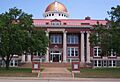
Lawton City Hall (2010)
-
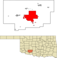
Location in the state of Oklahoma
See also
 In Spanish: Lawton (Oklahoma) para niños
