
Comanche County, Oklahoma facts for kids
Quick facts for kids
Comanche County
|
||
|---|---|---|

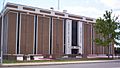
Comanche County Courthouse
|
||
|
||

Location within the U.S. state of Oklahoma
|
||
 Oklahoma's location within the U.S. |
||
| Country | ||
| State | ||
| Founded | July 8, 1901 | |
| Seat | Lawton | |
| Largest city | Lawton | |
| Area | ||
| • Total | 1,084 sq mi (2,810 km2) | |
| • Land | 1,069 sq mi (2,770 km2) | |
| • Water | 14 sq mi (40 km2) 1.3%% | |
| Population
(2020)
|
||
| • Total | 121,125 | |
| • Density | 111.74/sq mi (43.143/km2) | |
| Time zone | UTC−6 (Central) | |
| • Summer (DST) | UTC−5 (CDT) | |
| Congressional district | 4th | |

Comanche County is a county in the state of Oklahoma. In 2020, about 121,125 people lived here. This makes it the fifth-largest county in Oklahoma by population. The main city and county seat is Lawton.
Comanche County was created in 1901. It was part of the Oklahoma Territory back then. The county got its name from the Comanche Native American tribe. It is also part of the larger Lawton metropolitan area.
The land where Comanche County is today used to be home to the Comanche, Kiowa, and Apache tribes. These lands were opened for new settlers on August 16, 1901. People could get land through a special lottery.
Today, Comanche County has three cities and seven towns. It is also home to the Fort Sill military base. You can also find the Wichita Mountains Wildlife Refuge here. The county's landscape is mostly flat with gentle hills, like much of the Great Plains. But in the north, you'll see the Wichita Mountains.
Getting around Comanche County is easy. Interstate 44 and three major US Highways cross the county. You can also fly into the Lawton-Fort Sill Regional Airport. Buses like Greyhound Lines and the Lawton Area Transit System also serve the area.
The economy of Comanche County mainly relies on the government sector. This includes the military base. The county is run by a board of three elected officials. There are many schools, including Cameron University, and three hospitals for healthcare.
Contents
- Discovering Comanche County's Past
- Exploring Comanche County's Landscape
- People of Comanche County
- Comanche County's Economy
- News and Entertainment
- Getting Around Comanche County
- Learning in Comanche County
- Healthcare in Comanche County
- Communities in Comanche County
- Famous People from Comanche County
- Images for kids
- See also
Discovering Comanche County's Past

Long ago, the land that is now Oklahoma was home to early Native American groups. These included the Clovis, Folsom, and Plainview cultures. Later, in the 1500s, Spanish explorers like Francisco Vásquez de Coronado visited the area. At that time, the Wichita and Caddo tribes lived here. Around the 1700s, the Comanche and Kiowa tribes moved into the Oklahoma and Texas regions from the north.
For most of the 1700s, France controlled this area as part of Louisiana. But in 1803, the United States bought the land in the Louisiana Purchase. This was during Thomas Jefferson's time as president.
In 1830, the U.S. Congress passed the Indian Removal Act. This law moved many Native American tribes to Indian Territory. The southern part of this territory was first given to the Choctaw and Chickasaw tribes. But in 1867, the Medicine Lodge Treaty gave the southwest part of their lands to the Comanche, Kiowa, and Apache tribes.
Fort Sill and Early Settlements
Fort Sill was built in 1869. Major General Philip Sheridan started it to stop raids by Native American tribes into Texas. In 1874, the Red River War began. The Comanche, Kiowa, and Southern Cheyenne tribes left their reservation. The U.S. Army fought them until they returned to Indian Territory in 1875.
In 1891, the U.S. Congress wanted to open the land for more settlers. They formed a group to talk with tribal leaders. After many years of discussions, President William McKinley announced on July 4, 1901, that the government would control about 2 million acres of extra Native American land.
Three spots were chosen for county seats. Lawton was picked as the county seat for Comanche County. Non-Native American settlers could buy land lots starting on August 6, 1901. Later, in 1906, more land called Big Pasture was opened for settlement. This land was originally set aside for Native American livestock.
Changes to County Borders
In 1910, a new county called Swanson was created. It used land from western Comanche County and southern Kiowa County. But Comanche County sued, and the Supreme Court closed Swanson County in 1911.
In 1912, the southern part of Comanche County was used to create a new county called Cotton County. At that time, Comanche County reached all the way to the Red River.
Exploring Comanche County's Landscape

Comanche County covers about 1,084 square miles. Most of this is land (1,069 square miles), with about 14 square miles of water.
The county is part of the Great Plains. This means it has lots of prairie land, few trees, and mostly flat ground with gentle hills. In the northern part of the county, you'll find the Wichita Mountains. Mount Scott and Mount Pinchot are the highest points here.
The land is mostly made of limestone in the north. In the south, you'll find sandstone and some shale. Creeks like East Cache Creek and West Cache Creek have rich soil deposits. The Wichita Mountains are made of granite from a very old time period.
Cities and Towns in Comanche County
Comanche County has three cities. The biggest is Lawton, located in the middle of the county. It's the county seat. In 2010, Lawton had about 96,867 people, which was 78% of the county's population.
Cache is west of Lawton, with about 2,796 people. Elgin is in the northeast, with about 2,156 people.
Many towns are also in the county:
- Fletcher
- Sterling (northeast)
- Medicine Park (north central)
- Indiahoma (west)
- Geronimo (southeast)
- Chattanooga (south)
- Faxon (south)
Fort Sill is also in Comanche County. This large military base covers 90,000 acres. It is a training center for the U.S. Army Field Artillery and Air Defense Artillery.
Nature and Wildlife
The Wichita Mountains Wildlife Refuge is a protected area in Comanche County. It covers 59,020 acres. This refuge was created in 1901. It provides a natural home for animals like bison, elk, and Texas longhorn cattle. It's one of many wildlife refuges across the United States.
Neighboring Counties
Comanche County shares borders with these counties:
- Kiowa County (northwest)
- Tillman County (southwest)
- Cotton County (south)
- Stephens County (southeast)
- Grady County (northeast)
- Caddo County (north)
Comanche County's Weather
Comanche County has a dry subtropical climate. The weather can change a lot each day, except in the hot, dry summer. Strong winds often blow from the south in summer, which helps cool things down. Cold winds from the north can make winters very chilly.
The average temperature is about 61.9°F (16.6°C). Summers can be very hot, with about 21 days reaching 100°F (38°C) or higher. Winters are usually mild, but sometimes it gets very cold. The area gets about 31.6 inches (803 mm) of rain and less than 3 inches (76 mm) of snow each year.
From late April to early June, Comanche County can have severe weather, including tornadoes. For example, an F4 tornado hit Lawton in 1957, and an F3 tornado struck in 1979.
People of Comanche County
| Historical population | |||
|---|---|---|---|
| Census | Pop. | %± | |
| 1910 | 41,489 | — | |
| 1920 | 26,629 | −35.8% | |
| 1930 | 34,317 | 28.9% | |
| 1940 | 38,988 | 13.6% | |
| 1950 | 55,165 | 41.5% | |
| 1960 | 90,803 | 64.6% | |
| 1970 | 108,144 | 19.1% | |
| 1980 | 112,456 | 4.0% | |
| 1990 | 111,486 | −0.9% | |
| 2000 | 114,996 | 3.1% | |
| 2010 | 124,098 | 7.9% | |
| 2020 | 121,125 | −2.4% | |
| U.S. Decennial Census 1790-1960 1900-1990 1990-2000 2010 2020 |
|||
In 2010, there were 124,098 people living in Comanche County. The population density was about 116 people per square mile.
The people living in Comanche County come from many different backgrounds. In 2010, about 64.5% were White, 17.5% Black or African American, and 5.9% Native American. About 11.2% of the population was Hispanic or Latino.
Many households (36.5%) had children under 18 living with them. About 48.2% were married couples. The average household had 2.53 people.
The median age in the county was 31.3 years old. This means half the people were younger than 31.3, and half were older. About 25.1% of the population was under 18.
The median income for a household in the county was $43,817. For families, it was $51,564. About 17.6% of the population lived below the poverty line.
Comanche County's Economy
Comanche County's economy mainly focuses on government, manufacturing, and retail. In 2010, the Lawton area's total economic output was about $4.89 billion. Half of this came from the government sector, especially from Fort Sill.
Private businesses made up $2.23 billion of the economy. The biggest private industries were manufacturing, real estate, and retail trade. In May 2010, about 41,720 people had jobs in the county. Many worked in office support, food service, and sales.
News and Entertainment
The Lawton Constitution is the main daily newspaper in the county. It prints about 30,000 copies. The Cannoneer is a weekly newspaper for military personnel at Fort Sill. The Cameron Collegian is for students at Cameron University. Okie Magazine is a monthly magazine about news and fun in Southwest Oklahoma.
You can listen to several radio stations in Lawton. These include AM stations like KXCA 1050 and KKRX 1380. FM stations include NPR affiliate KCCU 89.3, KZCD 94.1, KMGZ 95.3, KJMZ 97.9, KBZQ 99.5, KLAW 101.3, and KVRW 107.3.
Comanche County is part of the Wichita Falls, Texas, and Lawton TV market. KSWO-TV channel 7 (an ABC station) is the only local TV station that provides local news. Other major stations are based in Wichita Falls.
Getting Around Comanche County
Comanche County is mainly served by Interstate 44, also known as the H. E. Bailey Turnpike. This highway connects the county to Oklahoma City to the northeast and Wichita Falls, Texas to the south.
US Highway 62 also crosses the county. It links to nearby towns like Altus to the west and Anadarko to the north. Other important roads are US Highway 277 and US Highway 281.
Several State Highways also run through the county:
- State Highway 7 connects Lawton to Duncan.
- State Highway 17 connects Elgin to Sterling.
- State Highway 36 links Chattanooga to Faxon.
- State Highway 49 goes through the Wichita Wildlife Refuge and Medicine Park.
- State Highway 58 connects to Carnegie.
- State Highway 115 leads from Mountain View through Meers to the Wichita Mountain Refuge.
Public Transportation
The Lawton Area Transit System (LATS) provides local bus service for Lawton and Fort Sill. Its main station is near the Lawton Public Library. LATS has five main routes around the city.
For travel between cities, Greyhound Lines offers buses to Oklahoma City and Dallas.
Air Travel
The Lawton-Fort Sill Regional Airport (LAW, KLAW) serves Comanche County. It has daily American Eagle flights to Dallas/Fort Worth International Airport. The airport is also used for military flights.
Learning in Comanche County
Schools for Kids (K-12)
Many school districts serve different parts of Comanche County.
- Boone-Apache Public Schools
- Cache Public Schools
- Cement Public Schools
- Central High Public Schools
- Chattanooga Public Schools
- Cyril Public Schools
- Elgin Public Schools
- Empire Public Schools
- Fletcher Public Schools
- Geronimo Public Schools
- Indiahoma Public Schools
- Lawton Public Schools
- Mountain View-Gotebo Schools
- Snyder Public Schools
- Sterling Public Schools
- Walters Public Schools
Some districts, like Bishop Public School and Flower Mound Public School, only have elementary schools. Students from these areas go to Lawton Public Schools for middle and high school.
Lawton Public Schools is the largest district, with 16,398 students in 2009. It has many elementary, middle, and high schools, including Eisenhower, Lawton, and MacArthur. Other big districts are Cache Public Schools and Elgin Public Schools.
Comanche County also has private schools. The largest is Lawton Christian School. Lawton Academy of Arts & Science and St. Mary's Catholic School are also here. Trinity Christian Academy offers classes for younger students.
Higher Education
Cameron University is the main university in Comanche County. It's the largest state-funded four-year university in southwest Oklahoma. Cameron offers over 50 degree programs in areas like Business, Education, and Science. It was founded in 1909 and has about 6,000 students.
The Great Plains Technology Center also serves the county. It's part of the Oklahoma Department of Career and Technology Education System. Great Plains helps people get job training and develop new skills.
Healthcare in Comanche County
Comanche County has three main hospitals. Comanche County Memorial Hospital is a large non-profit hospital with 283 beds. Southwestern Medical Center has 199 beds. The U.S. Public Health Lawton Indian Hospital also provides health services for the large American Indian population in the city.
Communities in Comanche County
Cities
Towns
Other Communities
- Edgewater Park (Census-designated place)
- Lake Ellsworth Addition (Census-designated place)
- Lakeside Village (Census-designated place)
- Lawtonka Acres (Census-designated place)
- Bethel (Unincorporated)
- Meers (Unincorporated)
- Pumpkin Center (Unincorporated)
Famous People from Comanche County
Many notable people have lived in Comanche County:
- Musicians: Country singers Bryan White, Kelly Willis, and Leon Russell. Jazz trombonist Conrad Herwig, and Flaming Lips drummer Steven Drozd.
- Authors: Pulitzer Prize winner N. Scott Momaday, poet Don Blanding, and Hugo Award winner C. J. Cherryh.
- Politicians: U.S. Senator Thomas Gore, and U.S. Representatives like Scott Ferris and Elmer Thomas.
- Other Notable People: World War II Comanche Code Talker Charles Chibitty, World War II Nurse and POW Col. Rosemary Hogan, Academy Award winning actress Joan Crawford, NBA champions Stacey King and Michael Ray Richardson, Miss America 2007 Lauren Nelson, and NFL Pro Bowlers Will Shields and Jammal Brown.
Quanah Parker, a famous Comanche leader, built his last home in the town of Cache, Comanche County.
Images for kids
-
Comanche County Courthouse
See also
 In Spanish: Condado de Comanche (Oklahoma) para niños
