Meers, Oklahoma facts for kids
Quick facts for kids
Meers, Oklahoma
|
|
|---|---|

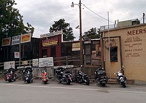
The Meers Store
|
|
| Country | United States |
| State | Oklahoma |
| County | Comanche |
| Elevation | 1,460 ft (450 m) |
| Time zone | UTC-6 (Central (CST)) |
| • Summer (DST) | UTC-5 (CDT) |
| ZIP codes |
73558
|
| FIPS code | 40-47500 |
| GNIS feature ID | 1100624 |
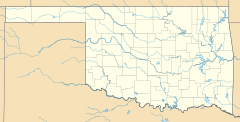
Meers is a small community in Comanche County, Oklahoma, United States. It's not an official city, but rather an unincorporated community. You can find it on State Highway 115, nestled in the foothills of the Wichita Mountains.
Meers was started in 1901 as a town for gold prospecting. It was named after Andrew J. Meers, who operated a mine there.
Today, the most famous building left from the original town is the Meers Store & Restaurant. The Food Network even called its signature MeersBurger the best hamburger in Oklahoma! This store also served as the local post office from 1902 until 1989. Now, people living in the area get their mail through Lawton.
Contents
Understanding the Meers Fault in Oklahoma
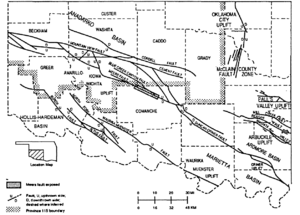
Meers is located near a special geological feature called the Meers Fault. A fault is like a big crack in the Earth's crust where rocks have moved past each other. The Meers Fault has two main parts: a northwestern line and a southeastern line. Both are found in the central lowlands of the area.
In 1985, scientists from the Oklahoma Geological Survey placed a seismograph inside the Meers Store. A seismograph is a tool that helps detect and measure earthquakes. This helps them keep an eye on any ground movement in the area.
Spanish Explorers and Gold in the Wichita Mountains
The Wichita Mountains region has a long history, even attracting Spanish explorers centuries ago. These explorers, known as conquistadors, came to North America in the 16th century, 17th century, and 18th century. They were part of the Spanish Empire's efforts to explore new lands.
The Spanish set up new territories like New Spain and Spanish Texas. They explored rivers like the Red River of the South. Their main goal was to find gold and silver. They believed there were "Seven Cities of Gold" in the New World.
In 1955, an old mill was found about 2 miles (3.2 km) south of Meers, near Meers Road. This mill, called an arrastra, was from the 16th century and seemed to be of Spanish design. An arrastra is a simple machine used to crush rocks. This helped the explorers get gold and silver from the earth. Crushing the rocks made the metals easier to carry on packhorses during their long journeys.
Meers Store: A Historic Landmark
The Meers Store is more than just a restaurant; it's a piece of history! In 1978, it was officially listed on the National Register of Historic Places. It was recognized as the Meers Mining Camp because it's the only building left from the community's early gold rush days.
Historical Video Archive
| ☆ |
| ☆ |
 | Calvin Brent |
 | Walter T. Bailey |
 | Martha Cassell Thompson |
 | Alberta Jeannette Cassell |


