Centralia, Texas facts for kids
Quick facts for kids
Centralia
|
|
|---|---|
| Country | United States |
| State | Texas |
| County | Trinity |
| Population
(2000)
|
|
| • Total | 53 |
| Time zone | UTC-6 (Central (CST)) |
| • Summer (DST) | UTC-5 (CDT) |
Centralia is a small, unincorporated community in Trinity County, Texas, United States. An "unincorporated community" means it's a place where people live, but it doesn't have its own local government like a city or town. In 2000, about 53 people lived there. It's part of the wider Huntsville, Texas area.
Contents
The Story of Centralia
Centralia began to be settled around the time of the American Civil War (1861-1865). Its town square was set up about ten years later. The name "Centralia" was chosen because the town was located right between two other places: Nogalus Prairie and Apple Springs. It was truly "central"!
Early Growth and Businesses
In 1874, Centralia got its own post office. Over the next 11 years, the community grew quite a bit. Its population reached about 150 people.
Centralia had two general stores where people could buy everyday items. There were also several steam sawmills and gristmills. Sawmills cut wood, and gristmills ground grain into flour. The town also had two blacksmiths, who made and repaired metal items. And, like many towns back then, it had a saloon.
Peak Population and Decline
By 1914, Centralia's population reached its highest point with 300 residents. However, after World War I ended, businesses in Centralia started to close down. The number of people living in the town slowly decreased over many decades.
In the mid-1930s, the community had one store and a factory that made chairs. Only about 75 people lived there then. By 1990, the population was just 26. It went up a little to 53 residents in 2000.
Tornado Strikes Centralia
On April 25, 2011, a strong windstorm called an EF1 tornado hit Centralia. This tornado caused many trees to fall down near the Davy Crockett National Forest.
Where is Centralia Located?
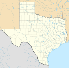
Centralia is found on Farm to Market Road 357. It is about 15 miles (24 km) northeast of Groveton. You can find it in the northeastern part of Trinity County.
Learning in Centralia
Centralia had its own school way back in 1885. Today, students in the community attend schools that are part of the Apple Springs Independent School District.
Famous People from Centralia
David Henry Hamilton, a well-known Texas statesman, once lived in Centralia. A "statesman" is someone who is a skilled and respected leader in government.
 | Jackie Robinson |
 | Jack Johnson |
 | Althea Gibson |
 | Arthur Ashe |
 | Muhammad Ali |


