Centreville, Illinois facts for kids
Quick facts for kids
Centreville, Illinois
|
|
|---|---|

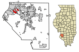
Location of Centreville in Clair County, Illinois.
|
|
| Country | United States |
| State | Illinois |
| County | St. Clair |
| Area | |
| • Total | 4.22 sq mi (10.93 km2) |
| • Land | 4.16 sq mi (10.78 km2) |
| • Water | 0.06 sq mi (0.15 km2) |
| Population
(2010)
|
|
| • Total | 5,309 |
| • Estimate
(2019)
|
4,897 |
| • Density | 1,176.88/sq mi (454.37/km2) |
| Time zone | UTC-6 (CST) |
| • Summer (DST) | UTC-5 (CDT) |
| ZIP Code(s) |
62207
|
| Area code(s) | 618 |
| FIPS code | 17-12203 |
| Wikimedia Commons | Centreville, Illinois |
Centreville was a city in St. Clair County, Illinois, United States. In 2010, about 5,309 people lived there. On May 6, 2021, Centreville joined with two other cities, Alorton and Cahokia, to form a new city called Cahokia Heights. This means Centreville no longer exists as a separate city.
Contents
Geography of Centreville
Centreville was located at 38°35′4″N 90°6′14″W / 38.58444°N 90.10389°W. It was a small city, covering about 4.29 square miles (11.11 square kilometers) of land. Only a tiny part of its area was water.
People in Centreville
The number of people living in Centreville changed over the years. Here's how the population looked at different times:
- 1870: 1,116 people
- 1960: 12,769 people
- 1970: 11,378 people
- 1980: 9,747 people
- 1990: 7,489 people
- 2000: 5,951 people
- 2010: 5,309 people
- 2020: 4,232 people
Who Lived in Centreville?
Most people in Centreville were Black or African American. In 2020, about 93.79% of the population was Black or African American. A smaller number of people were White, Asian, Native American, or from other backgrounds. Some people also identified as Hispanic or Latino.
Famous People from Centreville
Many interesting people have come from Centreville, including:
- Edward Burch, a musician who plays alternative country music.
- John Dettmer, a pitcher who played baseball for the Texas Rangers.
- Byron Gettis, an outfielder who played for the Kansas City Royals baseball team.
- Jordan Goodwin, a professional basketball player for the Washington Wizards.
- Cedric Harmon, a leader, speaker, and writer.
- Reginald Hudlin, a film director.
Schools in Centreville
Parts of Centreville were served by different school districts.
- Some areas were part of the Cahokia Unit School District 187. Lalumier K-8 School is located in Centreville.
- Other parts of the city were served by the East St. Louis School District 189. Brown Elementary School is also in Centreville.
Challenges in Centreville
Centreville faced some big challenges. It was located in an area called American Bottom, which is a floodplain near the Mississippi River. This meant the city often had problems with flooding. The drainage system also struggled, which sometimes led to issues with water and waste.
See also

- In Spanish: Centreville (Illinois) para niños
 | John T. Biggers |
 | Thomas Blackshear |
 | Mark Bradford |
 | Beverly Buchanan |

