
Cerrillos, Ponce, Puerto Rico facts for kids
Quick facts for kids
Cerrillos
|
|
|---|---|
.jpg)
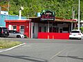
A section of rural Barrio Cerrillos along PR-139 heading northbound
|
|

Location of barrio Cerrillos within the municipality of Ponce shown in red
|
|

Cerrillos, Ponce, Puerto Rico
Location in Caribbean
|
|
| Commonwealth | |
| Municipality | |
| Area | |
| • Total | 3.33 sq mi (8.6 km2) |
| • Land | 3.13 sq mi (8.1 km2) |
| • Water | 0.20 sq mi (0.5 km2) |
| Elevation | 312 ft (95 m) |
| Population
(2010)
|
|
| • Total | 4,356 |
| • Density | 1,400.6/sq mi (540.8/km2) |
| Source: 2010 Census | |
| Time zone | UTC−4 (AST) |
Cerrillos is a special part of Ponce, Puerto Rico. It's one of 31 areas called barrios in the city. Cerrillos is a rural barrio, meaning it's more like the countryside. It's one of seven such barrios in Ponce. This area was first settled in 1878.
Contents
Where is Cerrillos?
Cerrillos is found in the eastern part of Ponce, Puerto Rico. It's located northeast of the main city area.
What are Cerrillos' Borders?
Cerrillos has clear boundaries. To the north, it's bordered by hills and the Río Cerrillos river. To the south, streets like El Monte, Guilarte, and Madrid mark its edge. The Río Cerrillos river also forms its western border. To the east, you'll find hills, part of Lake Number 5, and Palmarejo Road.
Cerrillos shares its borders with other barrios. To the north are Maragüez and Real. To the south, it borders Sabanetas and Coto Laurel. On its west side is Machuelo Arriba. Finally, to the east, it meets Real and Coto Laurel.
Lakes and Communities in Cerrillos
Cerrillos is home to four lakes, named Lake Number Two through Lake Number Five. Interestingly, Cerrillos Lake itself is not actually in Barrio Cerrillos. It's in the nearby barrio of Maragüez. However, the river that feeds Cerrillos Lake, called Rio Cerrillos, does flow through Barrio Cerrillos.
Many communities are located within Barrio Cerrillos. These include Ponderosa, Valle Alto, Portales del Monte, Haciendas del Monte, Mansiones del Sur, Mansiones de Ponce, Mansiones del Lago, and Cerillo Hoyo.
Size and Population
Cerrillos covers about 3.1 square miles of land. It also has about 0.2 square miles of water area. In 2010, the population of Cerrillos was 4,356 people. This means there were about 1,400 people living in each square mile.
The highest point in Barrio Cerrillos is 1,050 feet tall. This high spot is located at the very northern tip of the barrio.
Main Roads in Cerrillos
Several important roads help people get around Cerrillos. PR-14 runs through the southern part of the barrio. PR-587 is found in the northern sections. Also, PR-139 and PR-5139 are located in the western area of Cerrillos.
Images for kids
-
Italian food restaurant on Avenida Tito Castro
.jpg)
See also
 In Spanish: Cerrillos (Ponce) para niños
- List of communities in Puerto Rico
