Cerro Bandera facts for kids
Quick facts for kids Cerro Bandera |
|
|---|---|
| Highest point | |
| Elevation | 610 m (2,000 ft) |
| Naming | |
| English translation | Flag Hill |
| Language of name | Spanish |
| Geography | |
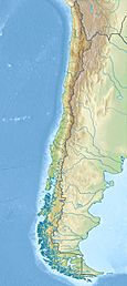
| Location | Navarino Island, Region of Magallanes and Chilean Antarctic, |
| Geology | |
| Mountain type | Hill |
| Climbing | |
| Access | Puerto Williams |
Cerro Bandera is a cool hill located on Navarino Island in Chile. Its name means "Flag Hill" in Spanish, and you'll see why when you reach the top! From the town of Puerto Williams, you can easily spot this hill. It's a popular spot for hikers and offers amazing views.
About Cerro Bandera
Cerro Bandera stands about 610 meters (2,000 feet) tall. It's not a huge mountain, but it's a fun challenge. The best part is the big Chilean flag waiting for you at the summit. This flag makes it easy to recognize the hill from far away.
The Hike to the Top
Getting to the top of Cerro Bandera and back usually takes about three hours. The path is well-marked, making it a great hike for families. As you climb, you'll walk through beautiful forests. You'll also get to see some amazing views of the Beagle Channel and the surrounding islands.
Gateway to Adventure
Cerro Bandera is more than just a nice hike. It's also the very first stop for a famous trekking route called the Dientes de Navarino (Teeth of Navarino). This is one of the southernmost hiking trails in the world! Hikers who want to explore the Dientes de Navarino circuit start their journey right here at Cerro Bandera.
See also
 In Spanish: Cerro Bandera para niños
 | Claudette Colvin |
 | Myrlie Evers-Williams |
 | Alberta Odell Jones |


