Cerro Maravilla facts for kids
Quick facts for kids Cerro Maravilla |
|
|---|---|
| Highest point | |
| Elevation | 3,953 ft (1,205 m) |
| Geography | |
| Location | Barrio Anón Ponce, Puerto Rico |
| Parent range | Cordillera Central |
| Climbing | |
| Easiest route | PR-143 (km 21.9) at PR-577 Barrio Anón Ponce, Puerto Rico |
Cerro Maravilla is a tall mountain in Puerto Rico. It is the fourth highest peak on the island. The mountain is about 1,205 meters (3,953 feet) high.
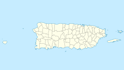
You can find Cerro Maravilla on the northern edge of Barrio Anón in Ponce. It is also very close to the town of Jayuya. This mountain is part of the Cordillera Central, which is Puerto Rico's main mountain range.
Cerro Maravilla is sometimes called El Cerro de los Mártires, meaning "Mountain of the Martyrs." It is known for an important historical event that happened there in 1978.
Getting to Cerro Maravilla
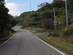
You can reach the top of Cerro Maravilla by taking Puerto Rico Highway 577. This road is about half a kilometer long. You can get onto PR-577 from Puerto Rico Highway 143.
PR-143 is a winding mountain road with two lanes. Many people use this road. The exact location of the peak is at these coordinates: 18°9′8.34″N 66°33′17.63″W / 18.1523167°N 66.5548972°W.
From the top of Cerro Maravilla, you can see amazing views. On clear days, you might be able to see both the northern and southern coasts of Puerto Rico at the same time!
During the winter, the air on the mountain is cool and fresh. At night, temperatures often drop to between 4 and 16 degrees Celsius (40s to 60s degrees Fahrenheit). After sunset, you will often hear the sounds of the famous coquis, which are small frogs native to Puerto Rico.
Mountain Weather
Cerro Maravilla has a special kind of weather called a Subtropical Highland Climate. This means it's usually cool and wet, even though it's in the tropics.
The mountain gets a lot of rain, especially from April to November. The wettest months are usually May, August, and September. In 1985, Cerro Maravilla had very heavy flooding after a lot of rain fell for 24 hours straight.
See also
 In Spanish: Cerro Maravilla para niños
 | Shirley Ann Jackson |
 | Garett Morgan |
 | J. Ernest Wilkins Jr. |
 | Elijah McCoy |


