Anón facts for kids
Quick facts for kids
Anón
|
|
|---|---|

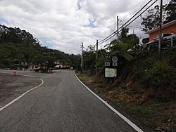
Street scene at road PR-143 East and the northern terminus of PR-139 in Barrio Anon, Ponce, PR
|
|

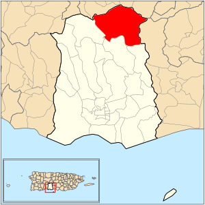
Location of barrio Anón within the municipality of Ponce shown in red
|
|
| Commonwealth | |
| Municipality | |
| Area | |
| • Total | 12.85 sq mi (33.3 km2) |
| • Land | 12.85 sq mi (33.3 km2) |
| • Water | 0 sq mi (0 km2) |
| Elevation | 1,611 ft (491 m) |
| Population
(2010)
|
|
| • Total | 1,670 |
| • Density | 130/sq mi (50/km2) |
| Source: 2010 Census | |
| Time zone | UTC−4 (AST) |
Anón (also known as Barrio Anón) is one of 31 barrios (like neighborhoods or districts) in the city of Ponce, Puerto Rico. It's located in the mountains and is one of nine barrios that border other towns. Anón shares its borders with the towns of Jayuya and Juana Díaz.
The name "Anón" comes from a native Indian word. This barrio was officially started in 1878. Anón is special because it's one of three barrios in Ponce that are part of the Cordillera Central mountain range.
Contents
Where is Anón Located?
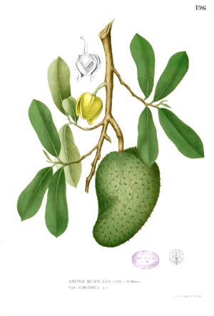
Anón is a rural, mountainous barrio found in the northern part of Ponce. It's north of the main city area. This barrio is located within the Cordillera Central mountains. It's home to Cerro de Punta, which is the highest mountain peak in all of Puerto Rico. The name "Anón" comes from a type of fruit tree called Annonaceae.
What are Anón's Borders?
Anón has clear boundaries. To the north, it's bordered by Road PR-143, which is part of the Ruta Panorámica (a scenic route). To the south, it's bordered by hills north of La Compuesta street and Las Mesas Road.
To the west, Anón is bordered by Santo Domingo Hill, El Guayabo Road, and the Río Cerrillos and Río San Patricio rivers. It also borders Cerrillo Road and Tres Palos-Ramal 1 Road. To the east, it's bordered by hills west of Road PR-123.

When looking at its neighbors, Anón borders several barrios from other towns. To the north, it touches Jauca, Zamas, Veguitas, and Saliente, all from the town of Jayuya. To the south, it borders Maragüez and Real in Ponce. To the west, it borders San Patricio in Ponce. To the east, it borders Collores from the town of Juana Díaz. Anón borders more barrios from other towns than any other barrio in Ponce.
Who Lives in Anón?
Anón is made up of several smaller communities. These include Jurutungo, Los Chinos, Vista Alegre, Raices, and Hogares Seguros.
In 2000, about 1,669 people lived in Anón. This meant there were about 130 people per square mile. By 2010, the population was very similar, with 1,670 people and the same density. Anón is the second largest barrio in Ponce by land area, after Canas. However, it's one of the least populated, with fewer people than San Patricio and Tibes.
Roads and Transportation
Several important roads serve the barrio of Anón. These include Road PR-143, PR-139, PR-511, and PR-517. These roads help connect the communities within Anón and link them to other parts of Ponce and Puerto Rico.
Anón's Mountains and Rivers
Anón covers about 12.85 square miles (33.3 square kilometers) of land. It does not have any large bodies of water within its borders.
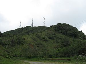
This barrio is home to some of Puerto Rico's highest mountains. The highest point in Anón is Cerro de Punta. At 4,390 feet (1,338 meters) tall, it is also the highest point in all of Puerto Rico. Monte Jayuya is the second highest peak in the barrio, standing at 4,300 feet (1,311 meters).
Anón is also where the Anón River and Inabón River begin. The Anón River flows into the Inabón River within Anón's boundaries. The Inabón River then continues until it reaches the Caribbean Sea, across from Caja de Muertos island. Other important rivers in Anón are Rio Blanco and Rio Prieto. A large part of the Toro Negro State Forest is also located in Barrio Anón, covering about 40% of the forest's area.
What is Jurutungo?
The community of Jurutungo is located deep inside the central part of barrio Anón. In Puerto Rican Spanish, "Jurutungo" means "a place that is very, very far away and hard to reach." It's not clear if the community was named this because it was so remote, or if the word itself became popular because of how far away the Jurutungo community felt.
See also
 In Spanish: Anón (Ponce) para niños
- List of communities in Puerto Rico
 | Mary Eliza Mahoney |
 | Susie King Taylor |
 | Ida Gray |
 | Eliza Ann Grier |


