San Patricio, Ponce, Puerto Rico facts for kids
Quick facts for kids
San Patricio
|
|
|---|---|

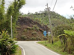
Street scene at PR-503 South and PR-505 in Barrio San Patricio, Ponce, Puerto Rico
|
|

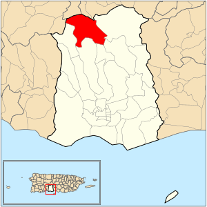
Location of barrio San Patricio within the municipality of Ponce shown in red
|
|
| Commonwealth | |
| Municipality | |
| Area | |
| • Total | 6.85 sq mi (17.7 km2) |
| • Land | 6.85 sq mi (17.7 km2) |
| • Water | 0 sq mi (0 km2) |
| Elevation | 2,103 ft (641 m) |
| Population
(2010)
|
|
| • Total | 564 |
| • Density | 82.3/sq mi (31.8/km2) |
| Source: 2010 Census | |
| Time zone | UTC−4 (AST) |
San Patricio is one of the 31 barrios (neighborhoods or districts) in the city of Ponce, Puerto Rico. It is located in the northern part of the municipality. San Patricio is one of the nine barrios that share a border with other towns. It was established in 1878.
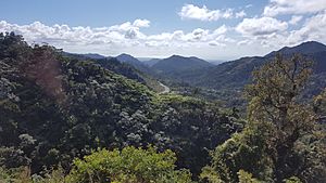
San Patricio is special because it's one of three Ponce barrios found in the Cordillera Central mountain range. The other two are Barrio Guaraguao and Barrio Anón.
Contents
Where is San Patricio?
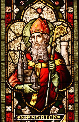
San Patricio is a rural and mountainous barrio. You can find it in the northern part of Ponce. Its name, San Patricio, comes from the Catholic Church saint, Saint Patrick.
What are San Patricio's Borders?
San Patricio has clear boundaries. To the north, it's bordered by Road PR-143. To the south, you'll find Road PR-505 and Pasto II Road. On the west, it's bordered by Road PR-503 and Road PR-10. The eastern side is bordered by Tres Palos Road and Road PR-139.
San Patricio also borders other barrios and towns. To the north, it touches Consejo barrio in Utuado and Pica and Jauca barrios in Jayuya. To the south, it borders Tibes and Montes Llanos. On the west, it borders Portugues barrio in Adjuntas and Guaraguao. To the east, it borders Anón and Maragüez. San Patricio is unique because it borders more towns than any other barrio in Ponce!
Features and People
The community of La Gloria is located in the northern part of San Patricio. Important roads like PR-10, PR-503, PR-505, and PR-143 run through the barrio.
San Patricio covers about 6.9 square miles of land. It has no water areas. In 2000, 465 people lived in San Patricio. This meant there were about 68 people per square mile. It was the least crowded barrio in Ponce.
By 2010, the population grew to 564 people. The density increased to about 82.3 people per square mile. One of its small communities is called La Mocha.
The highest point in San Patricio is 2,804 feet high. It is located at the far northwestern tip of the barrio.
Natural Landmarks
The Río San Patricio (San Patricio River) starts its journey in Barrio San Patricio.
See also
 In Spanish: San Patricio (Ponce) para niños
- List of communities in Puerto Rico
 | Victor J. Glover |
 | Yvonne Cagle |
 | Jeanette Epps |
 | Bernard A. Harris Jr. |


